Posted on:

Just had to be my luck, didn't it? My first time hiking in the Gorafe Desert Badlands and temperatures were forecast to be below freezing. Now in my eyes, the words "Desert" and "Freezing" shouldn't go together. "Hot" and "Desert", that would surely be the norm, wouldn't it?
The Desierto de Gorafe Geoparque lies some 30 minute drive north of the fine city of Guadix in Andalucía. A small group of us gathered in Guadix on a cold February evening at the end of February. We took shelter from the bitterly cold northerly wind in some nice, warm, lively bars where we overindulged by drinking far too many beers, wines and gins. The following morning, after a rather subdued breakfast, we ventured out into the cold morning air and braved the journey northwards to the town of Gorafe.
 The town of Gorafe
It's a picturesque town, set in a narrow, steep sided valley. To reach the start of our walk though we needed to drive up a narrow, winding and precipitous mountain track to the waiting plateau beyond. Thankfully, no black ice lay in waiting for the unready and we made it safely to the rim of the plateau. The plateau gave superb long distance 360° views to the snow capped mountain ranges of the Sierras of Magina, Cazorla, Segura, Sagra, Baza and of course our own, Sierra Nevada
 Sierra Nevada from the plateau
We had deemed the original 24 km walk too long for our ageing knees so had worked out a much more amenable 14 km alternative. Furthermore, by utilising two cars at each end we could reduce this to 12 km. We were to do our hike anti clockwise thus ensuring favourable sun lighting conditions throughout. Wrapped in thermals and gloved up against the bitterly cold air, we strolled easily down the good dirt road past lines of almond trees. There was no idea at this point of the incredible scenery that lie in wait.
 Sierra de Cazorla up ahead
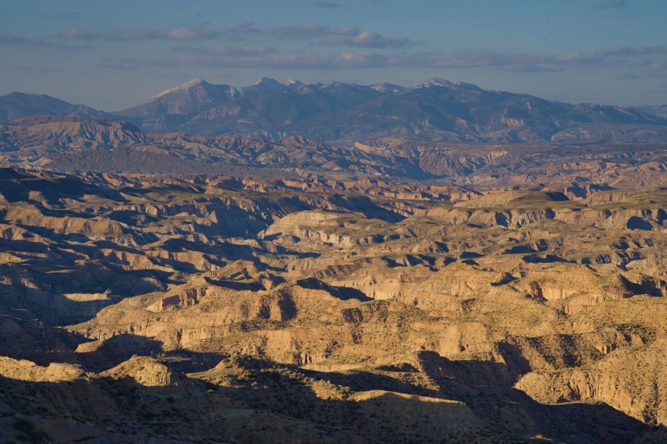
All of a sudden the flat, rather uninteresting and monotonous fields of almond trees gave way to an escarpment that fell away dramatically to the north. Into sight came a tight, twisted, chaotic landscape, battered by the elements for millennia upon millennia. Hundreds of small interlocking valleys and ramblas formed a maze of tortuous, precipitous countryside, seemingly impossible to negotiate. This is indeed very well described as "Badlands".


 "Poseurs"
But through these Badlands our dirt track continued, gradually descending. Always ahead rose the snow clad Sierra de Cazorla acting a northerly direction guide. The dramatic cliffs of the Barranco de Pollo appeared to our right. Why anybody could name this "Chicken Gorge" is anybody's guess! It's nothing like a chicken, more like a mini Grand Canyon.
 The "Chicken Gorge"
So far we had been hiking on a ridge road with steep drops, particularly to the right. Just after encountering the Chicken Gorge the path split. The right hand branch led onwards to the full 24 km route. We took the left hand branch here which would eventually turn to start heading back to the finish point. The character of the route changed here and became much more amenable and gentler in nature.
 Starting Rambla de los Anchurones
As we turned for the home leg we dropped down into a narrow dry valley called the Rambla de los Anchurones. Instead of being on ridge crests we were now walking through gorges. A nice change that added interest to the whole route. The other important change was that we became sheltered and out of the wind. The sun beat down, gloves and outer thermals were ditched and we walked onwards in t-shirts. Lunch was taken spread out on a grassy knoll under the hot sun. What a change.

We had some difficulty near the Fuente de Carrizal, when the valley floor became littered with overgrown vegetation but escape could be found by following faint tracks to the left, eventually rejoining a good track above the springs. From there on it was an easy walk to get to the finishing point and the waiting car near the prominent Mirador.
 Bushwacking near the Fuente de Carrizal"
 Leaving the Rambla de los Anchurones
Thoroughly recommended area to walk in. Generally easy walking on good tracks or dirt roads unless you get off route in which case it will be purgatory and you will possibly die horribly of falls, heat, cold, drought or exposure. As always with navigation, good forward planning is essential here.
12 km distance and 350 metres ascent/descent taking us 4 hours, including lunch and photographic stops.
Smugmug Photo Album
Tagged with:
More posts: