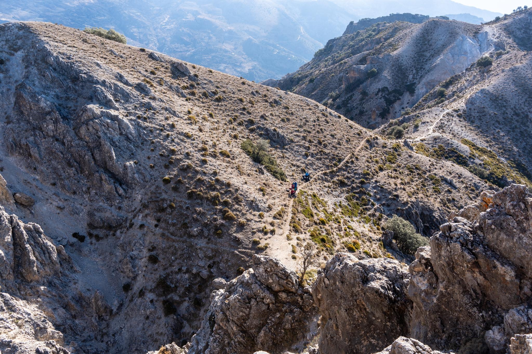
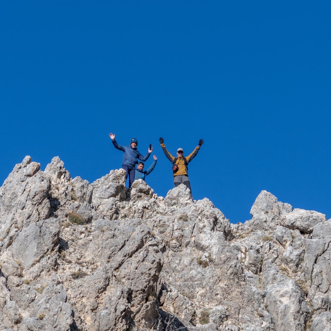
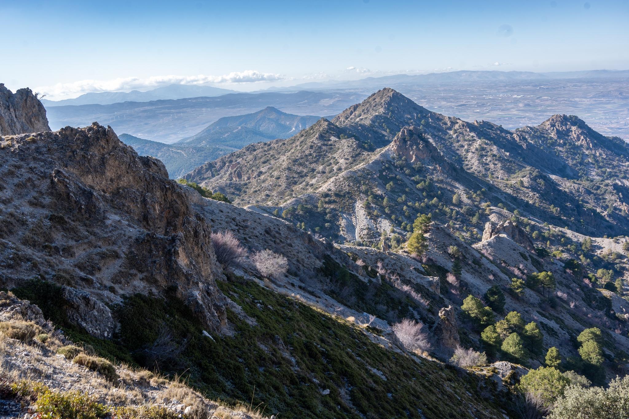
The scrambling descent route from the summitView east to the main snow covered Sierra Nevada rangeLooking down to the col below the summit pyramidThree of us on the summit of Corazon de la Sandia
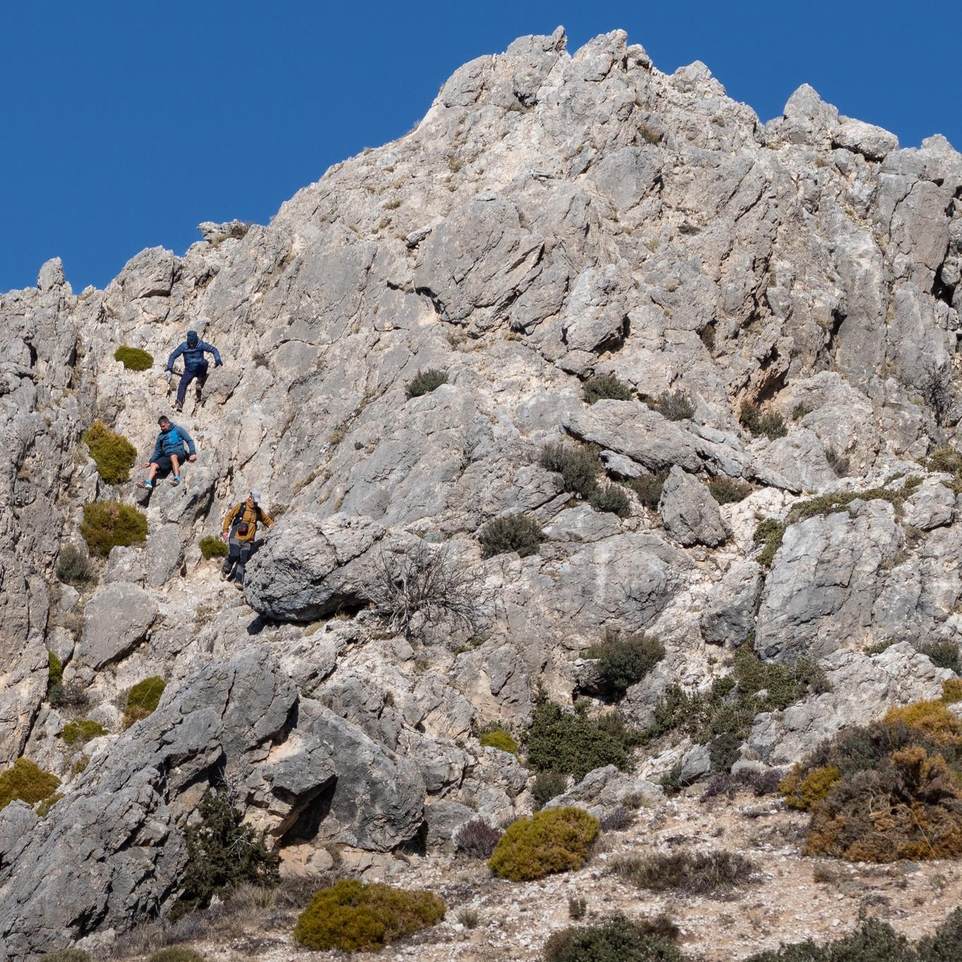
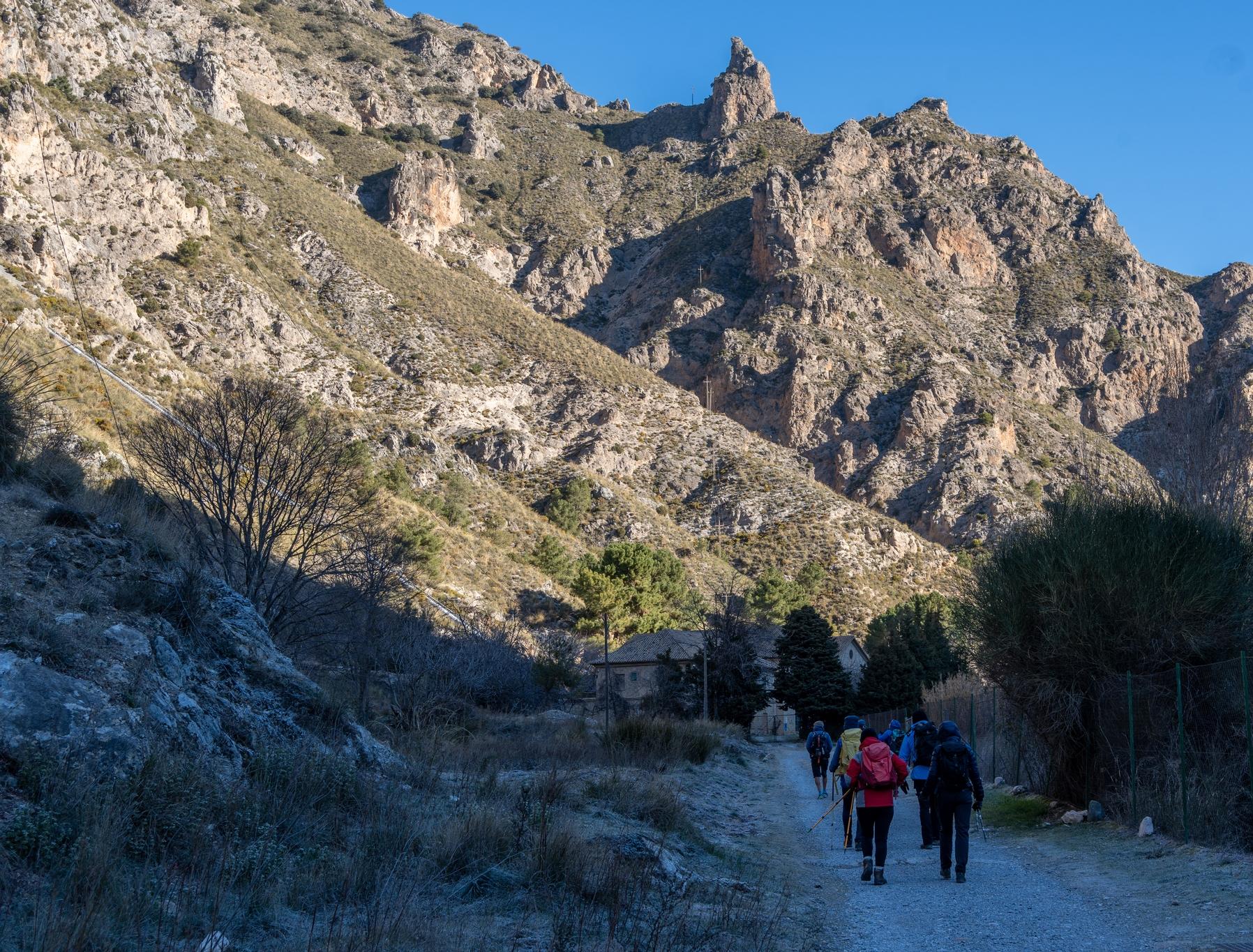
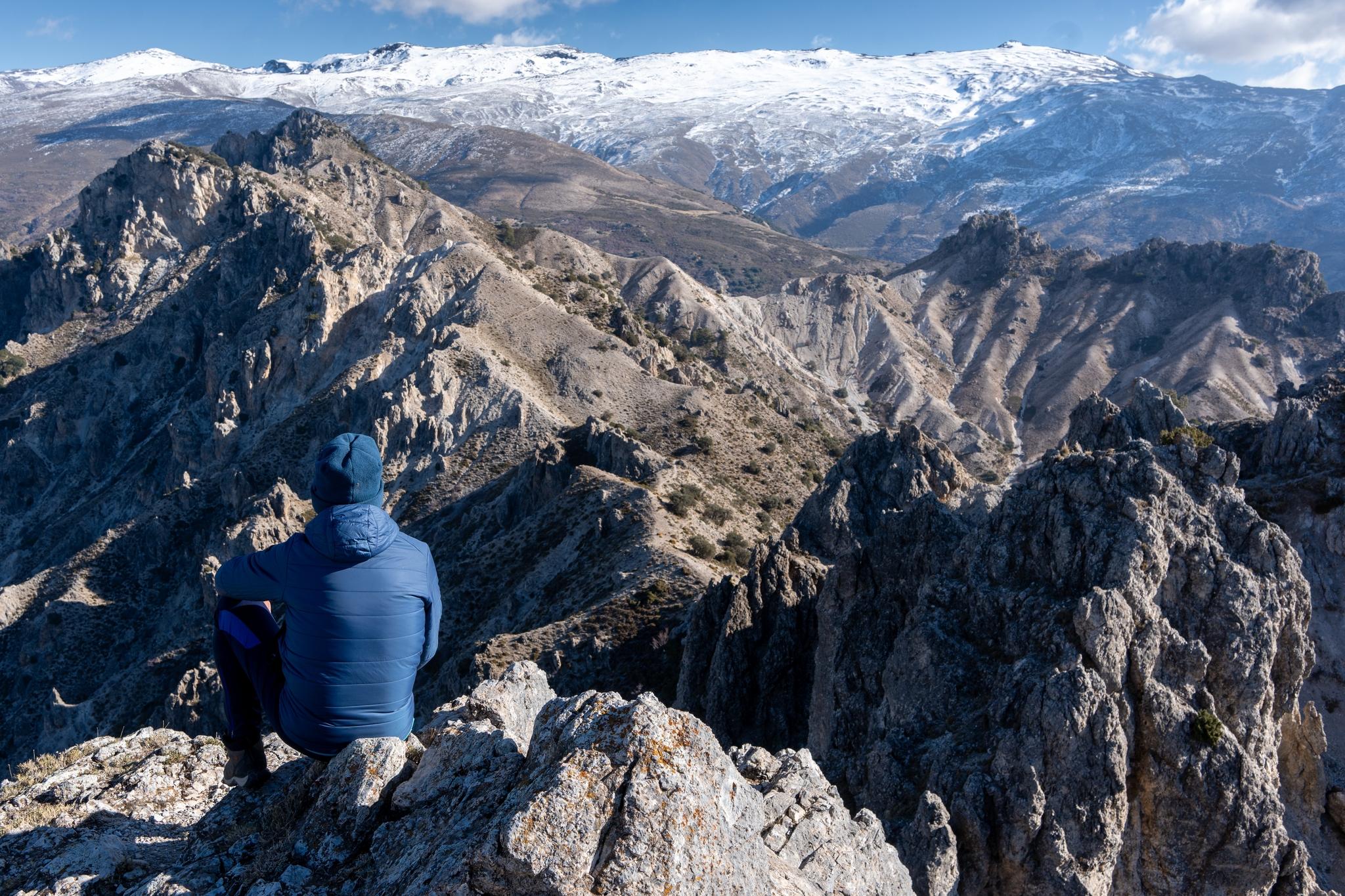
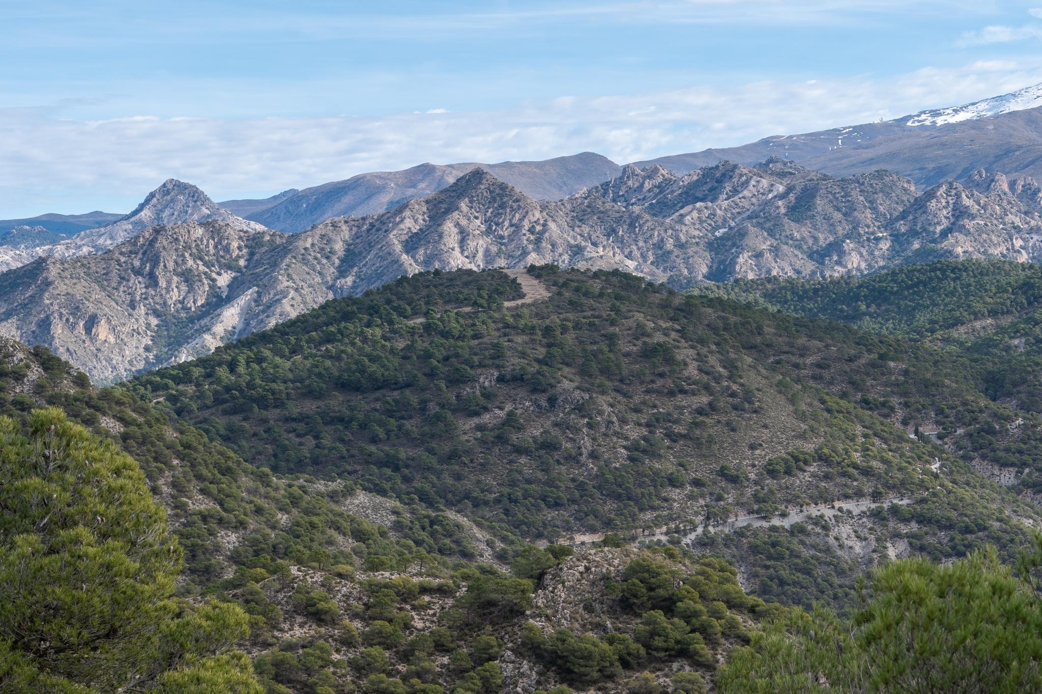
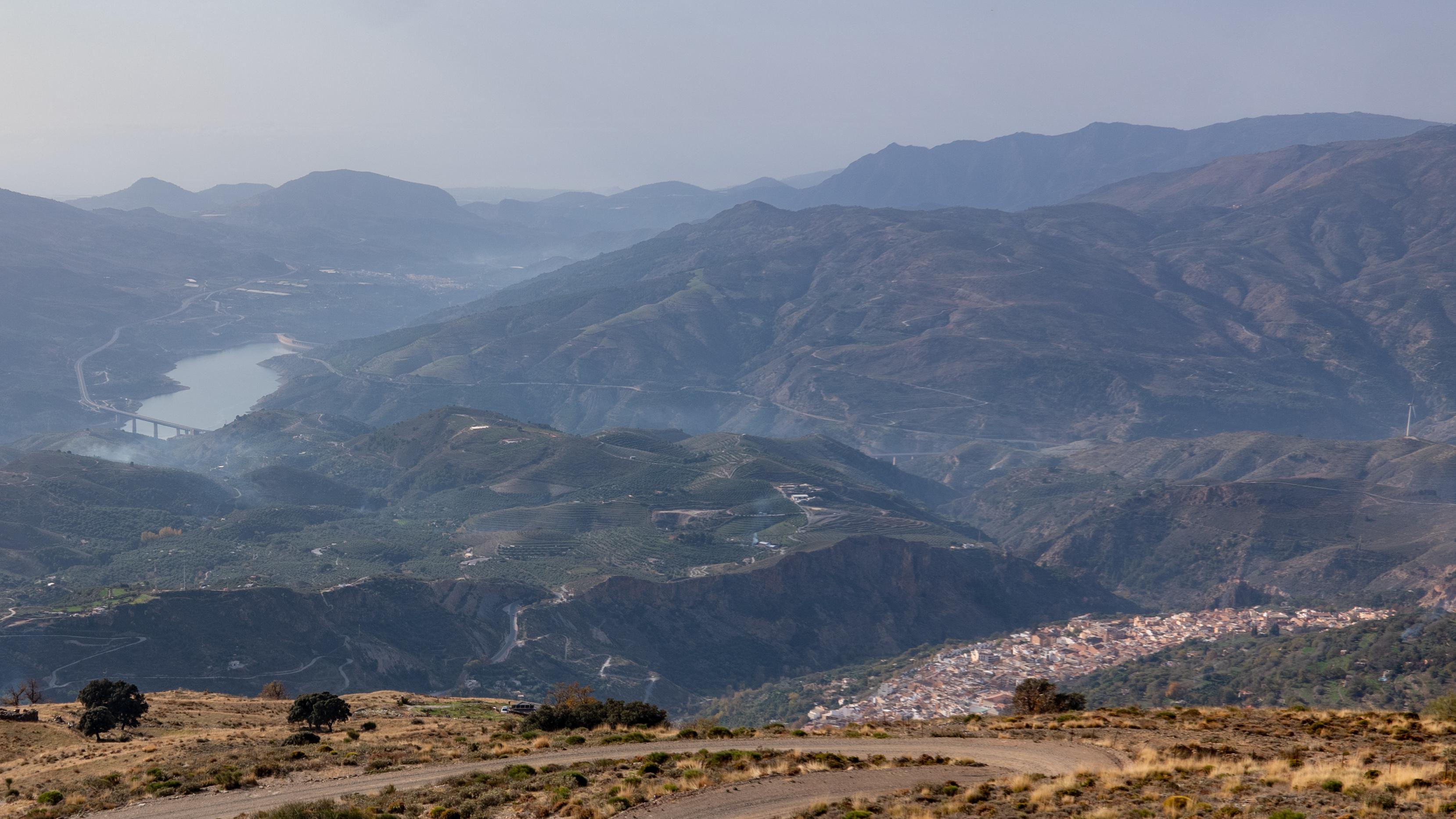
The Corazon de la Sandia (1885m) is is one of our favorite hikes. We started an ascent yesterday in the cold morning air of the Dilar Valley. Crossing the Rio Dilar we followed the twisting gorge of the Rambla del Rio Seca for 3km then heading up a steep slope, on a faint path, directly to the col R of the peak.
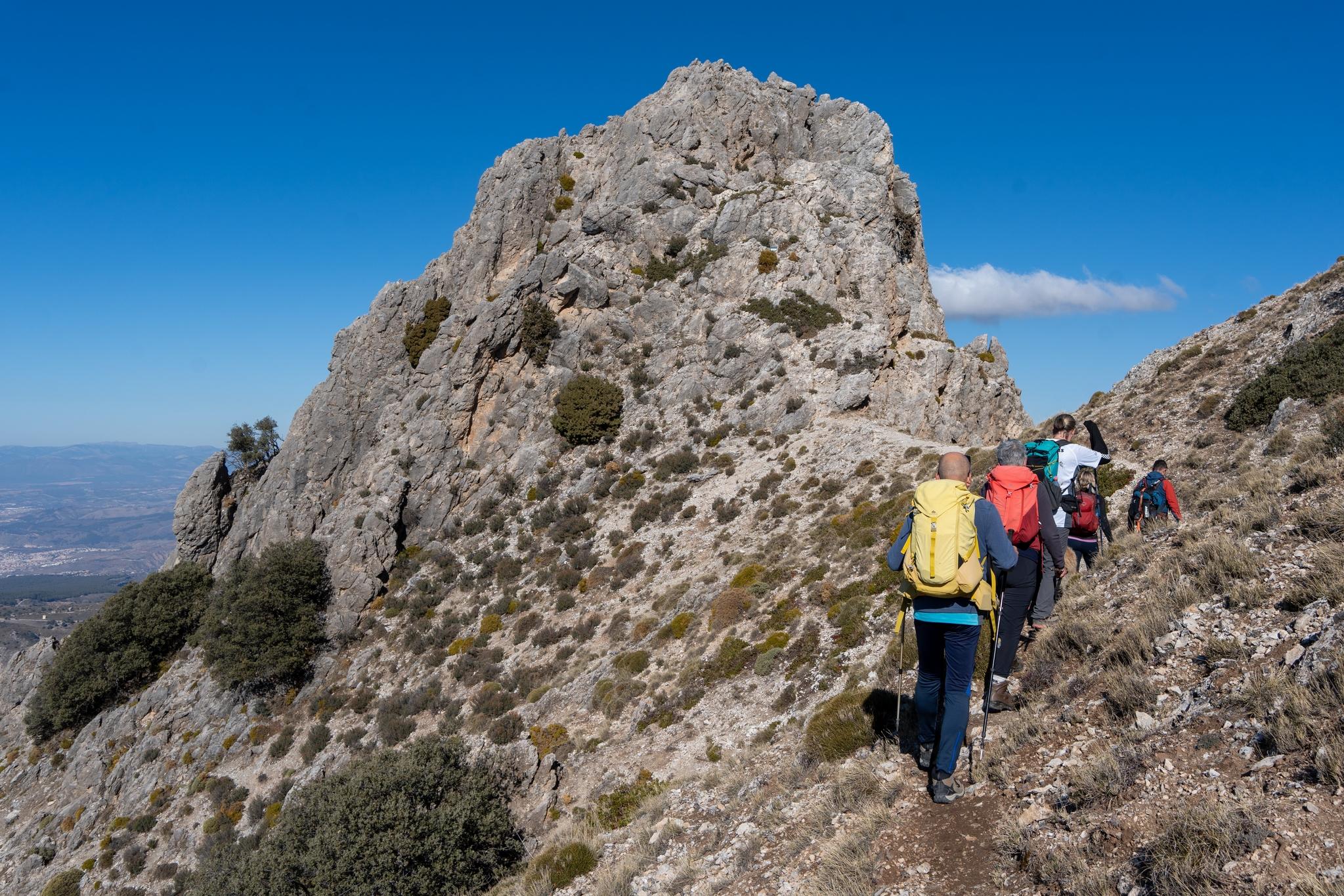
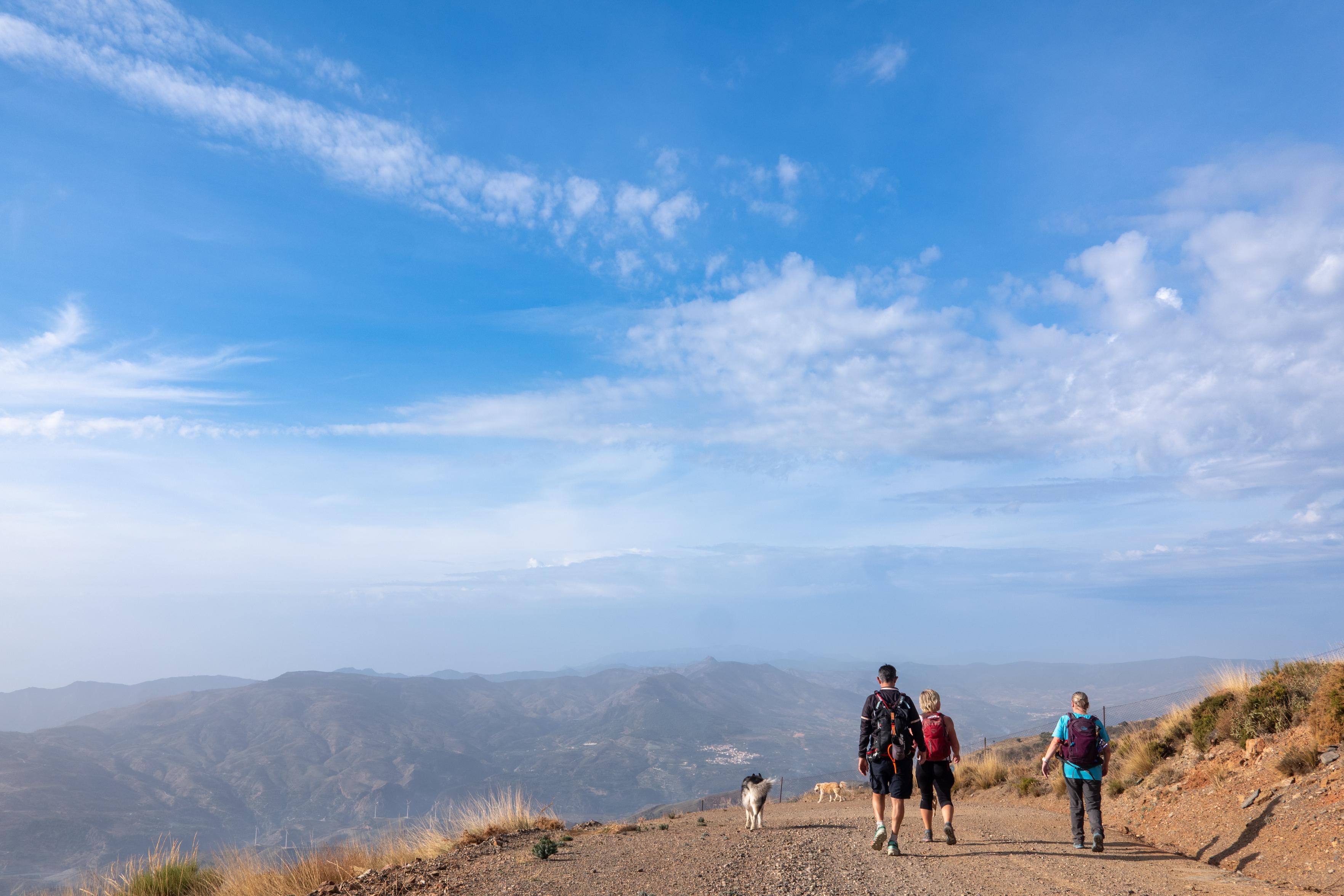
Group of hikers walking in the shade towards a distant mountain peak with sun on itLooking west towards the peaks of Picacho Alto rangeApproaching the summit pyramid of Corazon de la SandiaThe arid terrain in the foreground contrasts with the high mountain snows behind
Big day today on Corazon de la Sandia. There is no easy way up this peak, easiest route involves over 1000m of ascent & 14km. Nevertheless, despite the name, the "Heart of the Watermelon" is a dramatic peak.
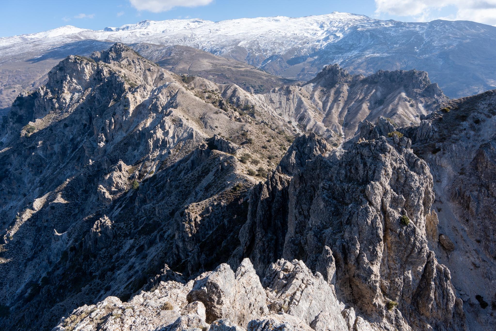
Will write more tomorrow about the route. Until then here's a view from it's rocky summit, looking towards the main Sierra Nevada range. The wonderful mountain scenery in between needs few words. It's tremendous!
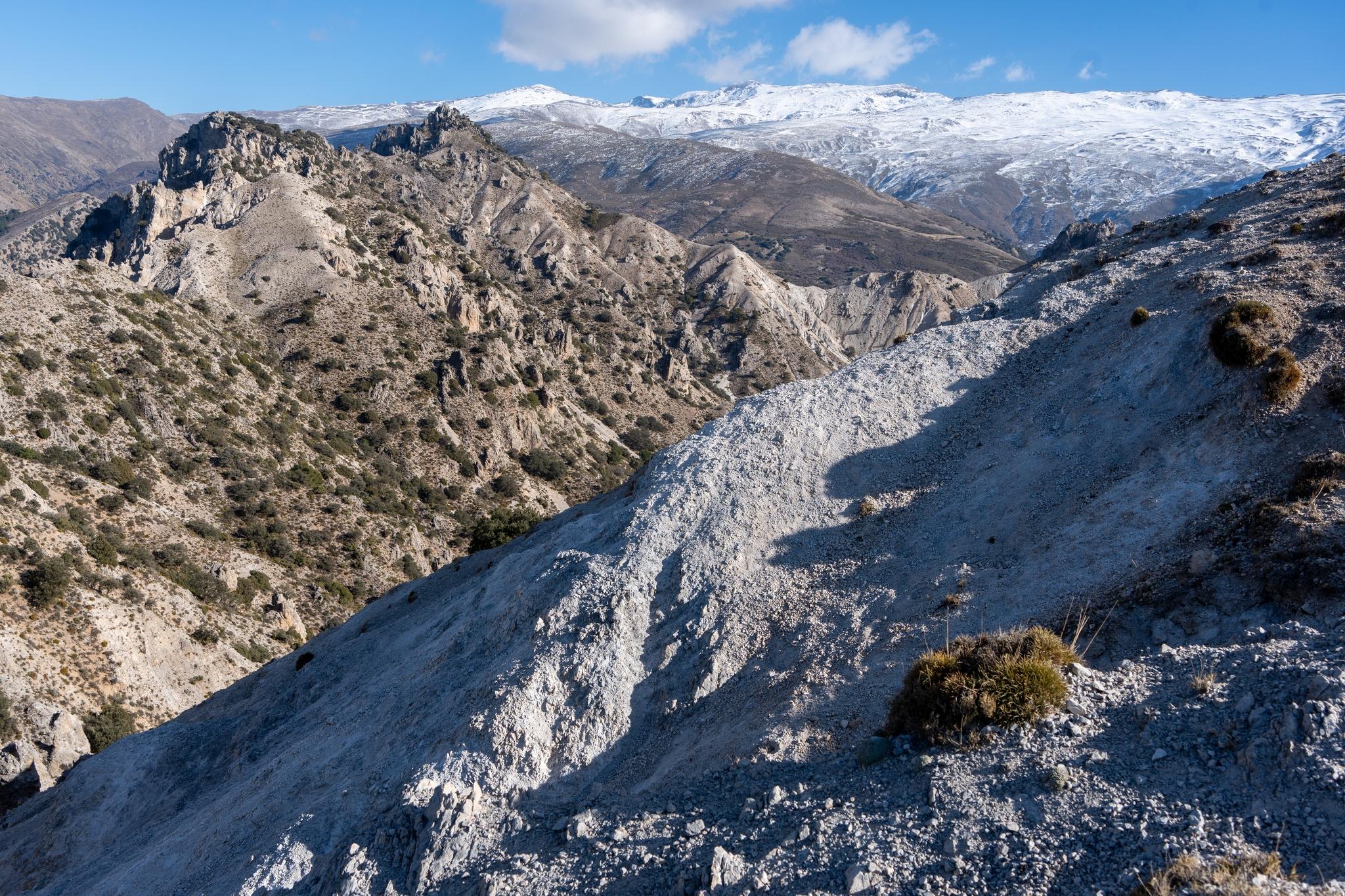
A person is sat at the summit of a mountain with a jagged series of peaks stretching into the distance. Beyond rises some even higher snow clad mountains
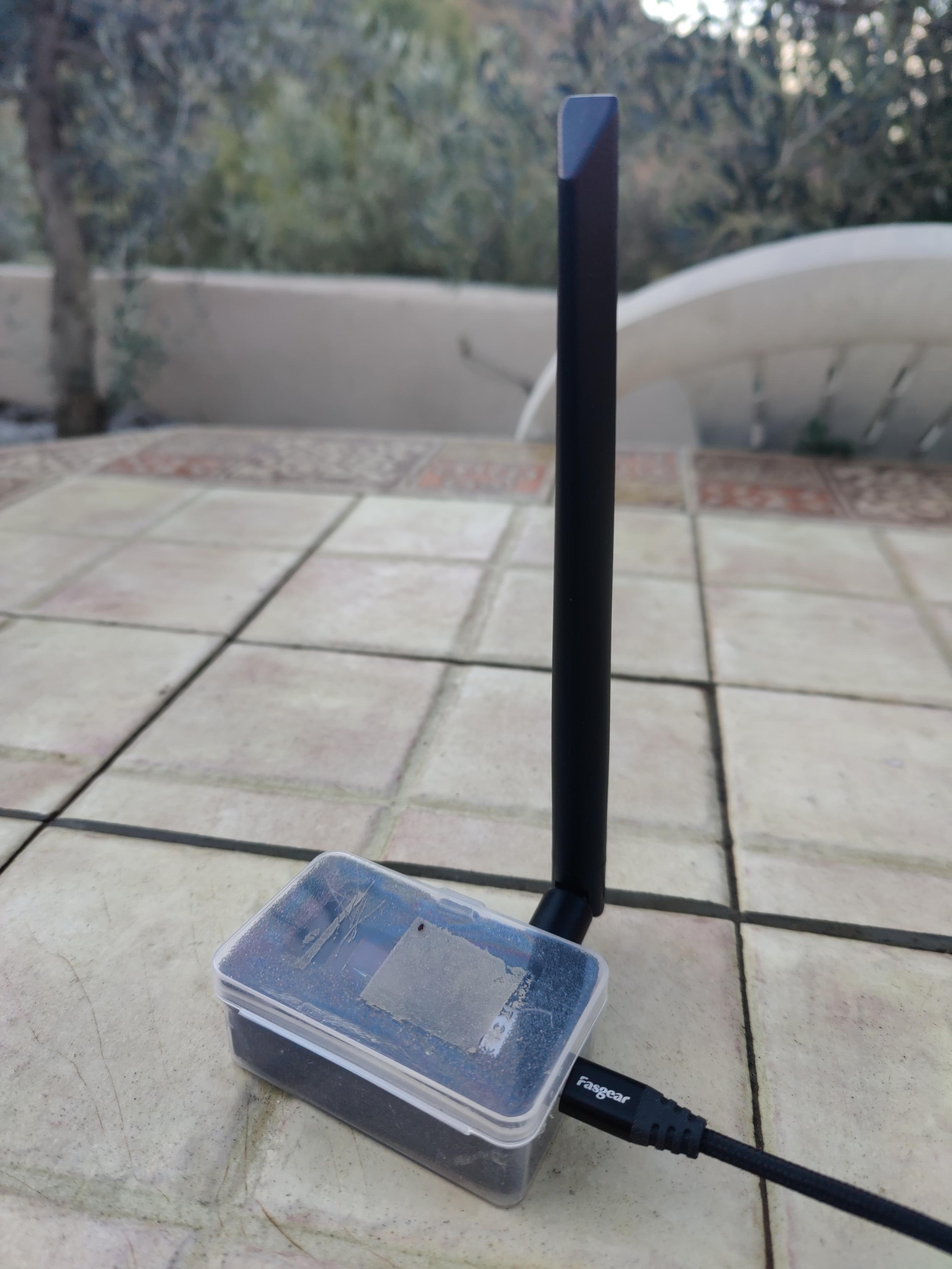
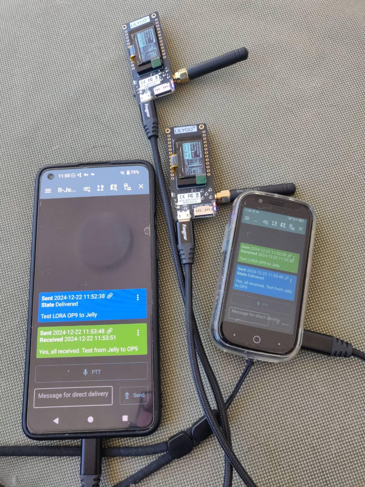
A tiny 21€ Lillygo LoRa board with antenna hooked up to my Meshtastic network.
#Meshtastic onboarding easier than #Reticulum but uses only LoRa for communication. Range testing next.
You can tell I'm from Yorkshire. Commercial 3d boxes cost twice as much as the cost of the radio itself, so I drilled some holes in the original box it came in. Job done 🤣
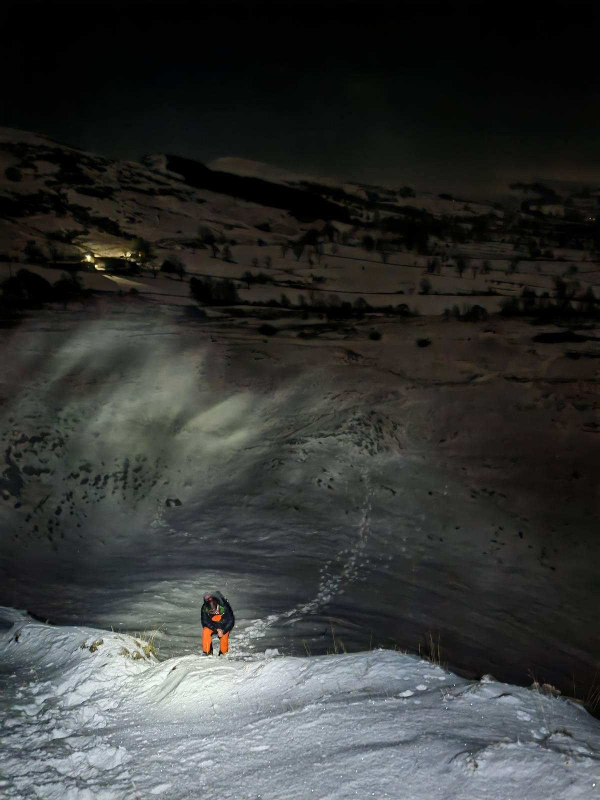
So proud of my two daughters. I just couldn't ever get them interested in climbing hills & mountains. Now, both in their 40's, they are qualified mountain leaders, do SAR stuff and go out at night into the hills to play in the snow. Why couldn't I get them to do that? 😂
Believe it or not this is on Mam Tor in the Peak District
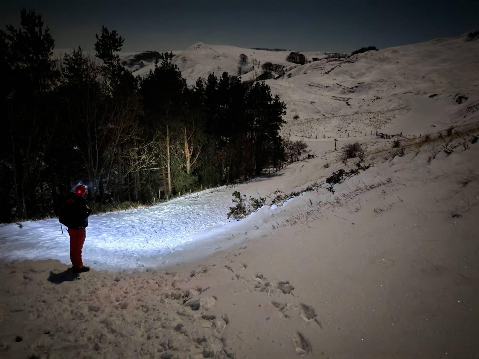
A person in orange pants is in the snow in the foreground illuminated by head torch. Behind is a dark snowy scene with only some lights from a farmhouse showingA person stands at the side of a dark forest at night. The way ahead is illuminated by his headtorch. The snows lead up to a broad mountain peak
I've always been interested in navigation. From reading wonderfully detailed paper maps by a winter fireside to micro navigating my way out difficult mountain terrain in a blizzard. Navigation has been made much simpler recently due to sophisticated GPS mapping systems. It's all interesting stuff. And, just when you thought we couldn't get much better .... Quantum Navigation appears out of the gloom. Interesting eh?
Been testing better antennas on today's dog walk that have expanded the range and increased the reliability of my local Reticulum Network. Even managed to voice transmit but words were lost due to the howling wind 😀.
That's the last time I'm ever going into an Ikea. Must have done 5 miles twisting and turning down alleyways and walkways lined with people and products 😂. No direct route to the part of the store you are looking for. At the end ... the €18 product we wanted. Online only, if at all, for me from now on.
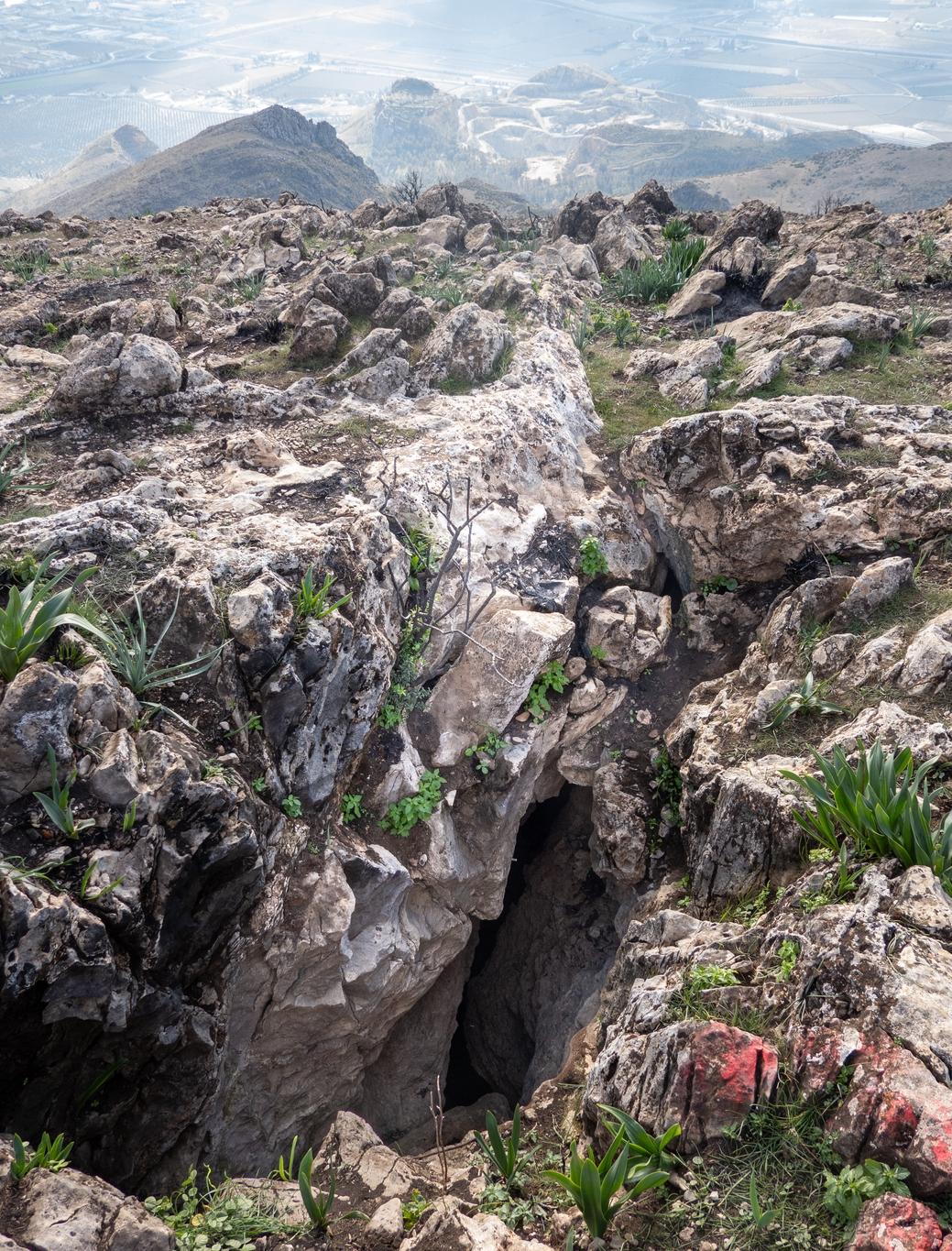
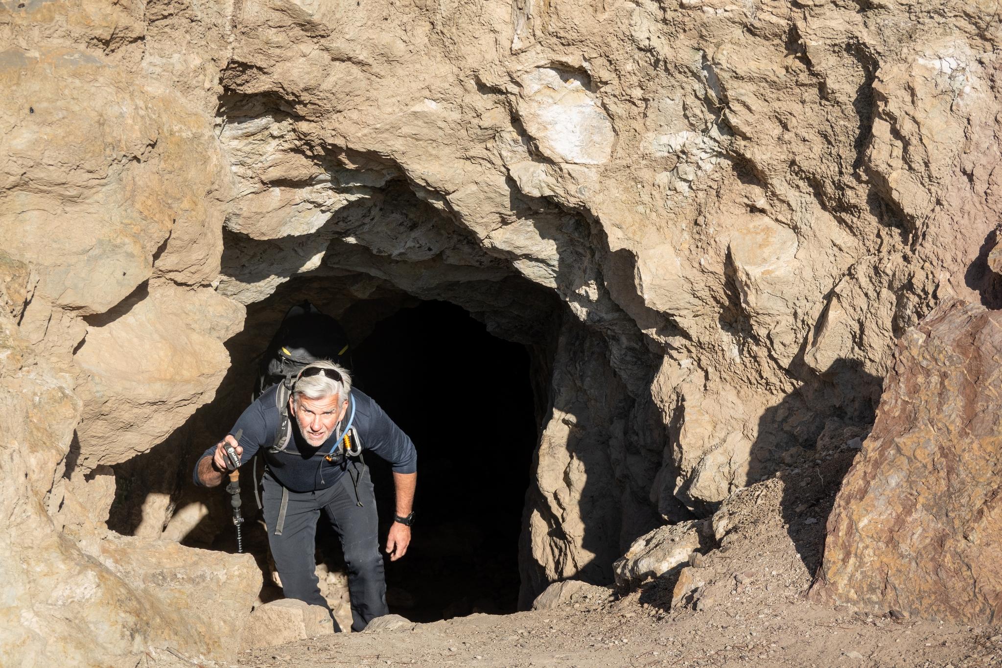
Yesterday we came across an interesting and unusual feature that we've never encountered before in mountains (outside of Kamchatka in 2013). A deep crack/crevice was found near the summit of Morron de Enmedio at 1098m in the Sierra Elvira. Coming up out of the crack was a constant strong blast of warm wind. This feature (the Raja Santa cavity) is just west of the summit if you want to experience this for yourselves. Natural warming for a cold winters day!
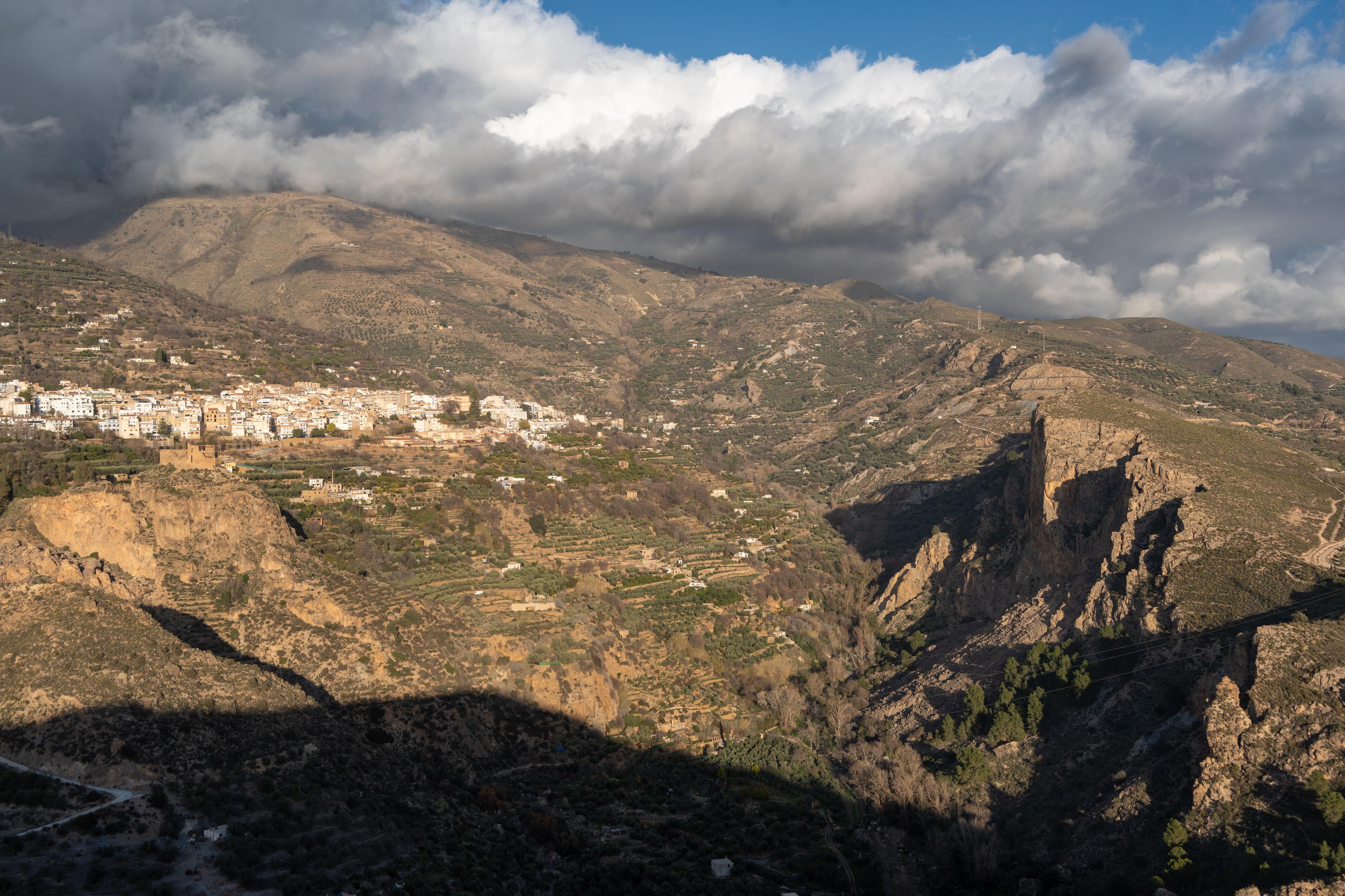
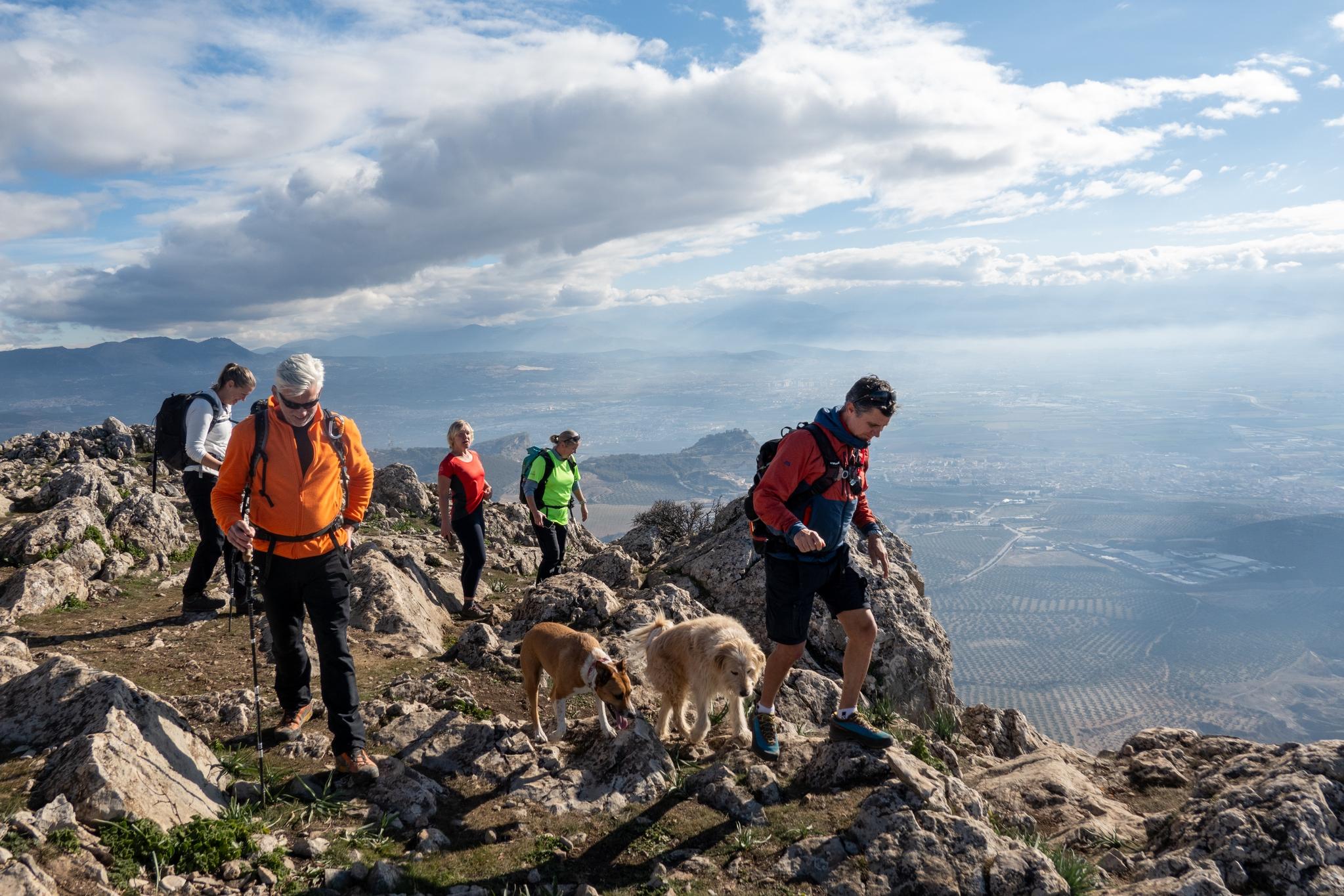
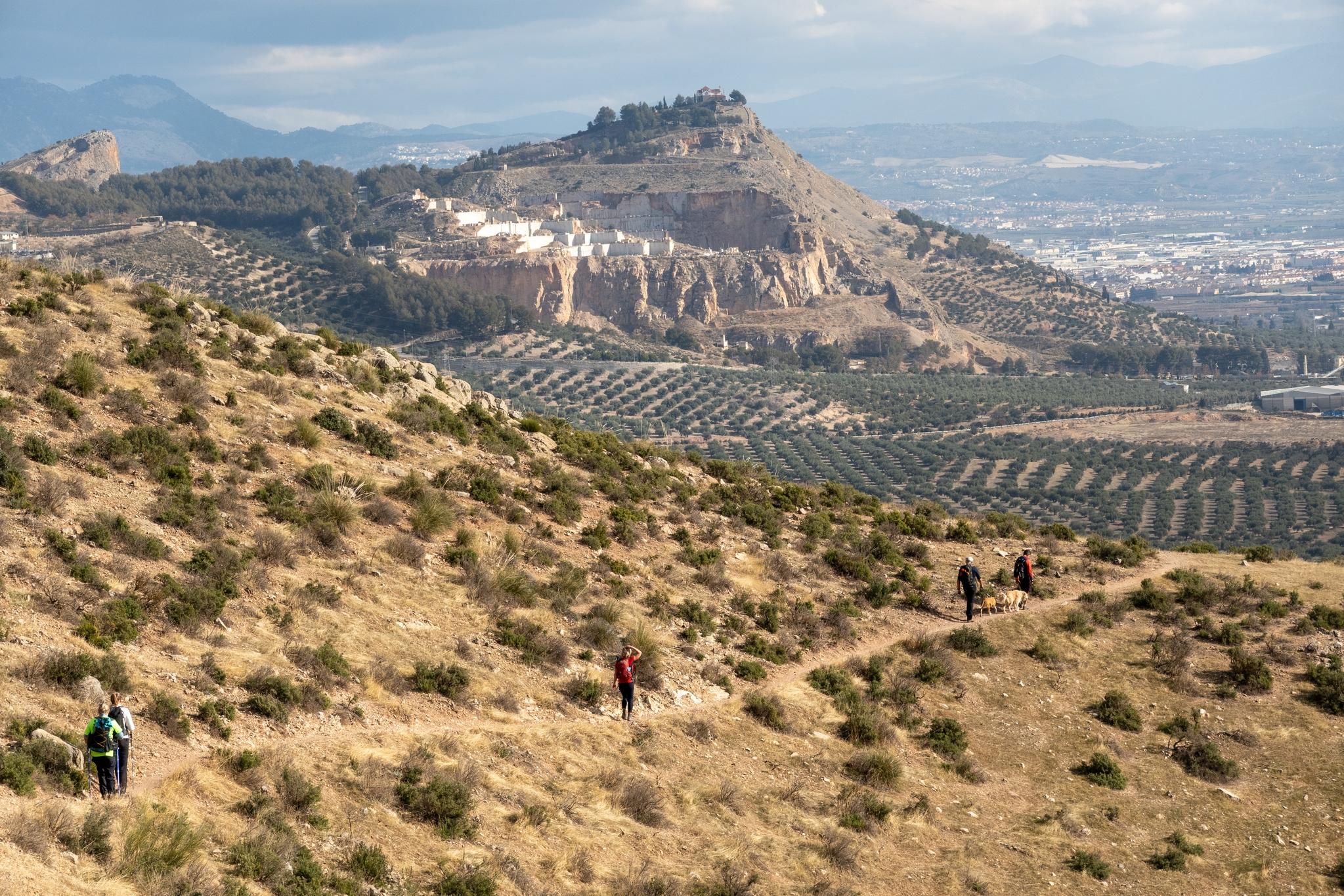
As we had never been to these mountains before we called this walk "The Sierras We've Never Heard Of"! The Sierra Elvira lie just NW of Granada city. Good motorway connections mean the start is just 45 mins drive from our home base in Lanjaron.
We started the walk at the large parking area at Collado de los Pinos and made our way up through pine forests and open slopes to the Collado del Morrón del Punta.
Looking back to the Collado de los Pinos and Morron del PuntaWalking along the summit ridgeAppearing out of a deep cave near the start of the routeThe route back with views to the marble quarry and Ermita on the hill
I love RSS feeds and do most of my blog and website catching up using these feeds. Used various pieces of software over the years to co-ordinate and aggregate feeds. Today, just installed FreshRSS on my server. Easy to install and no messing with ports forwarding etc. Just install on a server you run. Initial thoughts are that it works really well and provides a very nice platform to read your content.
Excited that without wifi, bluetooth nor mobile data I managed to connect the two phones and send/receive text messages via LORA.
Initial testing got me to the end of my land (100m) without problems. Not "line of sight" either. Will extend distance tomorrow on dog walk. What can these very tiny aerials achieve?
After that maybe time for big aerial on the roof?
Two phones (large and small) are connected via cables to two small radio receiversScreenshot showing delivery reports in blue stating the distance achieved in communicating.
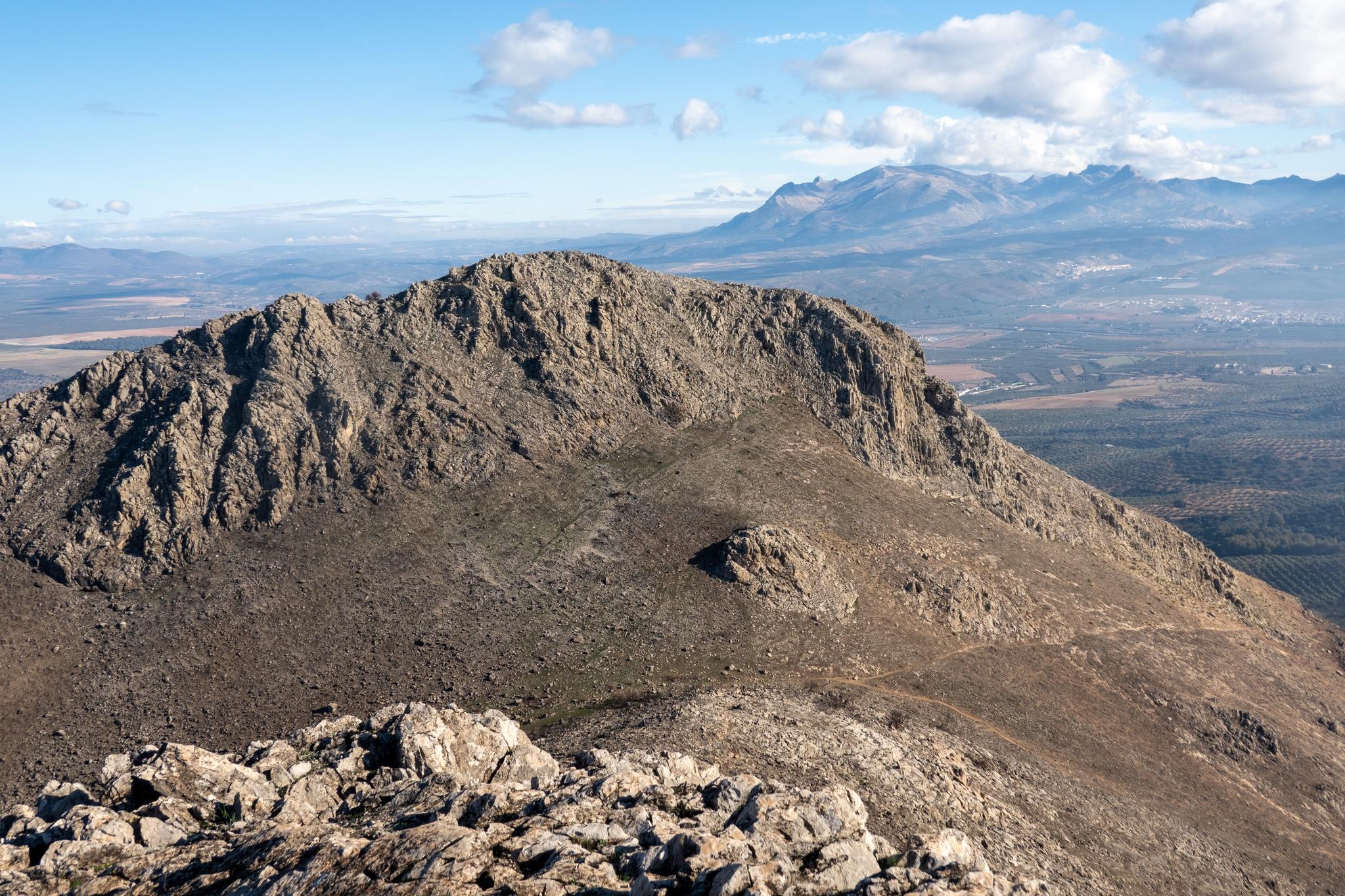
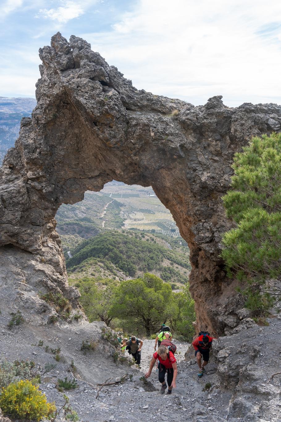
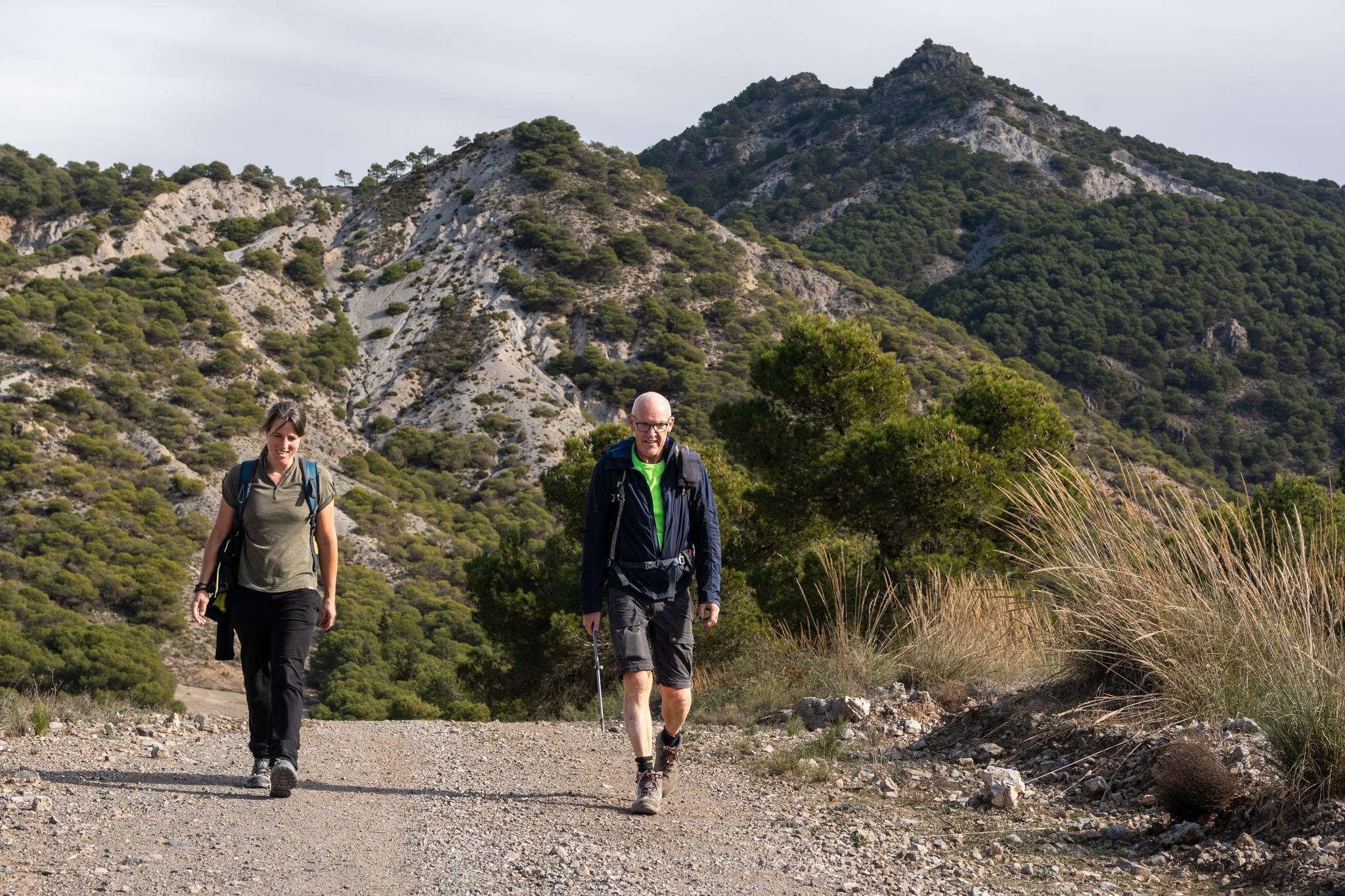
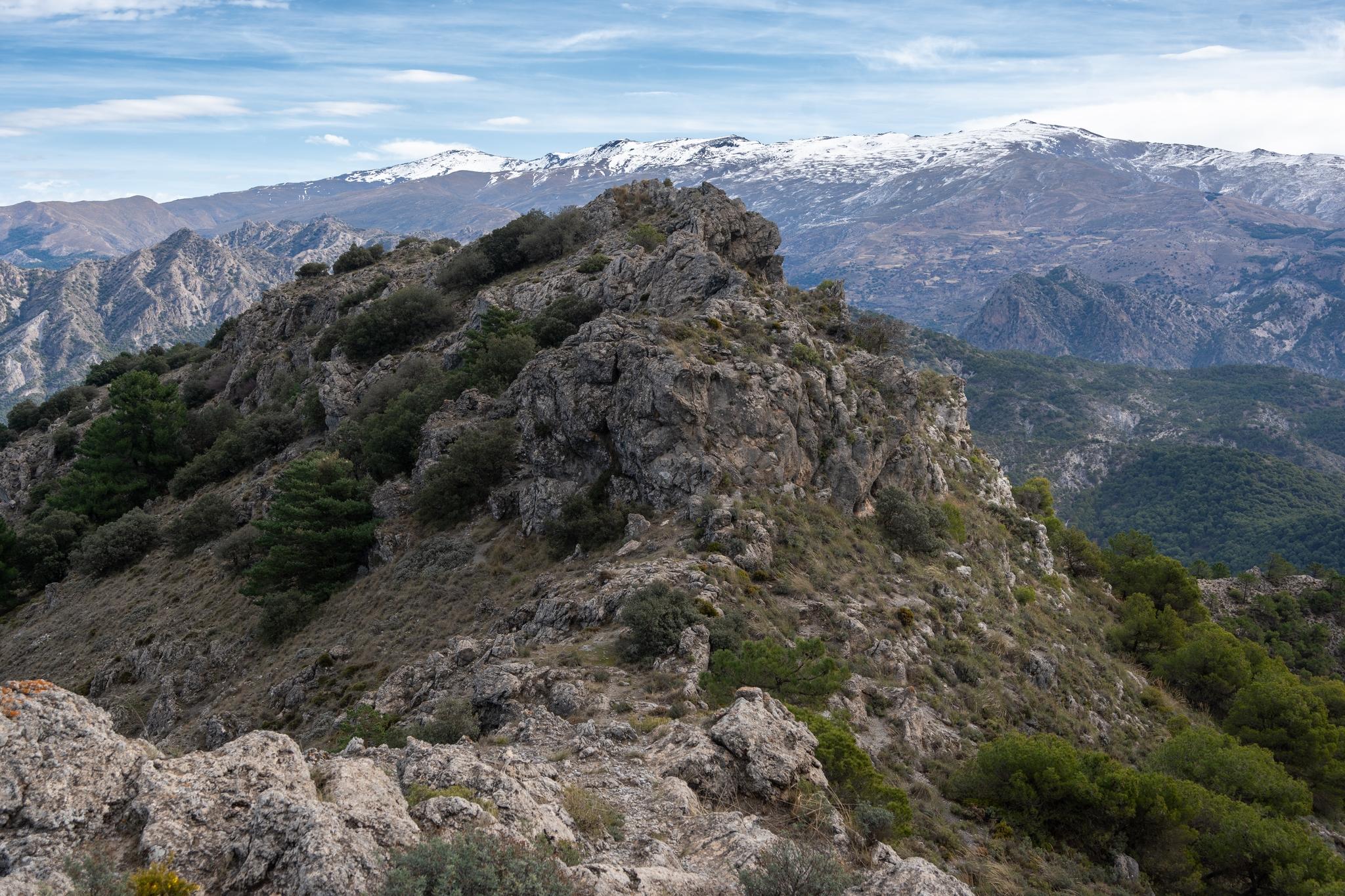
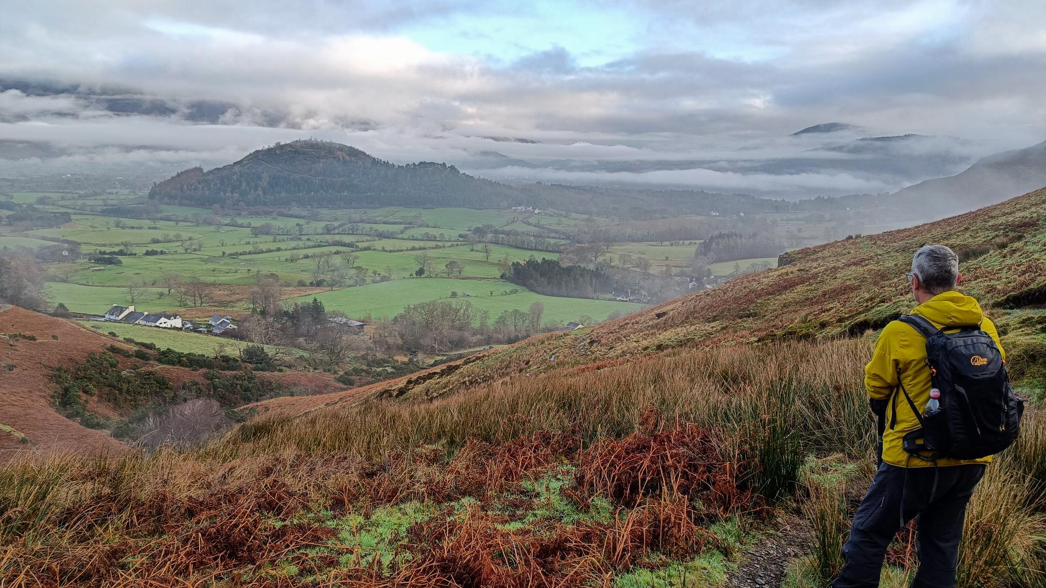
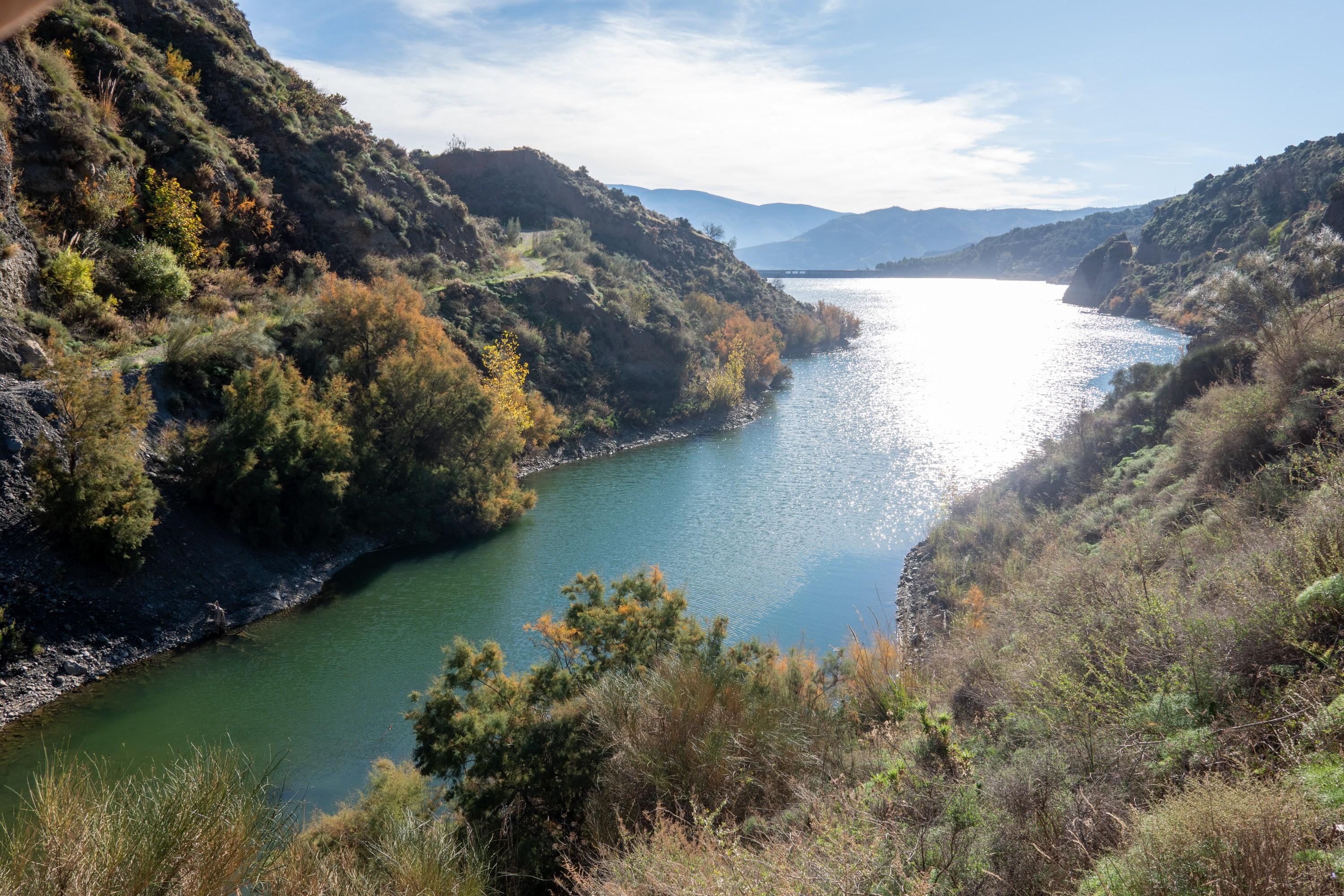
Back in southern Spain our group hiked up the Silleta de Padul from Padul (S of Granada). A nice 12km circular hike with 850m ascent/descent. Much of interest, including spectacular views of the Sierra Nevada mountains and the rock arch of "Piedra Ventana". Give it a go!
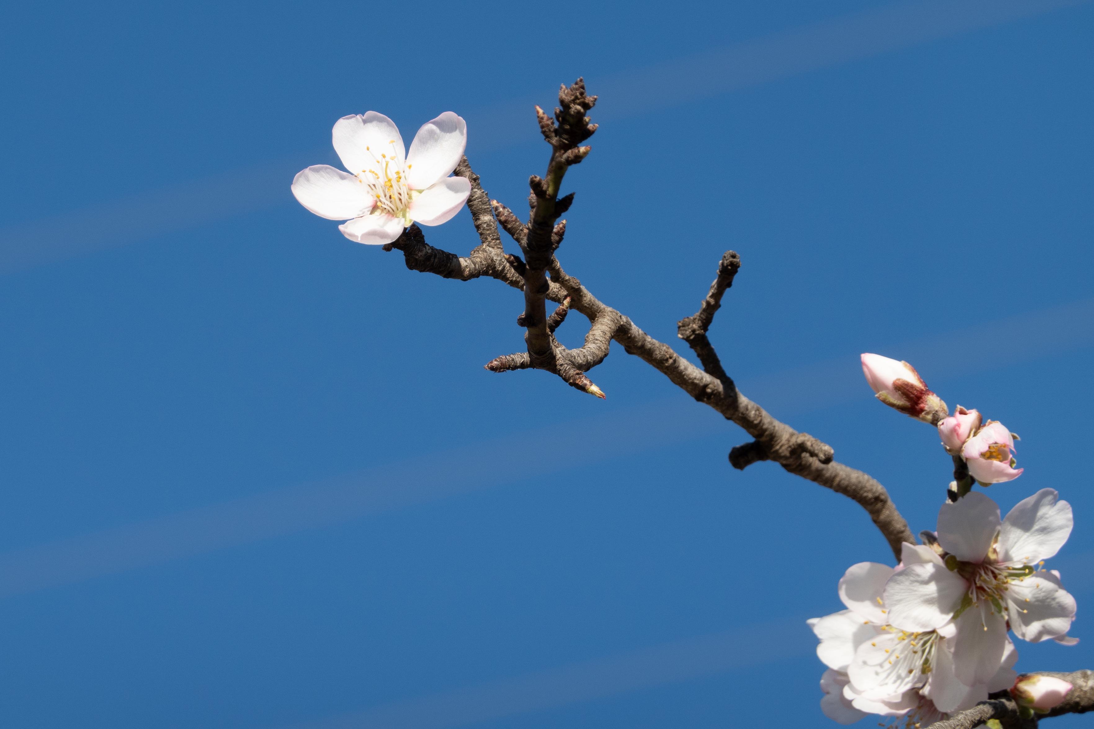
Nearly Christmas and we were fortunate to be able to walk around in t-shirts and shorts
A rock arch forms a window to lower ground and olive groves. Some people climb up through the windowTwo hikers walk down a dirt track and away from the tree covered peak of Silleta de PadulFrom the summit of Silleta de Padul looking towards the ridge line leading to the snow covered mountains of the Sierra NevadaThe mountains of the Cumbres Verdes near Granada. You can see Trevenque on the left and the Alayos de Dilar range closer. Top right is the start of the snow covered Sierra Nevada
I've seen Lautaro from far away to the south. A magnificent massif rising out of the Patagonian Icecap. Remote. Hats off to these two who managed to ski down the 2200m north face.
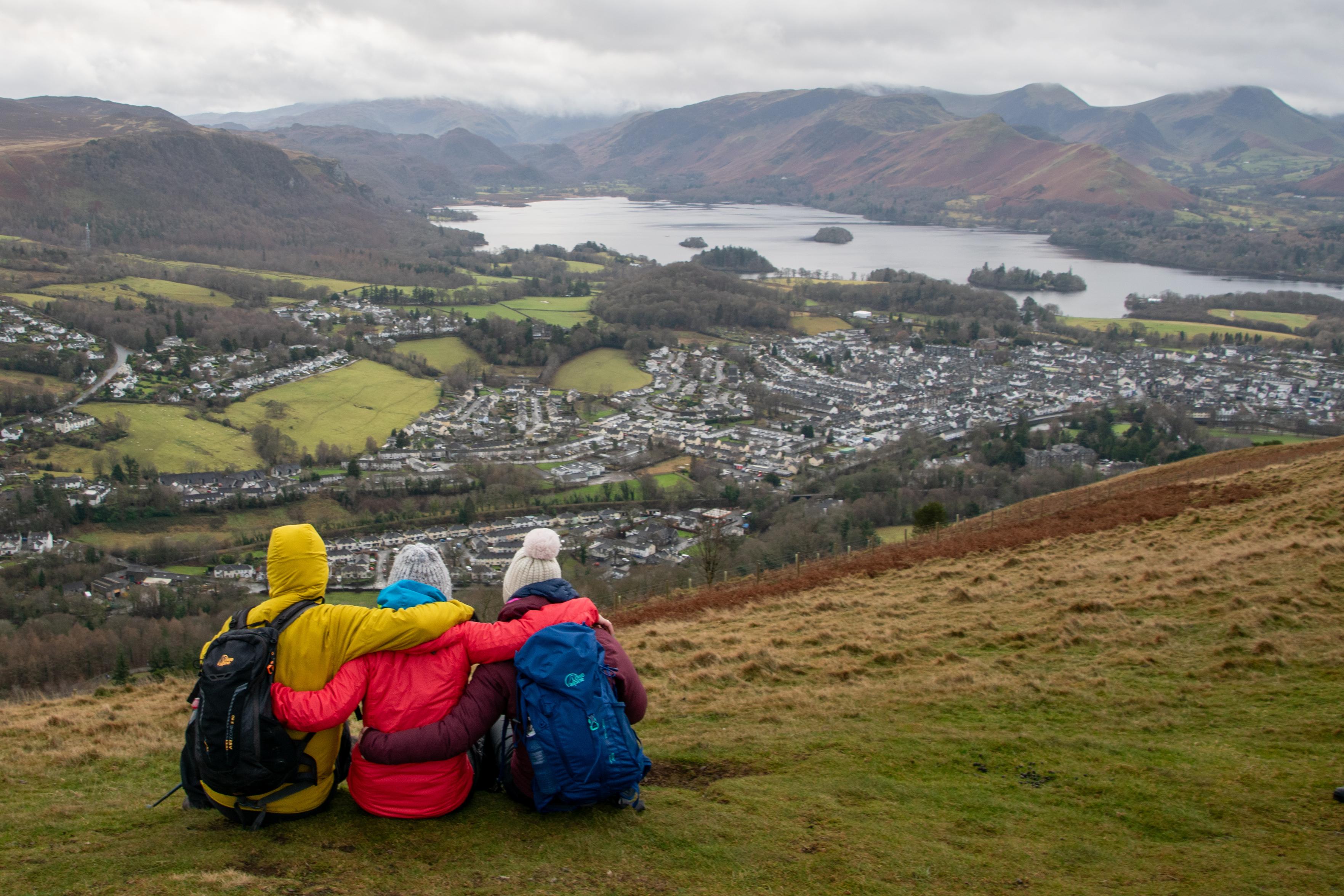
My two daughters and I sat on the diminutive summit of Latrigg last week, in the English Lake District with the town of Keswick and Derwentwater lake below.
We had just left my Dad, who died a few years back, with an eternal view over a place he dearly loved. What a final resting vista!
Three people in multi-colored jackets sit with their arms round each other looking over a town lake and hills.
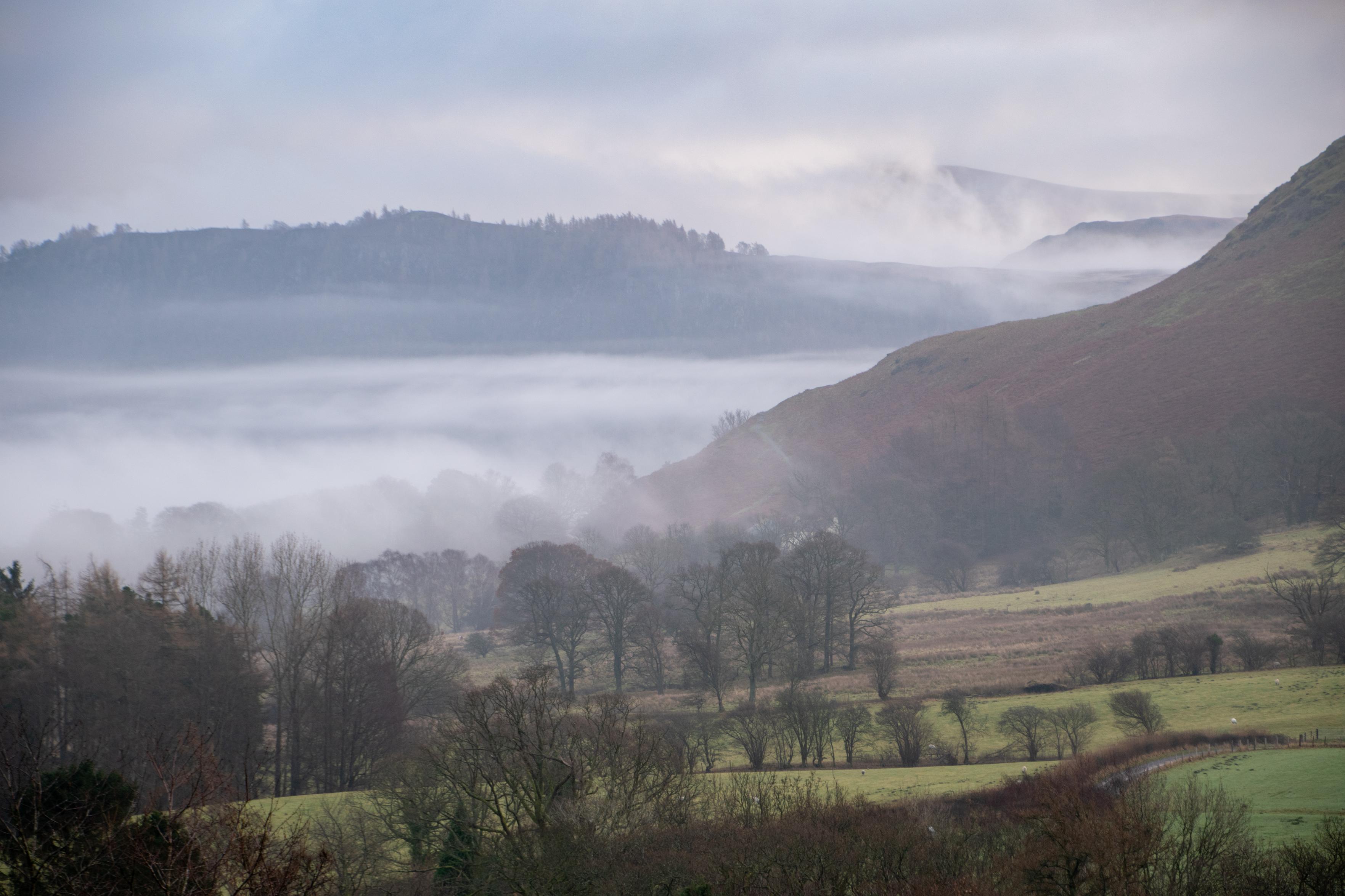
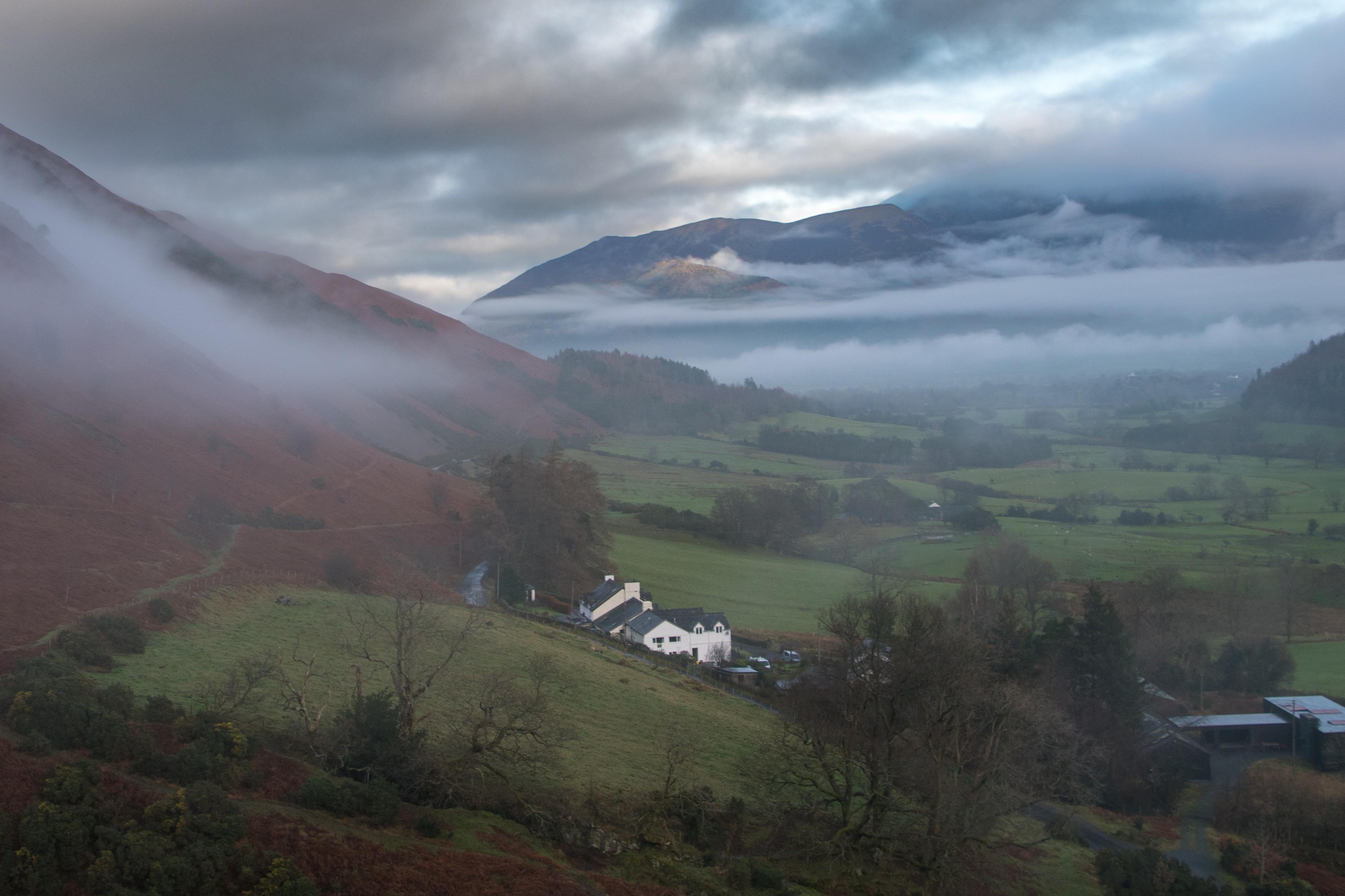
As a young inner city kid, in 1971 I was introduced to the hills. We spent some days camping & climbing the mountains surrounding the Newlands Valley in England's Lake District. Last week I returned to my spiritual hiking birthplace.
The forecast was dreadful but the gods were smiling. Cloud inversion & some wonderful light conditions. Quite emotional. Brought back many memories from my past.
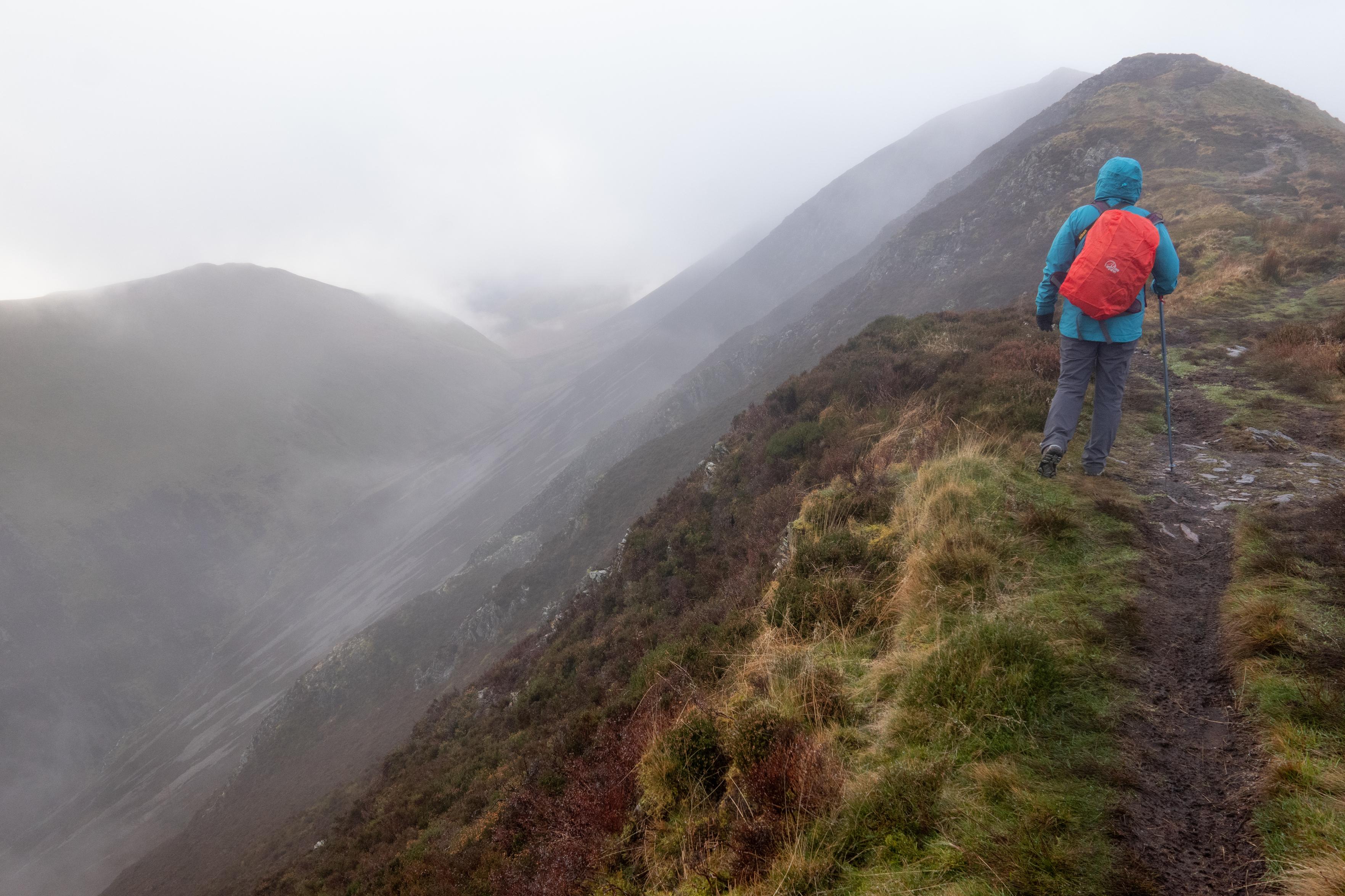
Looking across the Newlands Valley from Stairwith fields and tress intertwined with low mistsA person in blue jacket and red rucksack ascend a broad ridgeon the right. To the left lie mountains mists and ridgesLooking down the Newlands Valley to the peak of Skiddaw which is enclosed in cloud. A famhouse in the centre has red heather and bracken slopes going up to the left. Low inversion mists cloud the hillsidesA person in yellow jacket on the right looks down Coledale Beck towards the Newlands Valley and Keswick, Derwentwater area. Green fields mix with bright orange slopes of heather and braken.
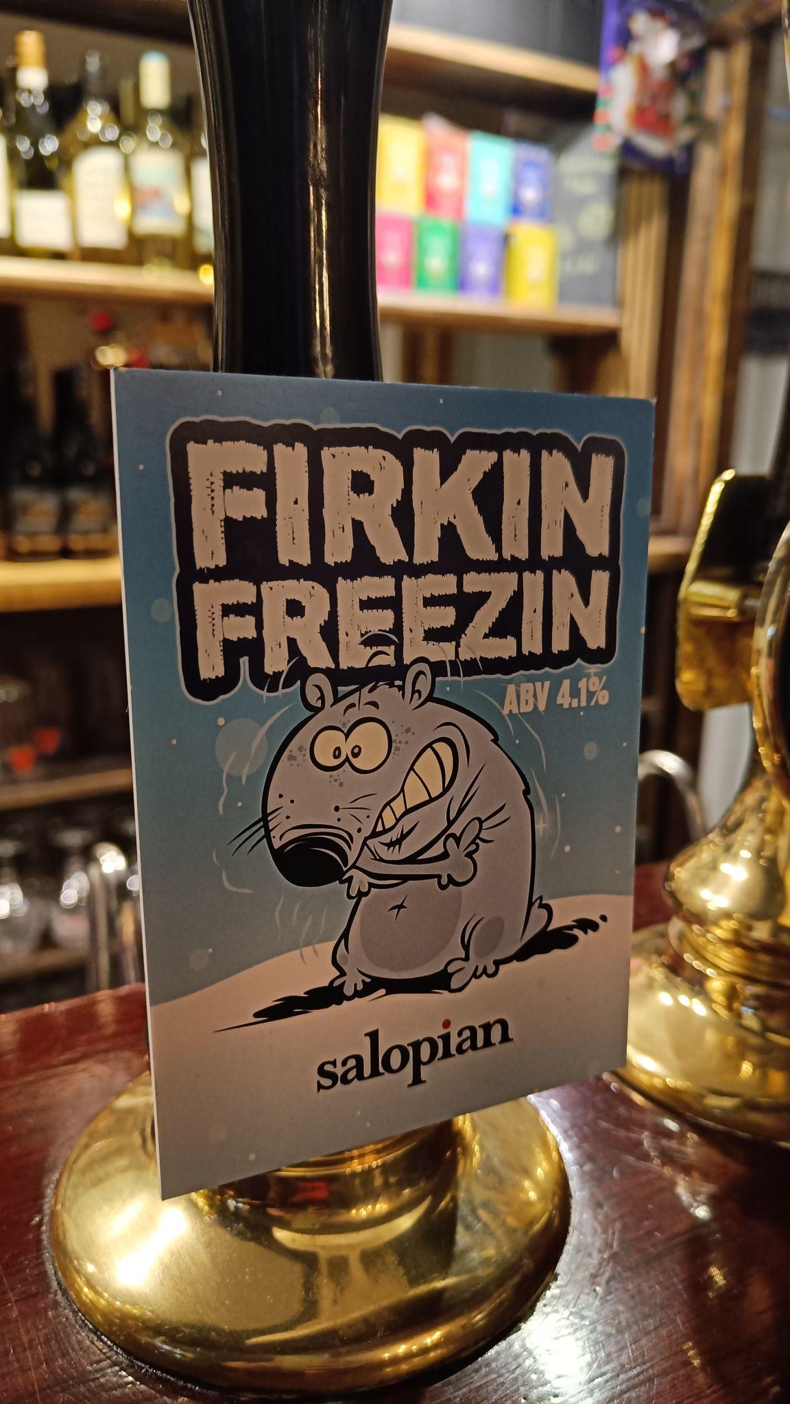
I'm back in the UK visiting friends and family pre xmas. It's cold, grey, damp and frankly, quite depressing. Having said that the local village pubs are warm, welcoming and offer some lovely tasting and wonderfully inventive cask beers such as this 😃
A firkin freezing sign on a bar cask beer in the UK
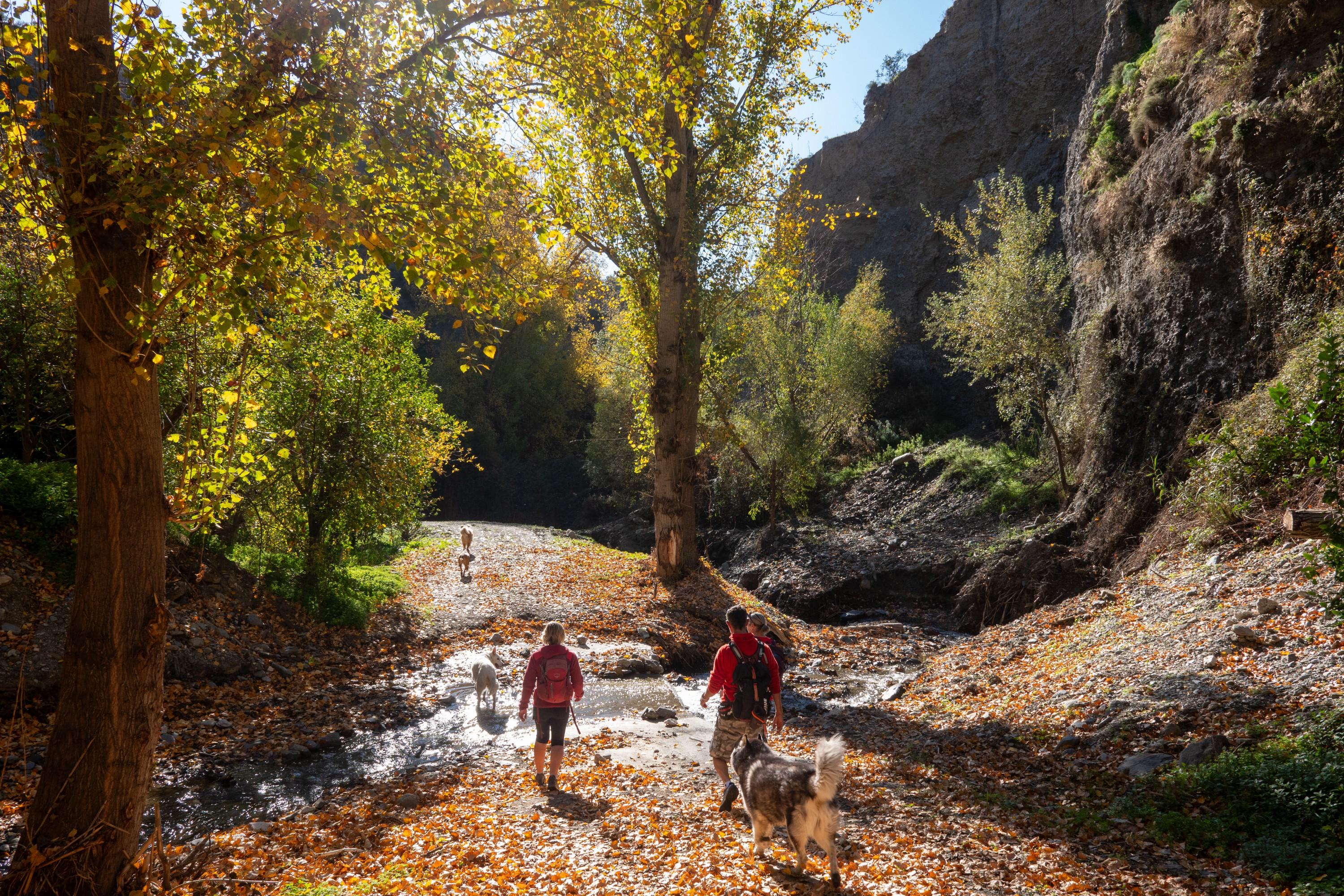
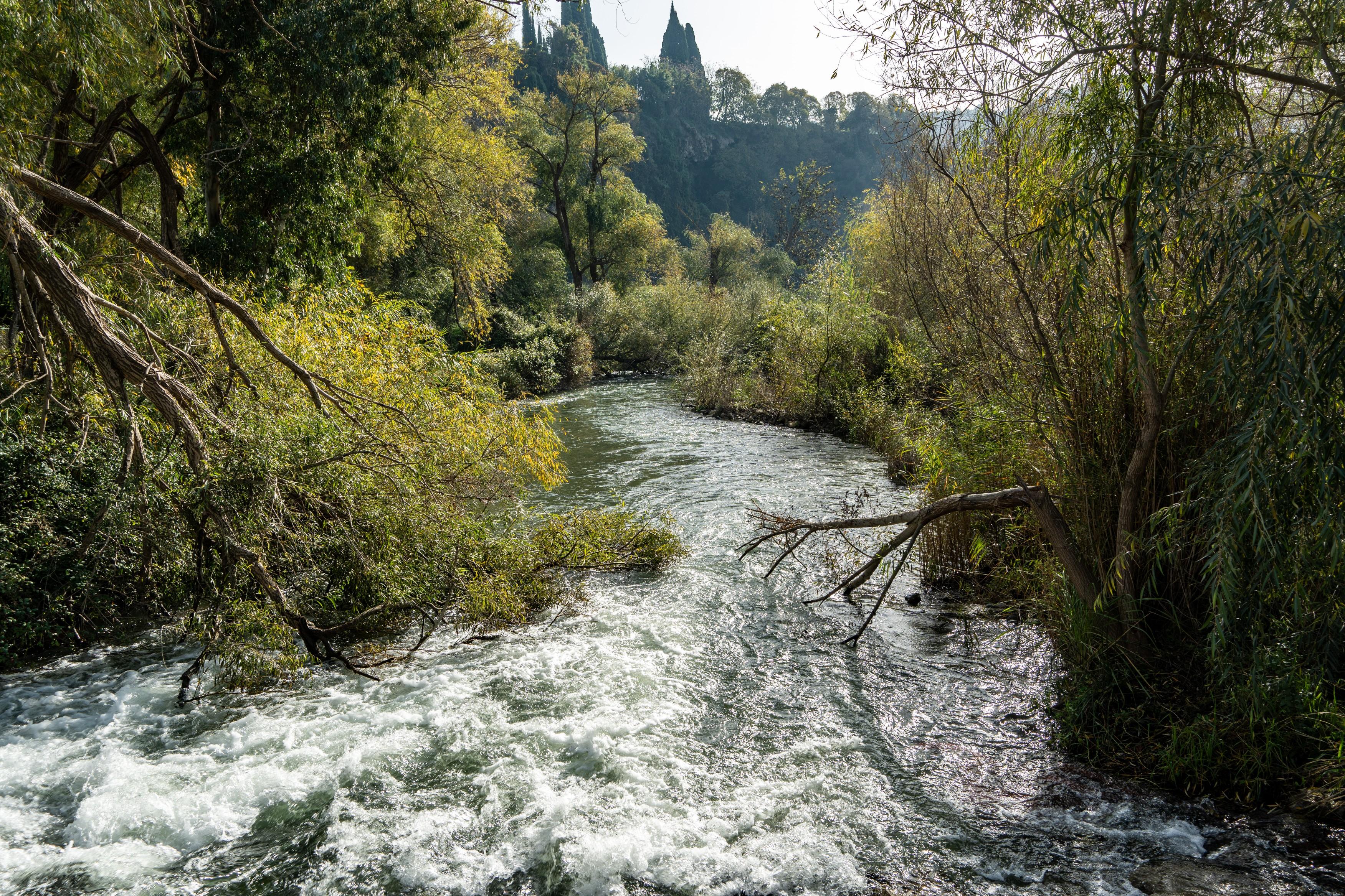
It's bank holiday here in Spain so we knew many of the popular walks would be busy. Instead we drove 15 minutes to a town called Chite, which we had never visited before. Had beautiful hike through lush forests and lakeside (Embalse de Beznar). A glorious 2 hour, 7km circular walk that ended at the bar in Chite.
Amazing what's on your doorstep that can sometimes get overlooked!
People walk along a narrow trail with a lake to the leftHikers about to cross a small stream with some auyumn colors trees to the leftA bay at the Embalse de Bezbar lakeThe hike back up the hill to Chite with views back to the Sierra de Almijara and Embalse de Beznar
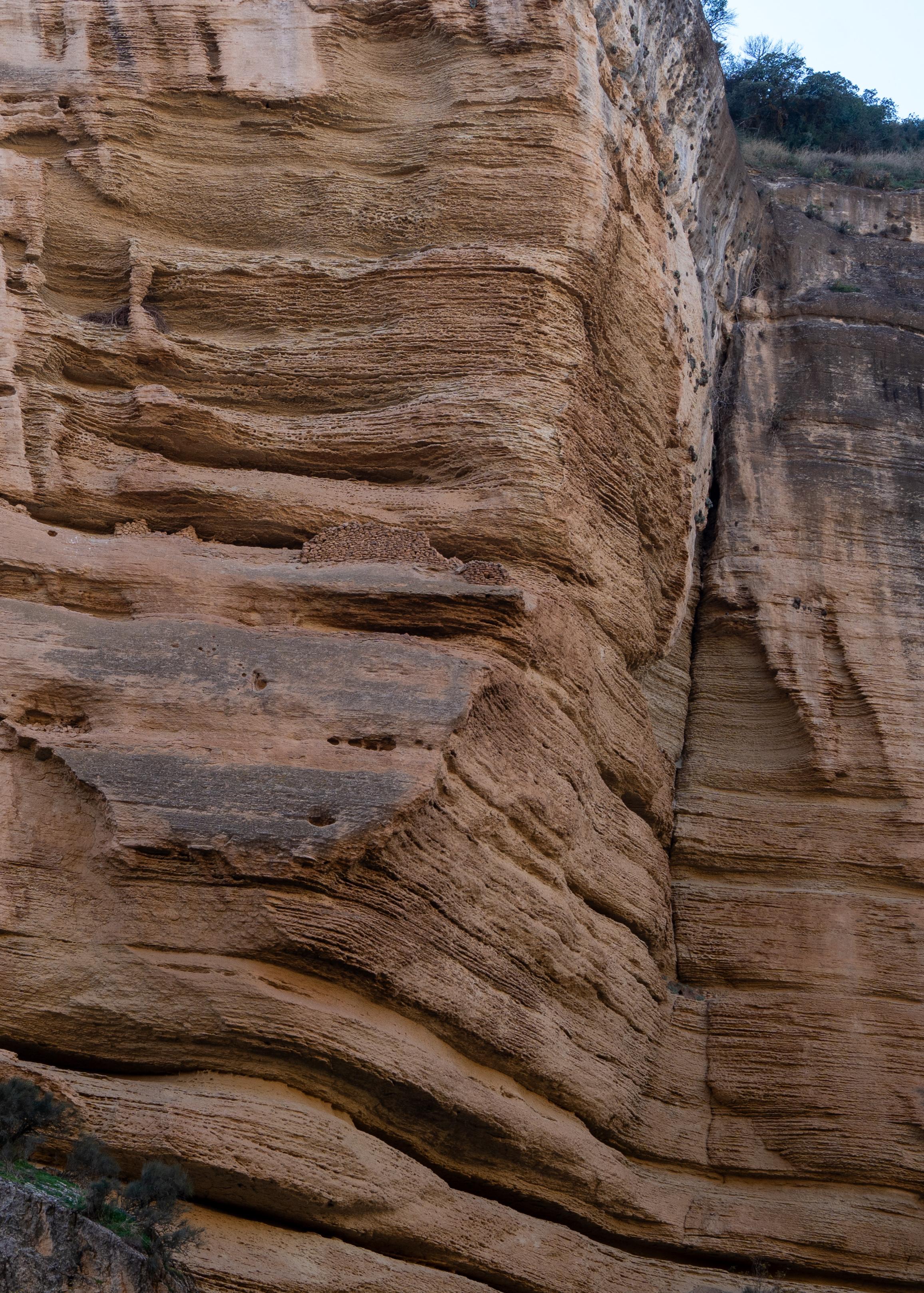
This is amazing. Spotted these walls half way up a vertical cliff in the Tajos de Bermejales. Who built them and why?
From Wikipedia ...
1/2
Neolithic people lived in the canyon 5,000 years ago, sheltering under its overhanging walls and using the river as source of food. There are traces of these early settlers on the canyon walls about 10 metres above the present river level. Some of the walls they built to enclose the cavities in the canyon wall are still visible.
An orange cliff face with horizontal ledges. One of the ledges has a wall built of stones
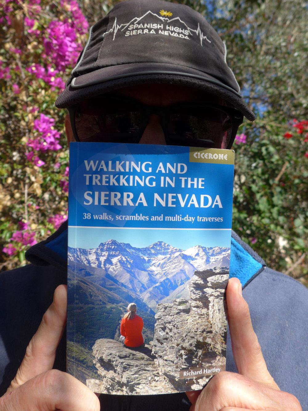
Not into self promotion but this is the 7th anniversary of the publication of my guidebook to Spain's Sierra Nevada. Can't believe how time has flown by.
They say everybody has a book in them, I guess this was mine. Quite hard writing a guidebook. You have to remain factual not flowery, keep stories short & relevant etc.
Yes, I get some royalties, cup of coffee for every book sold, but truth is that this was a labor of love, not for reward. My way to spread the word about these mountains.
A person with a baseball cap on and dark glasses has a mountain guidebook held up in front of his face
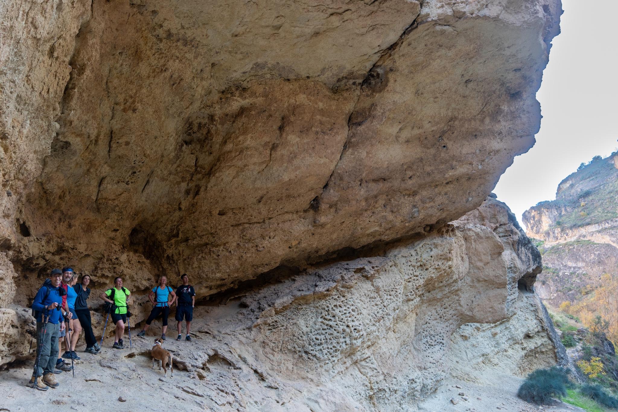
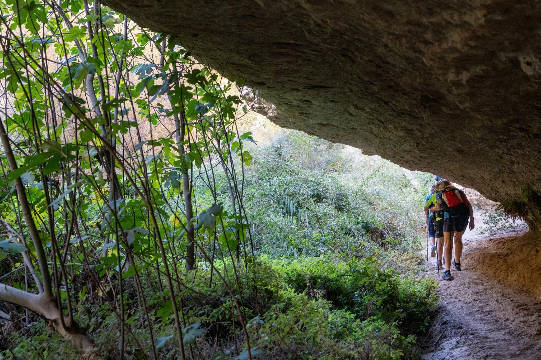
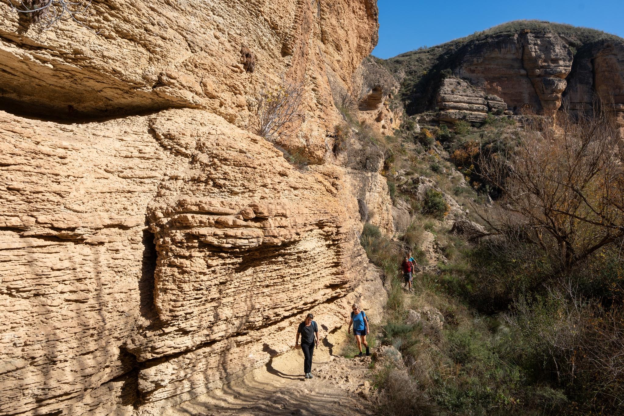
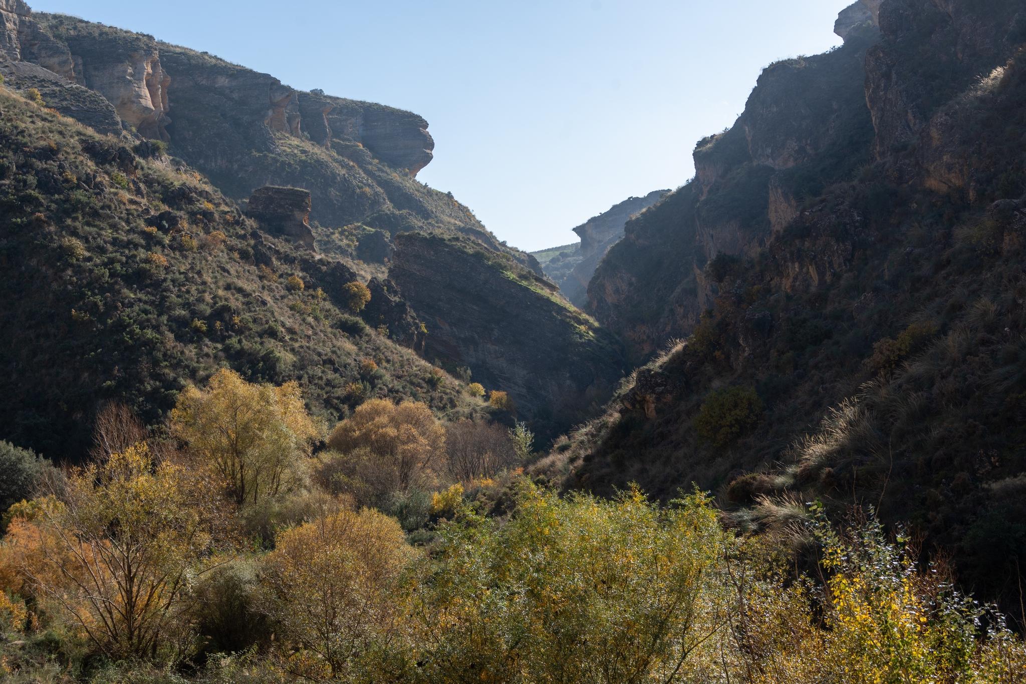
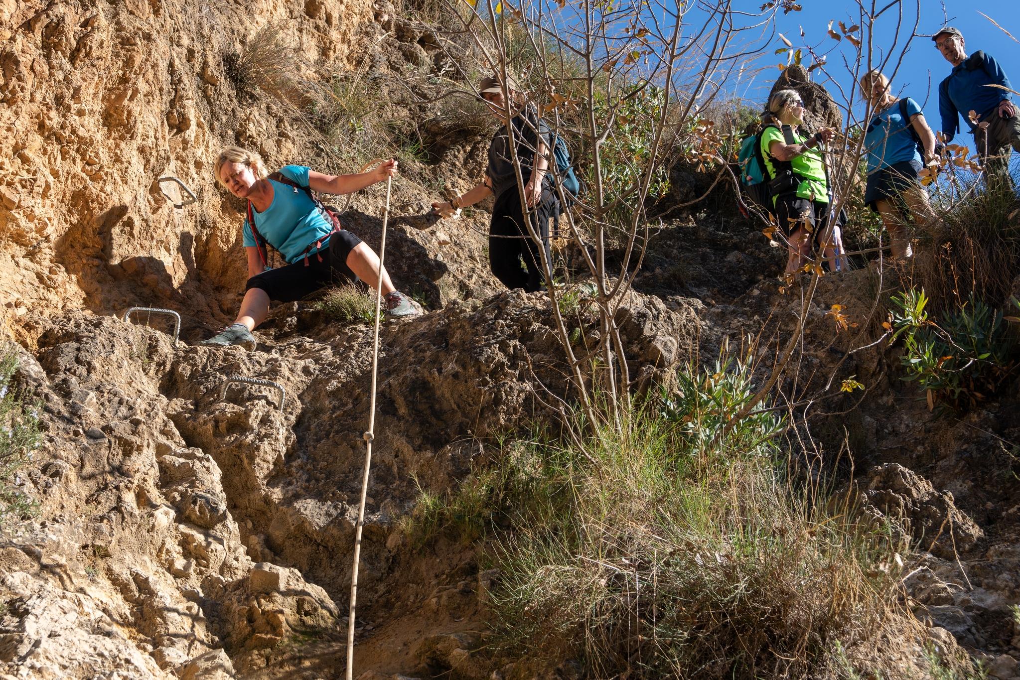
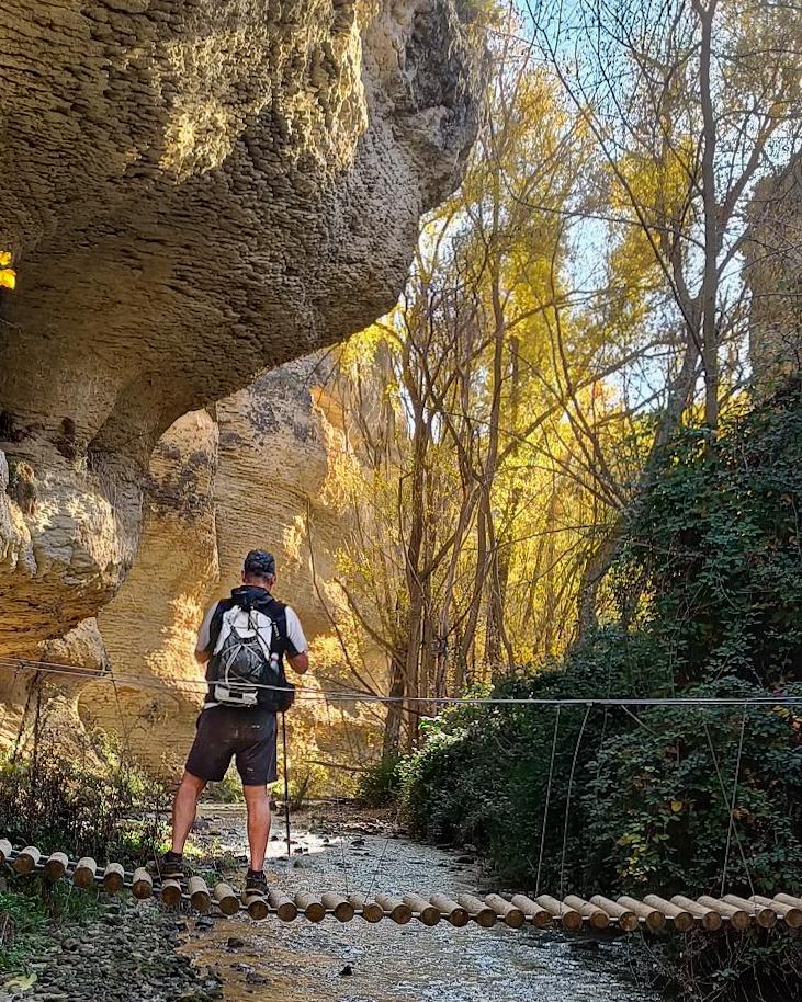
Some more photos from our trip this week down the Barranco de Tajos Bermejales. A very interesting hiking route with twists and turns, ups and downs and a few surprising features. Be prepared for some wobbly wire bridges, deep undergrowth, ladders, rungs and short sections of very easy scrambling, safeguarded by dodgy fixed ropes. Great stuff and recommended that you visit.
a group of hikers shelter in the shade beneath a huge overhanging cliffSome lush vegetation to the left. To the right there is an overhanging piece of cliff face through which a group of hikers are passingsome hikers pass by the base of a huge yellow cliff to the leftLooking back up the valley just traversed. The lush valley bottom is guarded by jagged cliffs
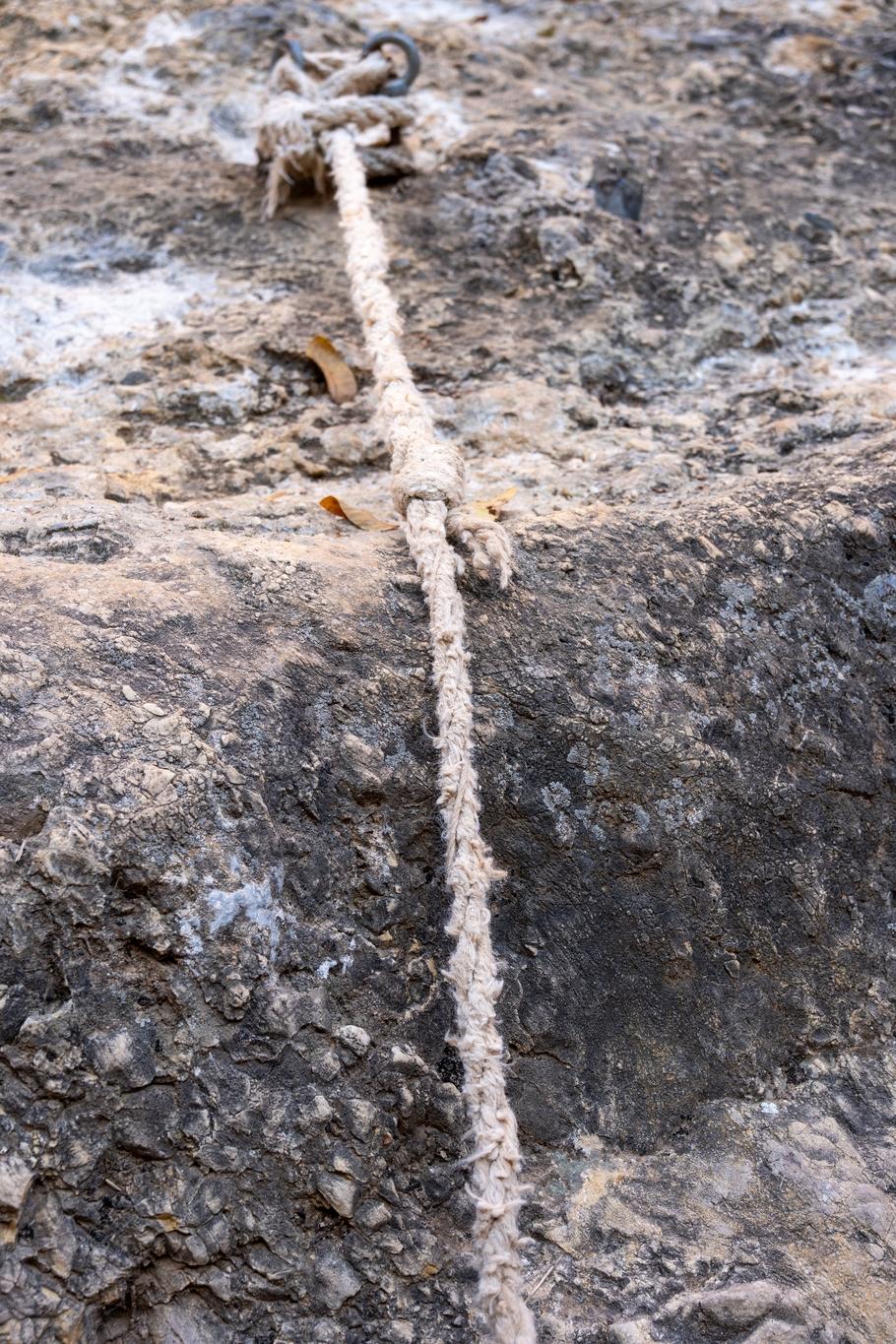
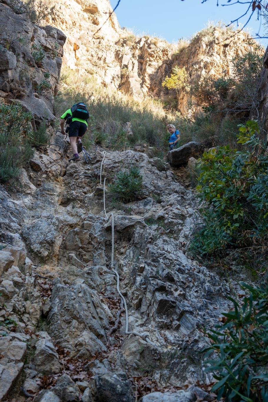
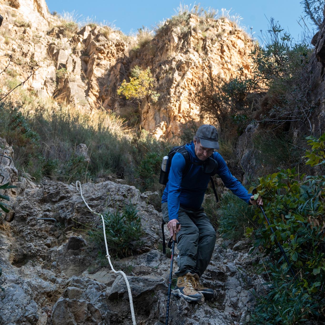
On certain sections of the Tajos de Bermejales gorge hike there are ropes to assist in descent or ascent. Have to say though that taking to the rocks direct seemed a much safer alternative 😀 . The first photo looks like Edward Whymper's rope that he last used on the Matterhorn in 1865!
A tattered old and frayed ropeA person in yellow starts to descend a rocky section of path alongside an old ropeA person in blue starts to descend a rocky section of path alongside an old ropeA person in blue tries to figure out how to descend a rocky section of path alongside an old rope
Being a keen photographer, that doesn't do "selfies", I don't get in photos much. I do love this one though taken yesterday by @khusky.
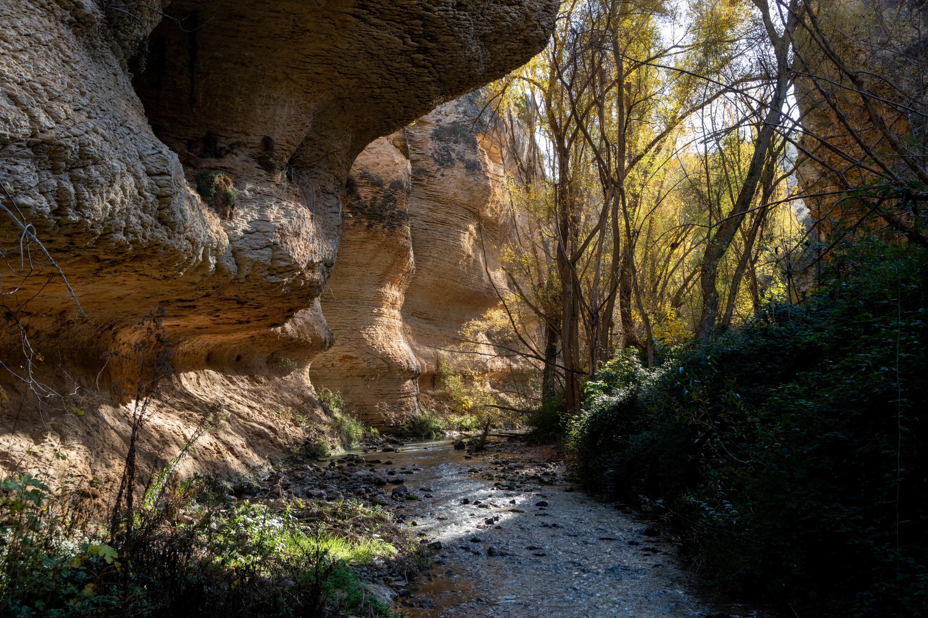
I'm on a rikkety bridge over a small river with huge rock walls towering above and a very colorful scene upstream. The Tajos de Bermejales gorge, near Granada
Off for a walk to visit the Tajos de Bermejales gorge. Strange to be getting my stuff ready and putting on shorts on 1st December. 14C now and 22C expected.
I find the Garmin Explore website incredibly slow and buggy. Seems like it hasn't improved in years. For a company that has some of the best backpacking/hiking aids when on the trail, this isn't good enough.
This has been a gripe of mine for many years and to be honest has stopped me from buying more Garmin gadgets (watches etc)
Anybody else feel the same or is it just me being a grumpy old man? 😀
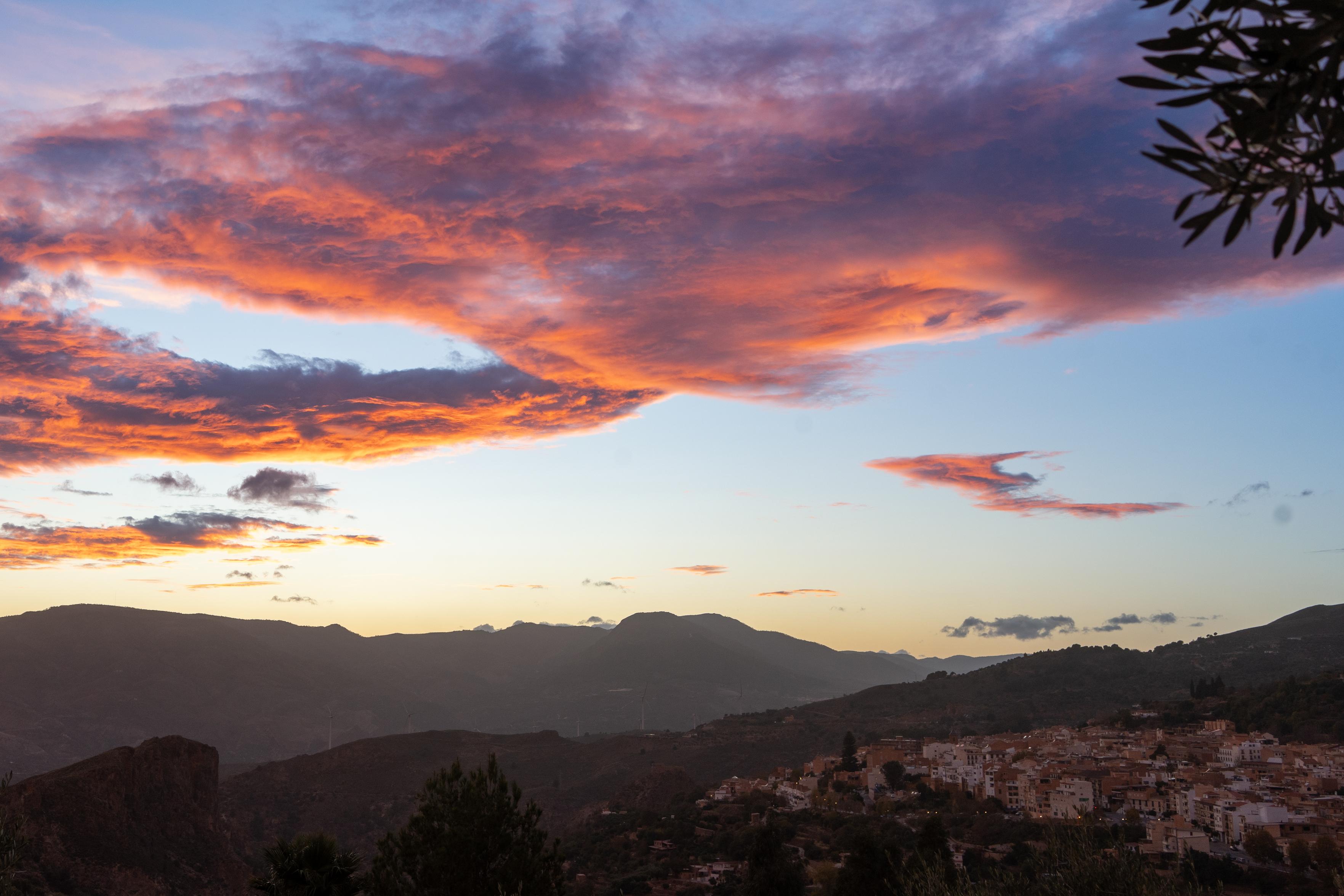
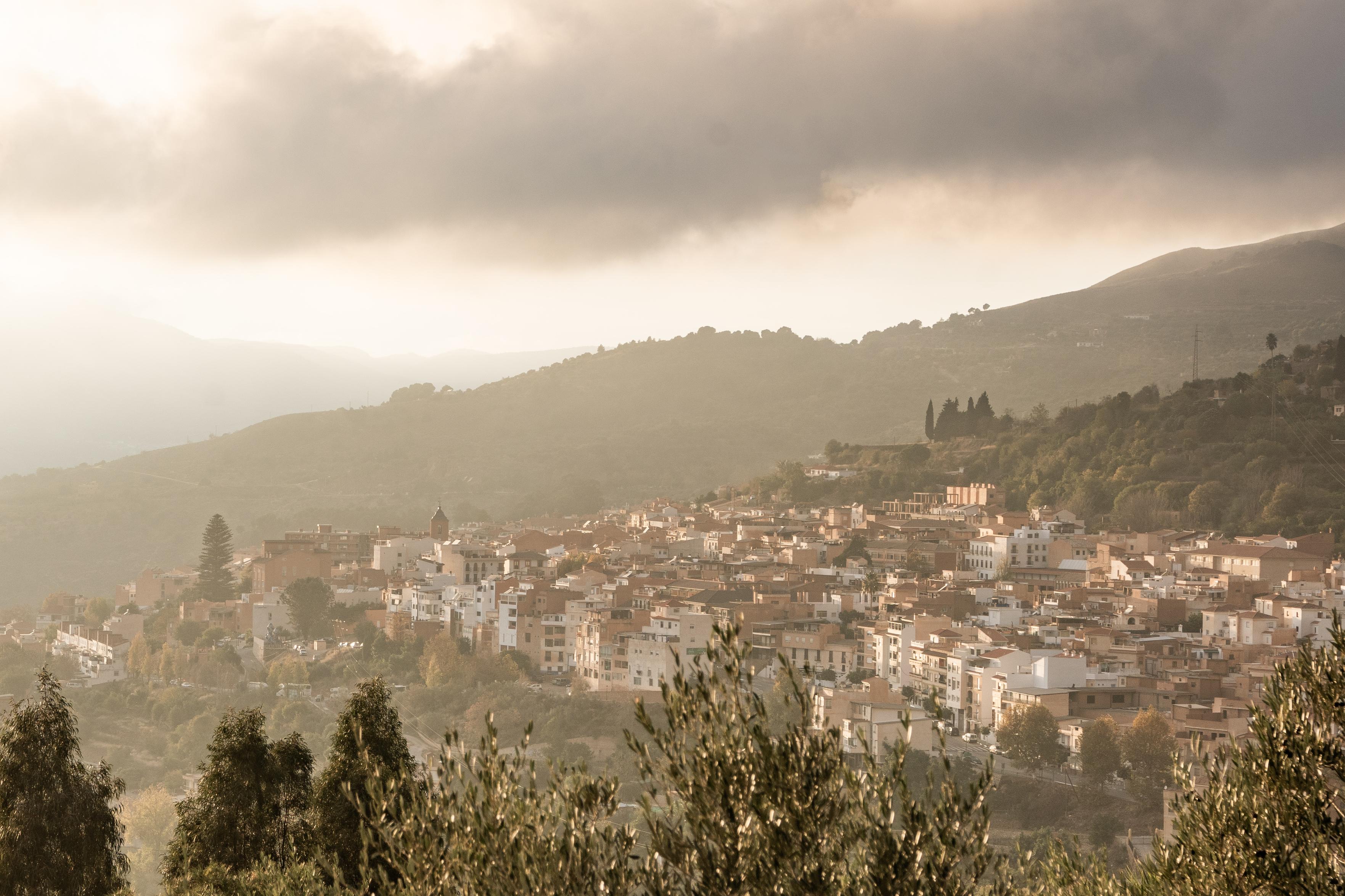
"You can see the pub from here" 😃 well maybe not the pub, but you can almost make out my house.
An unusual image showing the location of the town of Lanjarón (700m) nestled on a small hillside. The Tajos Colorao cliffs are beyond with the Lanjaron valley dropping down to the Rules dam and eventually the Mediterranean sea.
Today we've been walking down the lower Rio Guadalfeo as it approaches the Mediterranean sea at the Costa Tropical. A very different environment to what we are used to. These images almost remind me of some gentle pastoral scenes from the UK.
A river ends its way downstream with a lush variety of trees lining the banksA river ends its way downstream with a lush variety of trees lining the banks
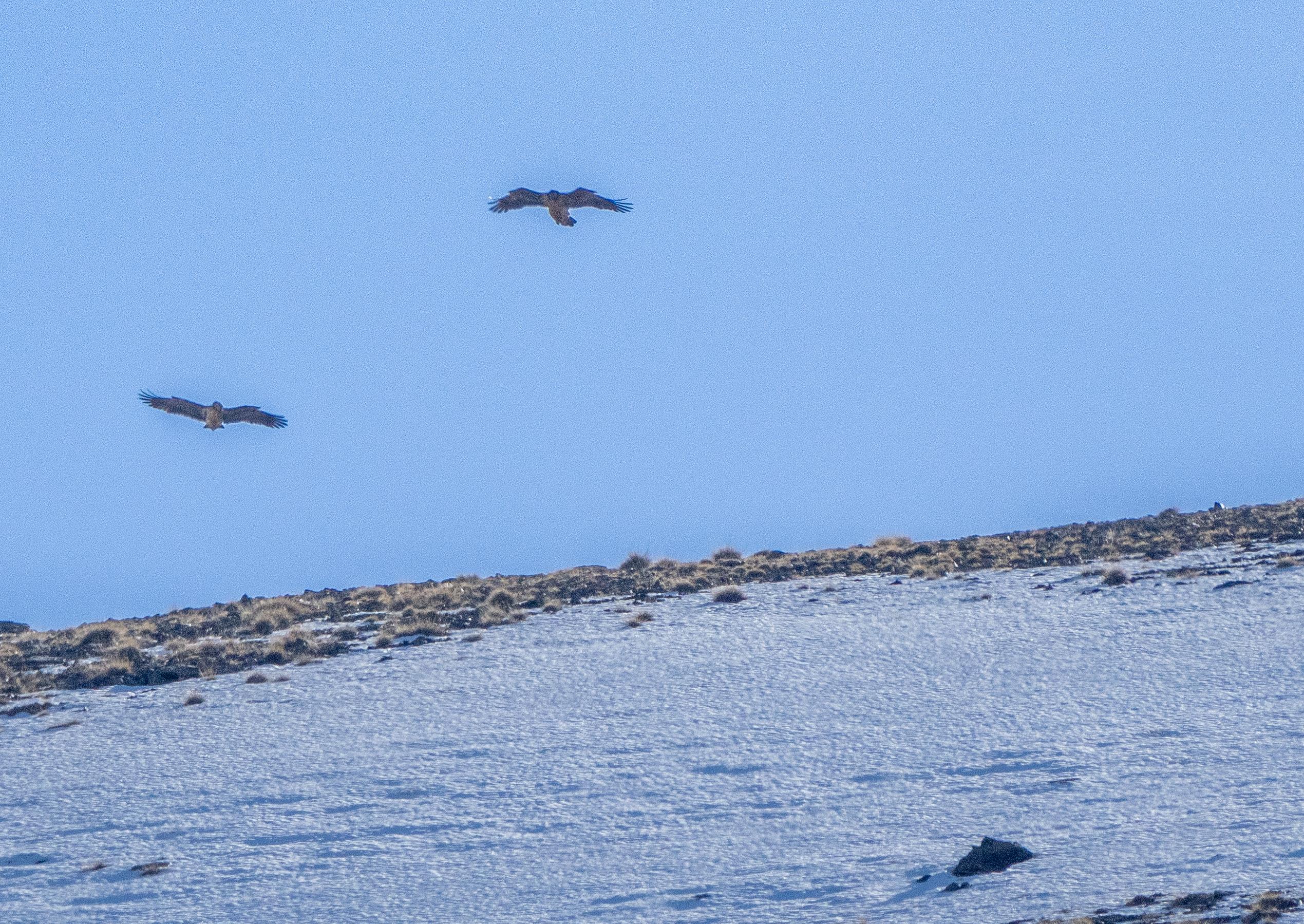
I feel very privileged. Today we spent over an hour in the presence of two very rare Bearded Vultures (Quebrantahuesos/Lammengeier).
They rode the thermals, dropping bones to extract the marrow. The process repeated itself throughout the encounter. This mating pair from Cazorla seemed to be really enjoying themselves and certainly put on a display for us. A rare treat for us to see.
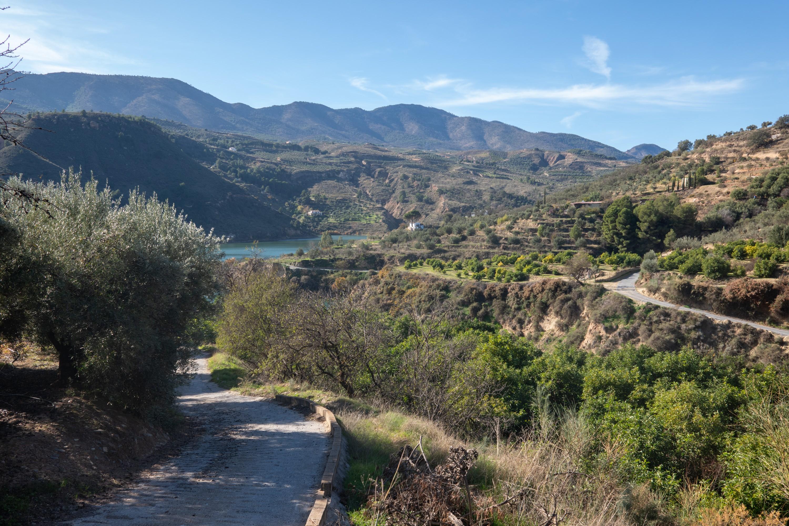
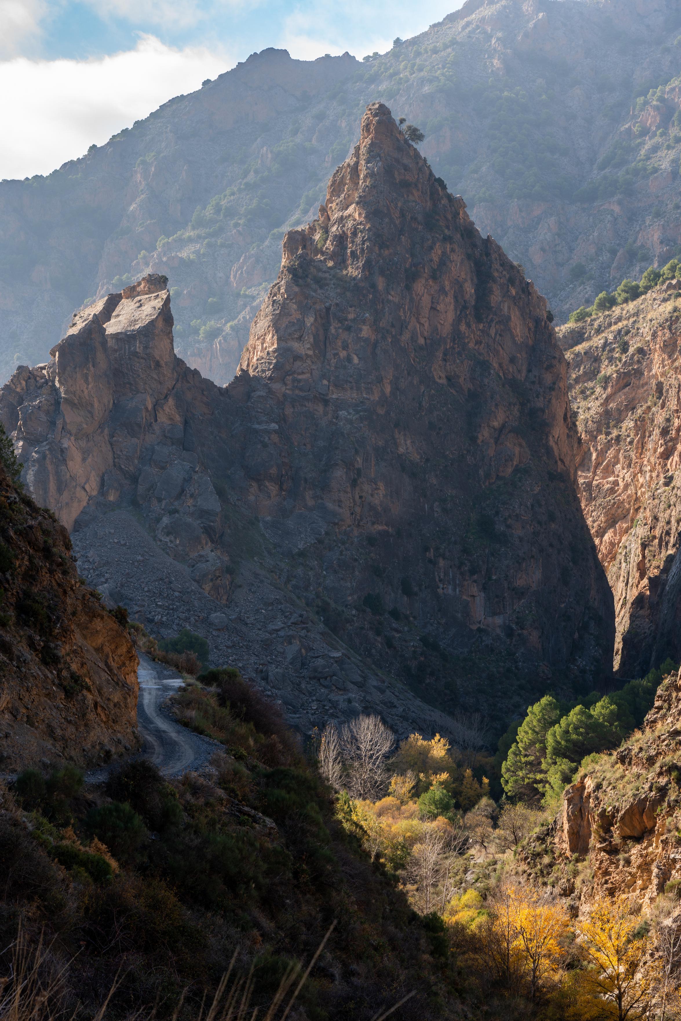
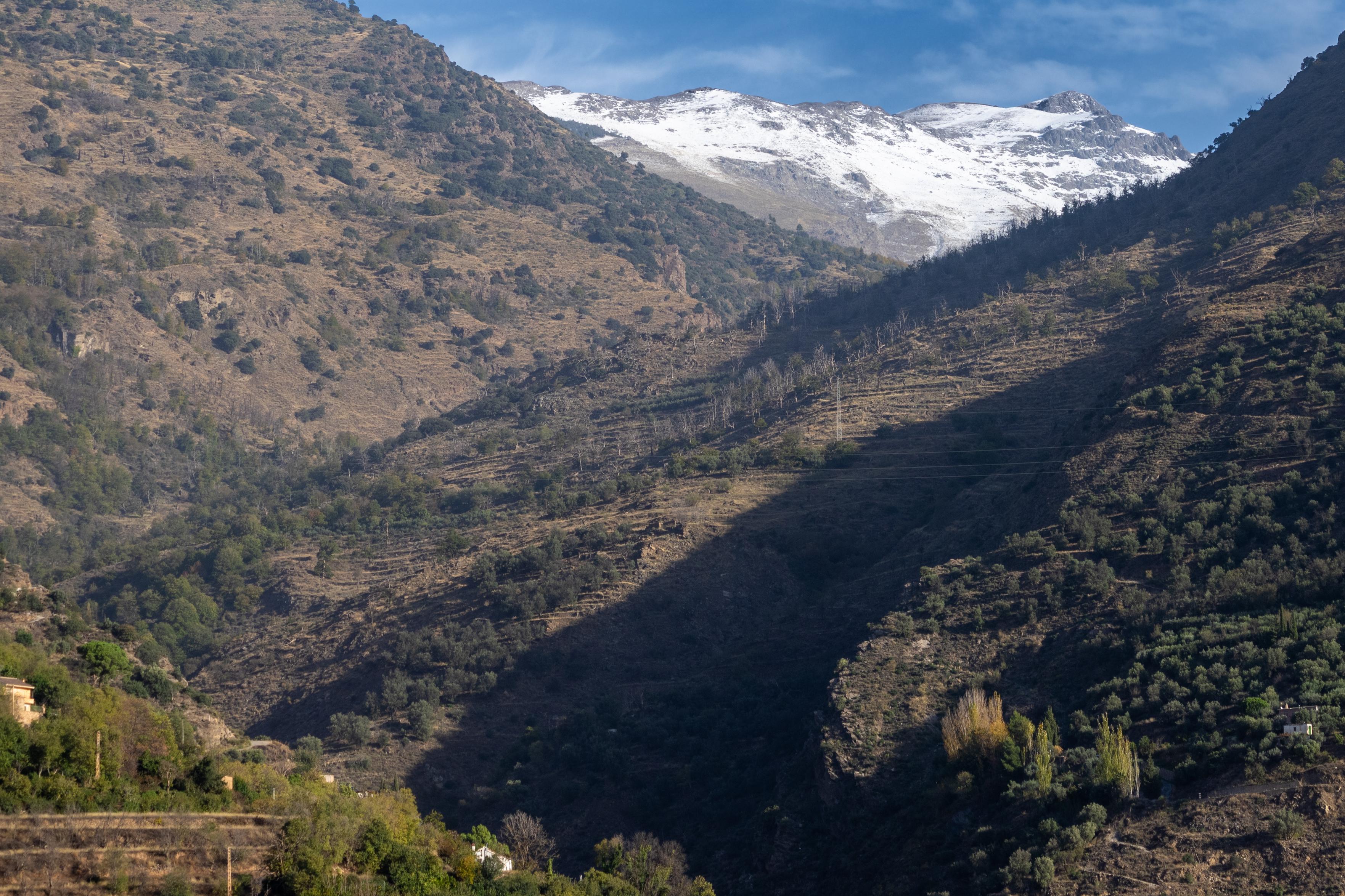
I've travelled this road from the Sierra Nevada mountains down to the village of Nigüelas many times. The final kilometers enter a spectacular gorge, but the light has never been right for an image. Either no shadow in early morning or directly into the sun late afternoon. Frustrating.
Today though, I was lucky. I arrived there with some beautiful light conditions. It's a dramatic place!
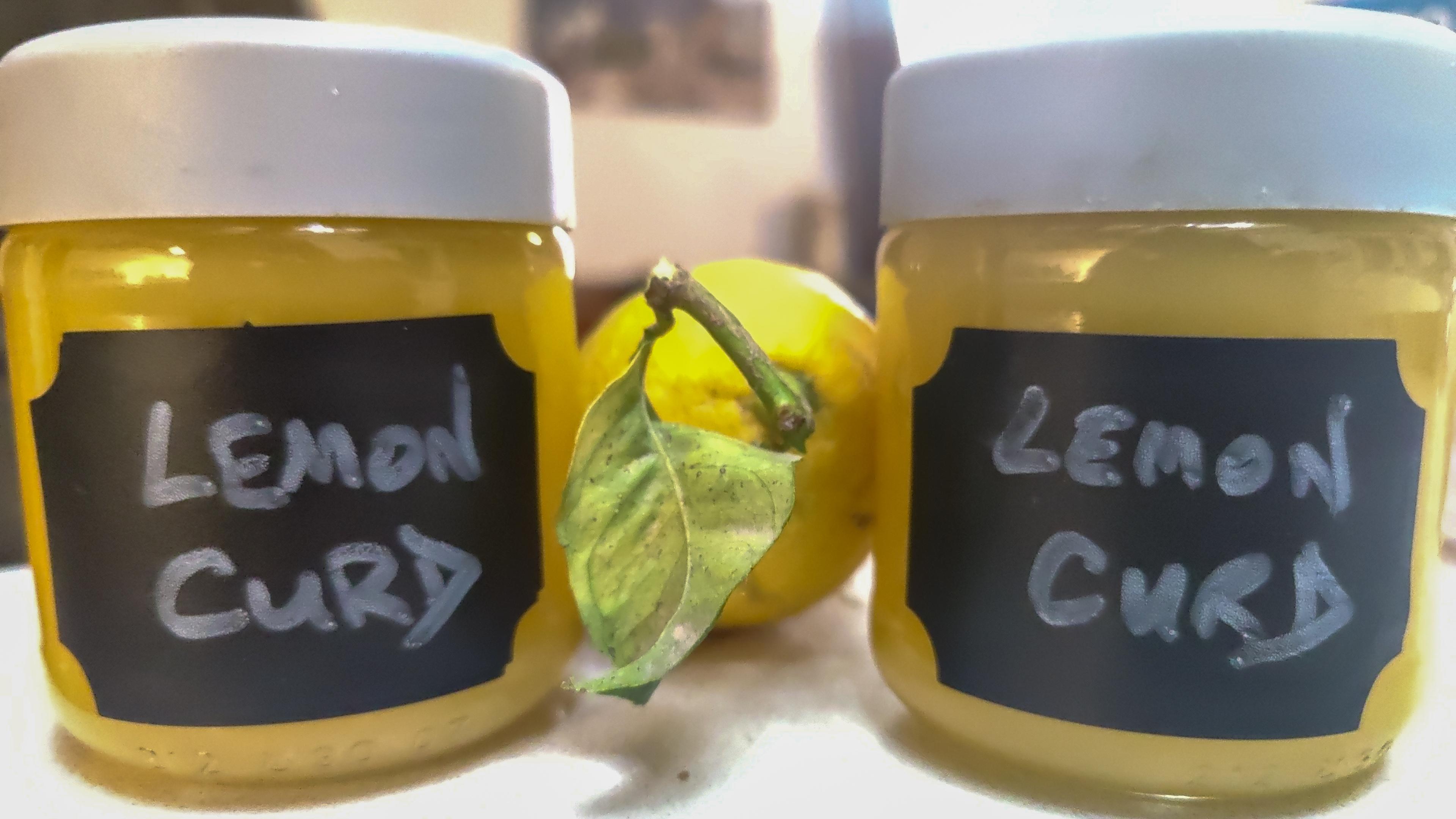
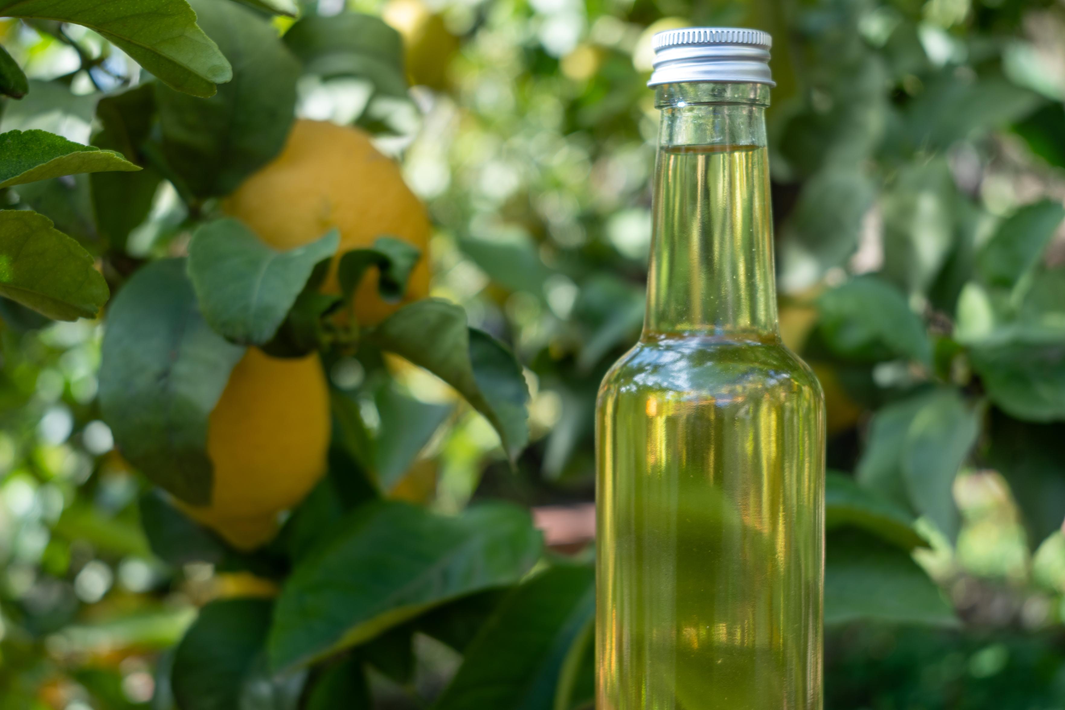
After a month of marinating some of our lemons in alcohol, today I completed the final steps and added sugar water before bottling. Home made Limoncello. Salud!
I hate colds/flu, especially those coughing fits that seem to last for weeks. Got infected by a hiking visitor from Plague Island during the week. I should have known better. That's written this weekend off for me then 😤 😭.
All those heading for the hills this weekend, enjoy yourself and I look forward to seeing the snaps from my perch in front of the TV.
We've bitten the bullet and decided to spend at least all of next November in El Chalten, Patagonia. Mountains, glaciers, photography & wildlife for at least 4 glorious weeks!
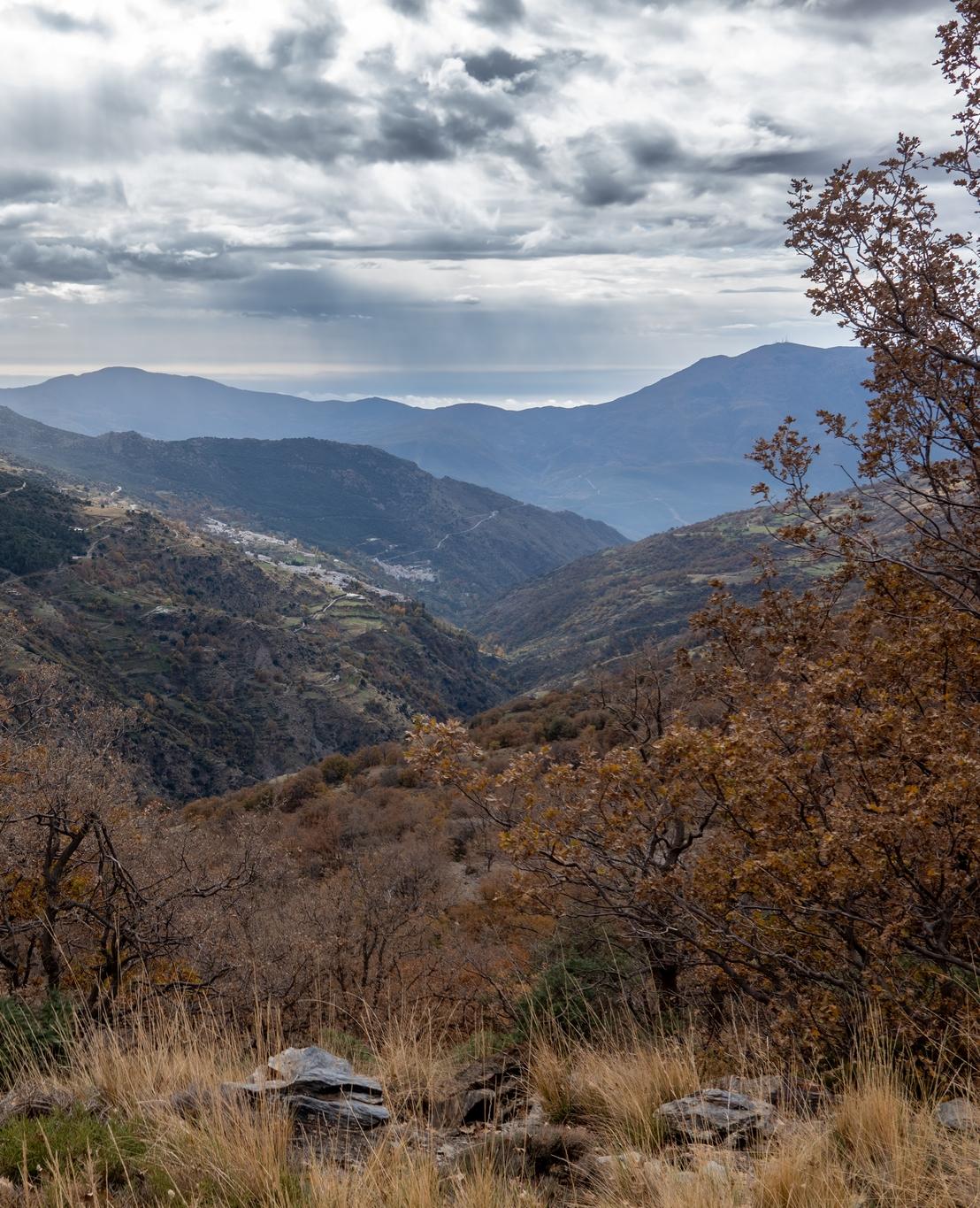
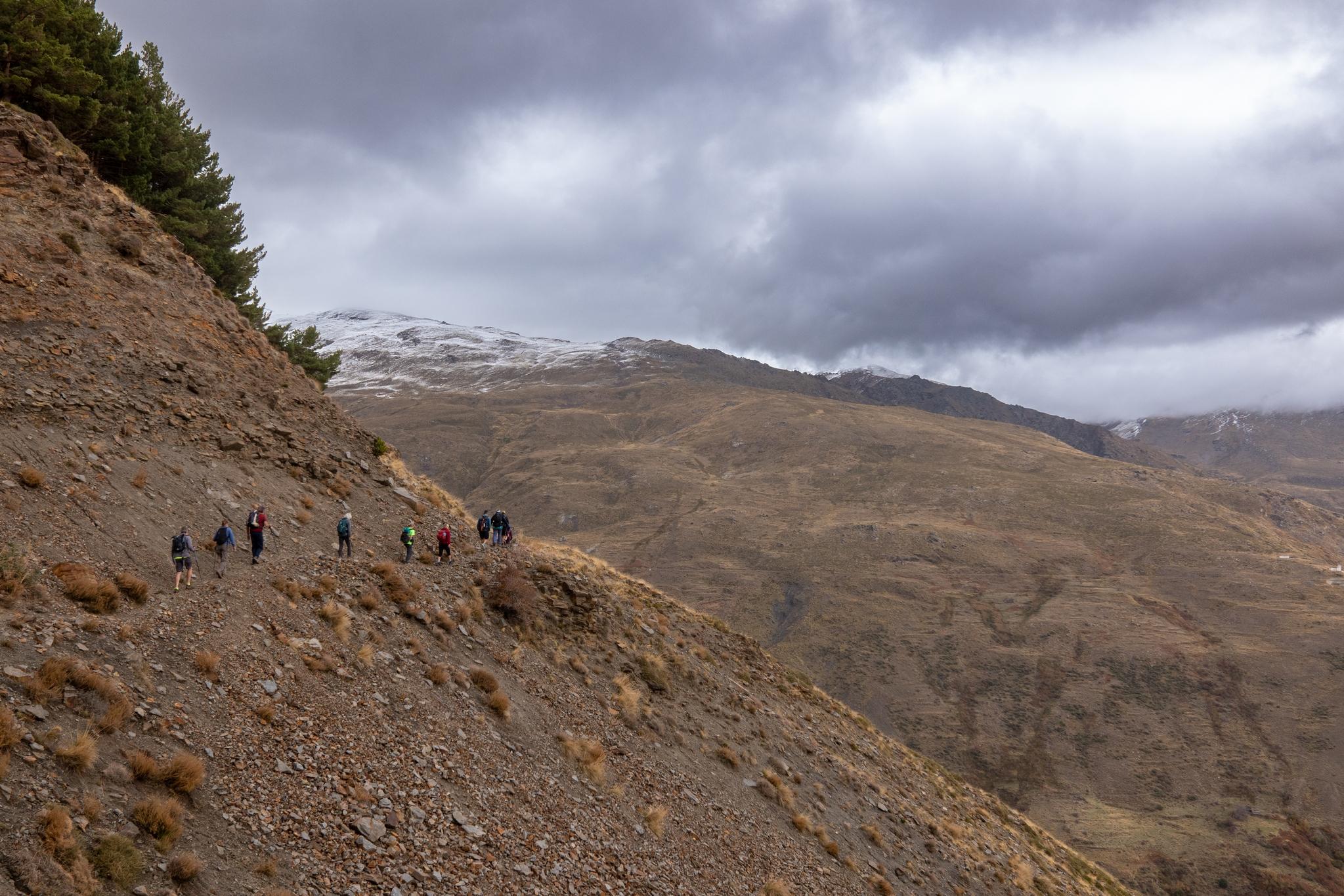
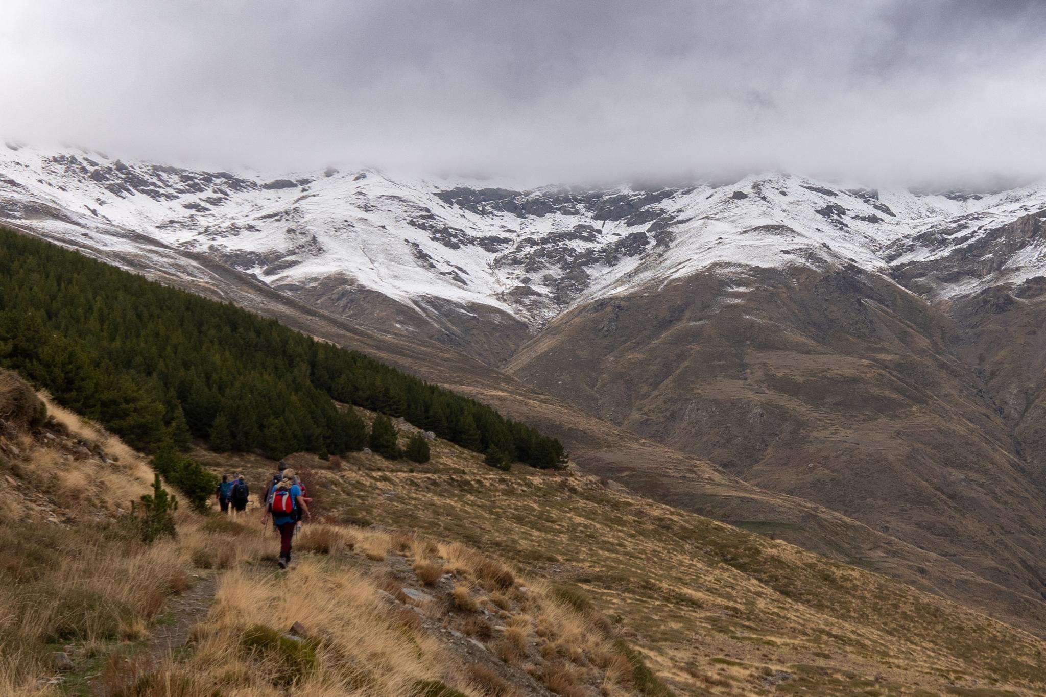
Exploring the quiet Toril valley in the Sierra Nevada yesterday. A moody day with cloud over the snow covered peaks but some spells of sunshine pushing through during the afternoon.
The head of the Toril Valley is a magnificent and dramatic place presenting a wall of snow covered mountains disappearing into the clouds.
Access was via Capileira and Cebadilla. 13km and 700m ascent.
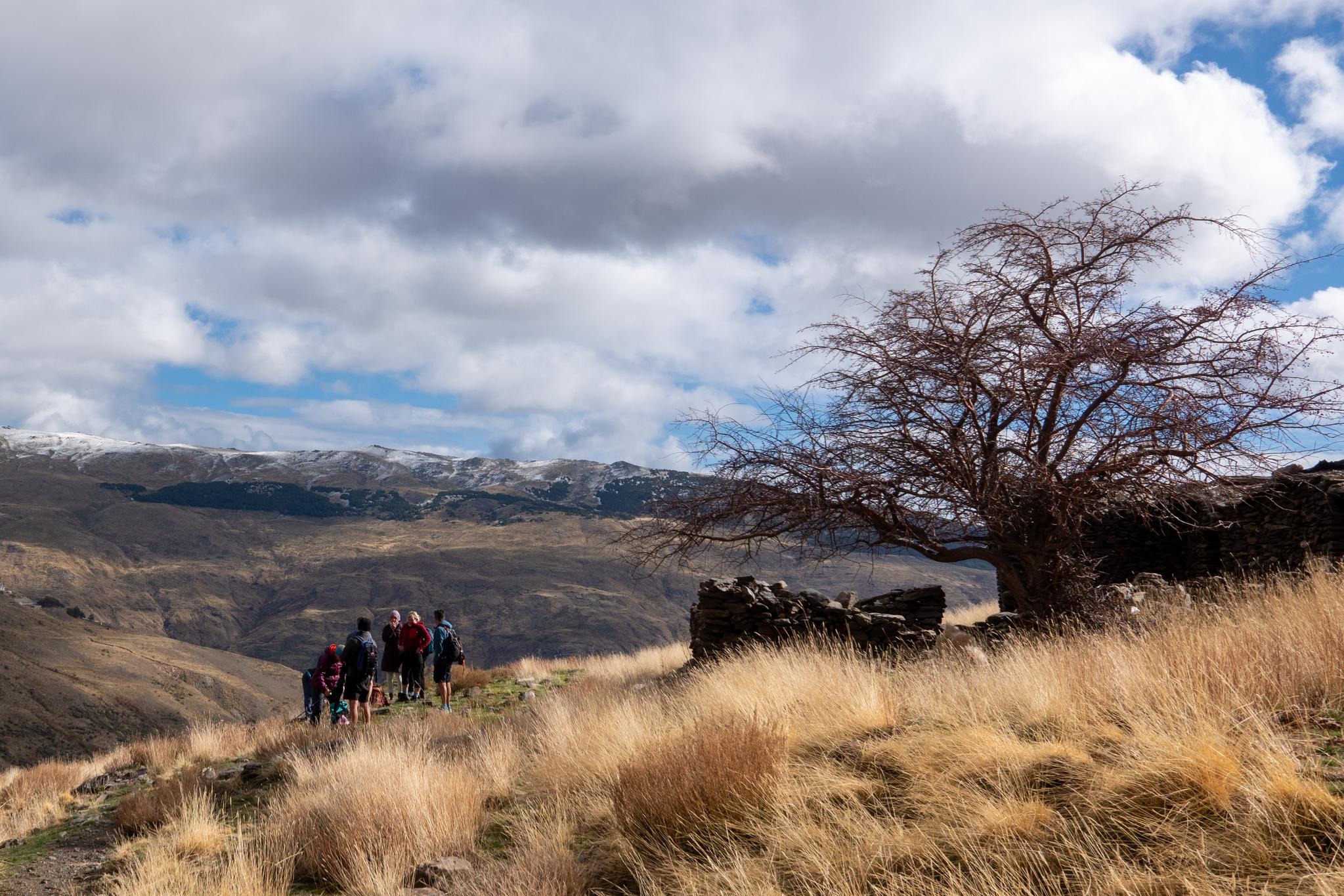
Looking back down the Poqueira Valley to the town of Capileira perched on the hillside. Rays of sun and coming down through the dark clouds. Autumn colors on the trees and shrubs in the foregroundA lonely tree and ruined "cortijo" are to the right of a group of hikers. Cloudy skies with some blue coming throughOur group of hikers is walking along a narrow path beneath a forest. behind are dark clouds and a snow covered peakThe head of the Toril Valley is a magnificent and dramatic place. A wall of mountain rises above with snow covered flanks
Thanks to my mate Ian Tupman who, on the 10th anniversary of the trip, has just re-edited some footage from our Patagonia Expedition in 2014. Additional footage, photos and a new soundtrack.
He's probably just cost me upwards of €5000 as I shall have to return now 😤.
Seriously, superb images that brought back some of the finest memories of my mountain life. Music combined nicely with the footage. Thanks for that Ian
We collected 240kg of olives from our land over the past couple of days. Today came the exciting part when we took them down to the local mill.
Here they do the first press of the olives and in return we receive back our very own oil. 40 litres of thick, dark green extra virgin olive oil. No money changes hands. Olives for oil.