After a couple of mountain bivouacs I am sold on using Sleeping Quilts rather than Sleeping Bags. 1. Generally lighter weight (no zip) 2. You can micro manage temperatures much better than enclosed in a bag 3. You can turn & move much easier 4. Zips! There aren't any. How frustrated have I got in the past when zips get snagged whilst trying to extract oneself quickly in the middle of the night?
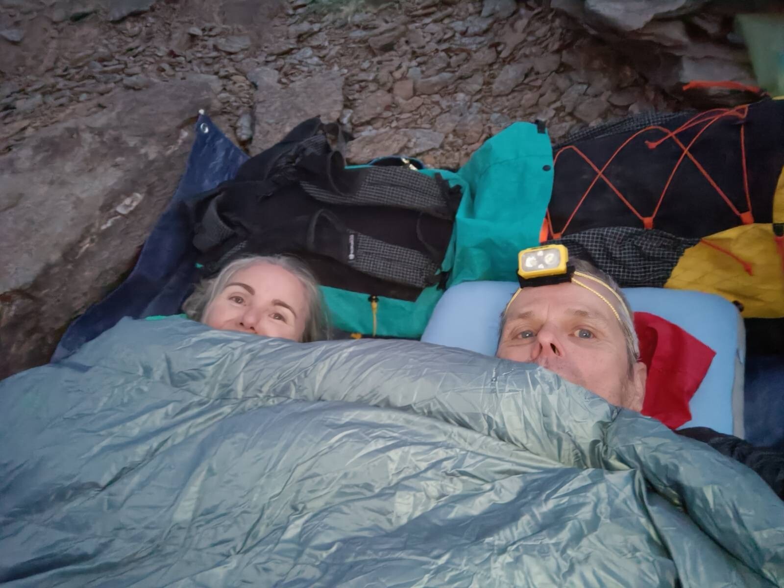
Photos ... me & my better half tucked in for the night at our last location.
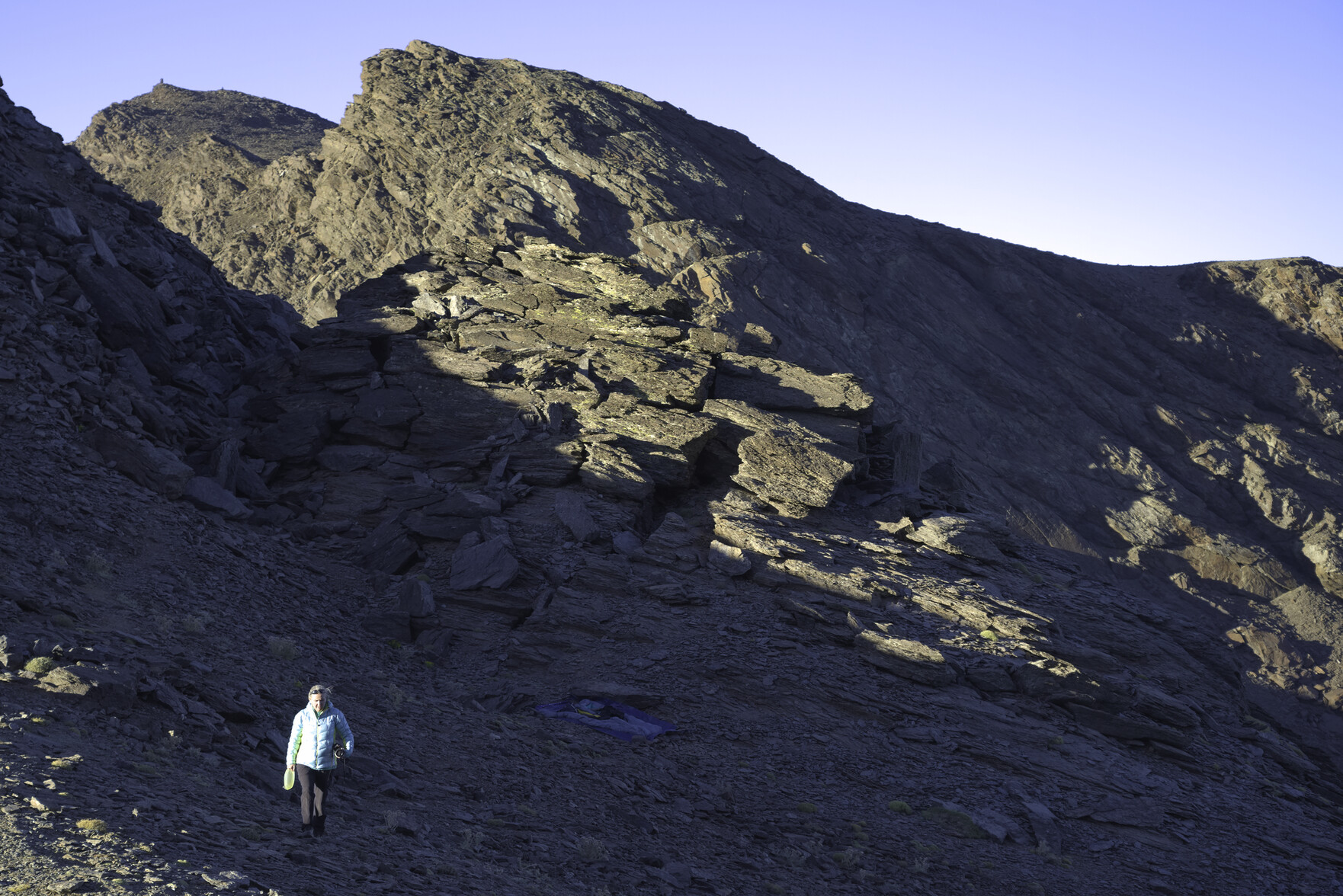
Two hikers wrapped in a sleeping quilt at a mountain bivouac siteThe location for our last mountain bivouac. Evening sunshine illuminating the mountain tops
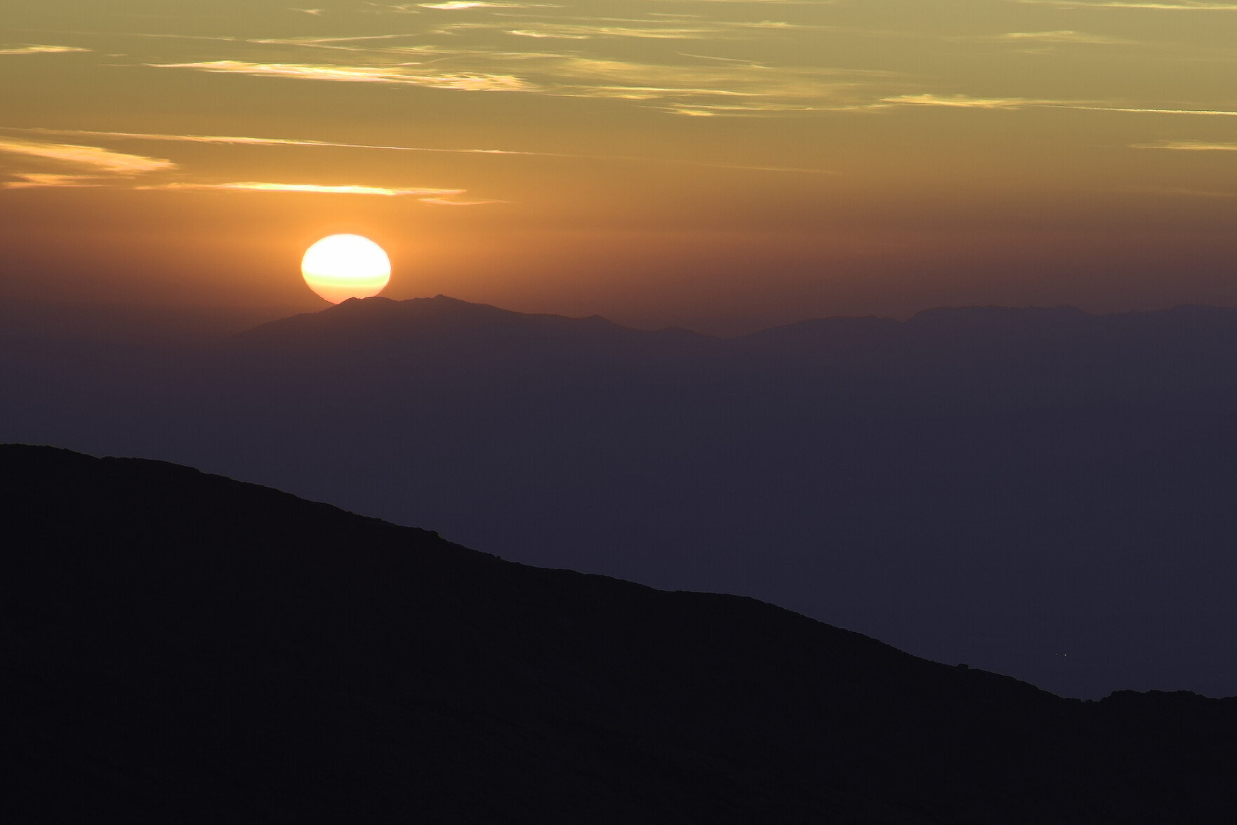
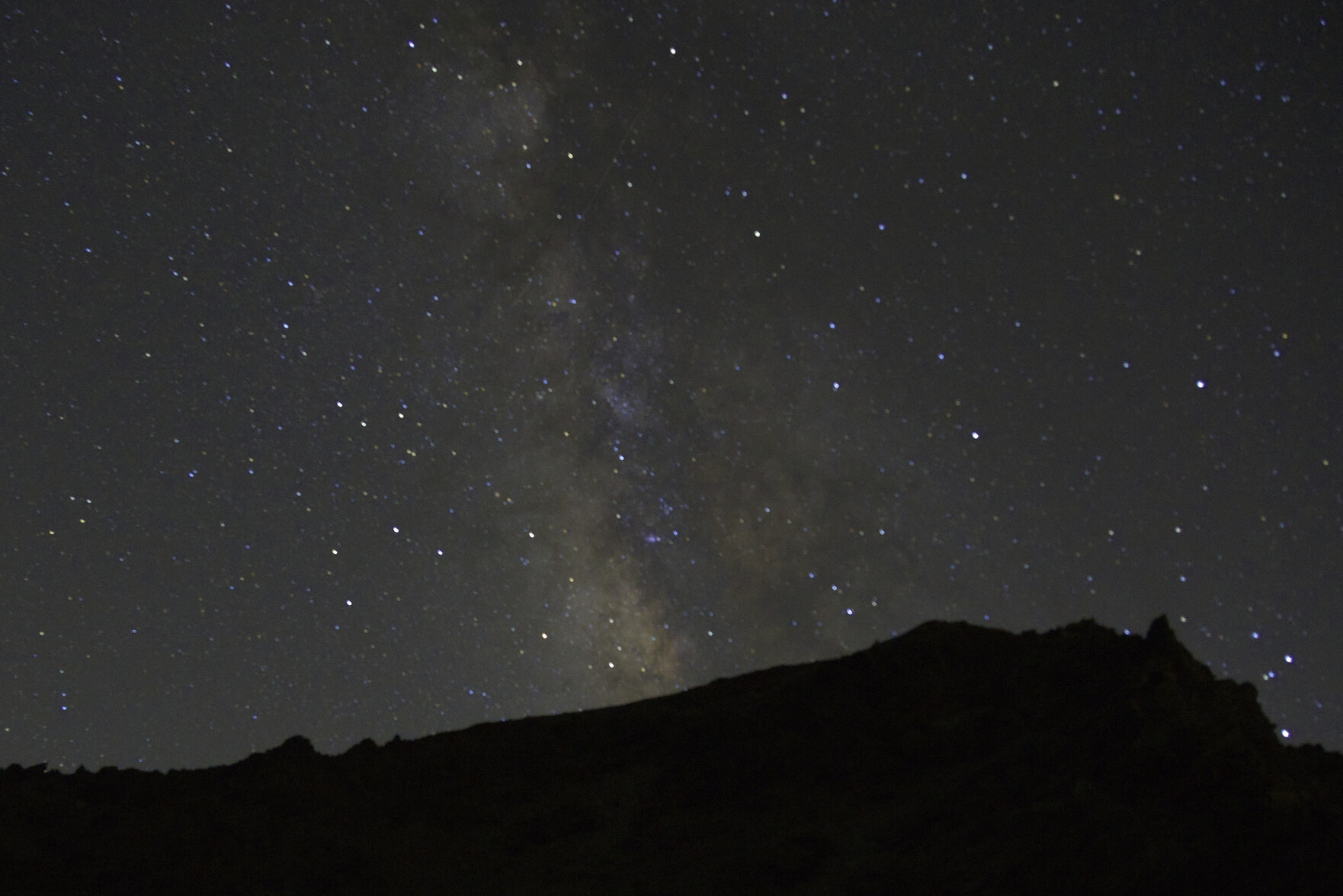
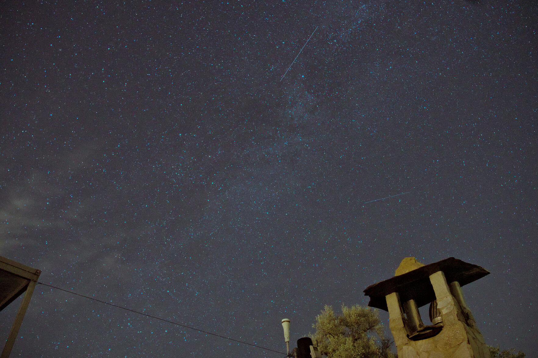
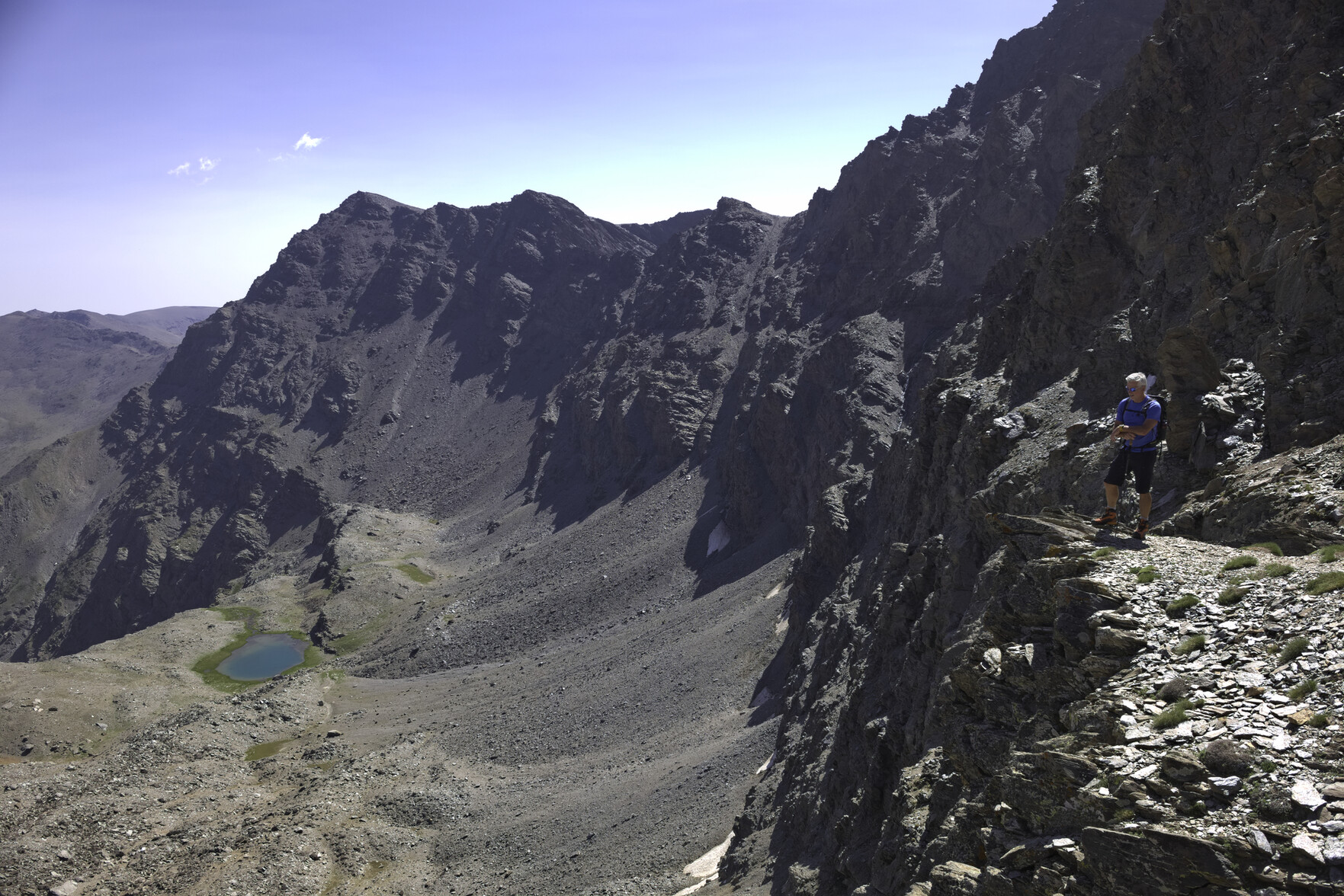
The summit of Mulhacén 3482m yesterday evening from our bivouac on the Collado de Siete Lagunas 3230m to the north. Milky Way showing in all it's glory. Cold temperatures too with strong wind blowing.
Came across a site yesterday that created a website for me within 30 seconds. Yes, that's right, 30 seconds. All I had to do was enter a website title, the main selling point and location. 30 seconds later I had a beautiful website with photos, text, testimonials, contact form, features sections, footer etc. All AI generated of course and customizable. I have no doubt it could have been hosted and online for €10 a month, for another mere 30 seconds of my time. Amazing!
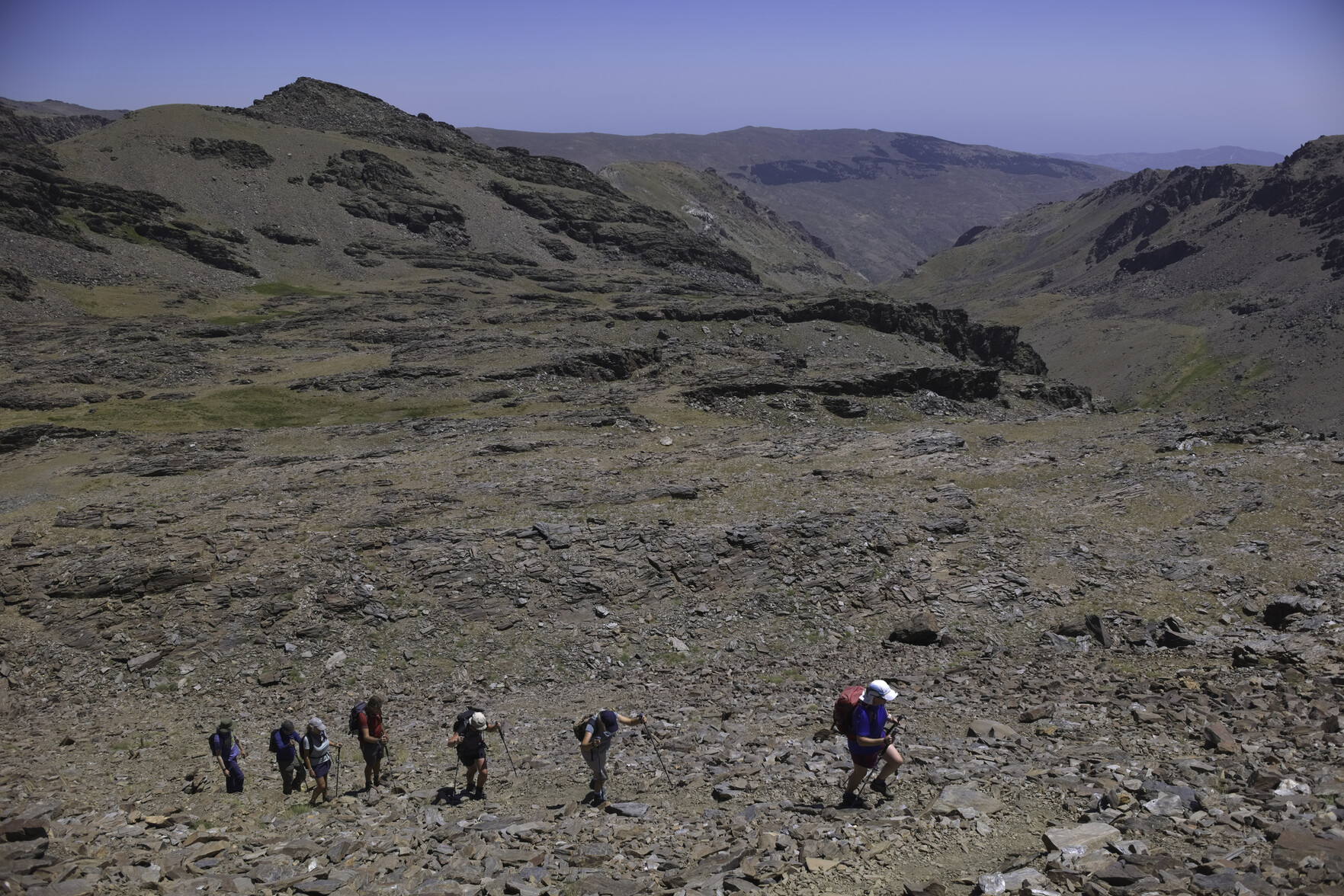
Tomorrow we have an overnight trip into the Sierra Nevada visiting the spectacular "Vasar de Mulhacen" path across it's north face. An open bivouac at night on the Collado de Siete Lagunas (3230m), with a knee burning 1600 metre descent to the village of Trevelez the following morning. Should be some really good photographic opportunities. Looking forward to this immensely.
Cancelled my Spotify membership a month ago and have been searching for a self hosted music alternative. Now set up a Navidrome instance on a Pikapod server. Very easy to set up (a few mins and clicks of buttons). Uploaded 2k+ songs from my archives. Cheap to run (approx $3 a month). Accessible on all my devices. So far, so good.
Exciting news that Framework products are now available to order in three more countries including my own: Italy, Spain, and Belgium! That includes the Framework Laptop 13, Framework Laptop 16 pre-orders. Better get my planning head on!
I'm quite excited about local-first software development. I've been playing about with Anytype note taking and am quietly optimistic. Good article about how a "local first" approach can set us free from the corporate cloud.
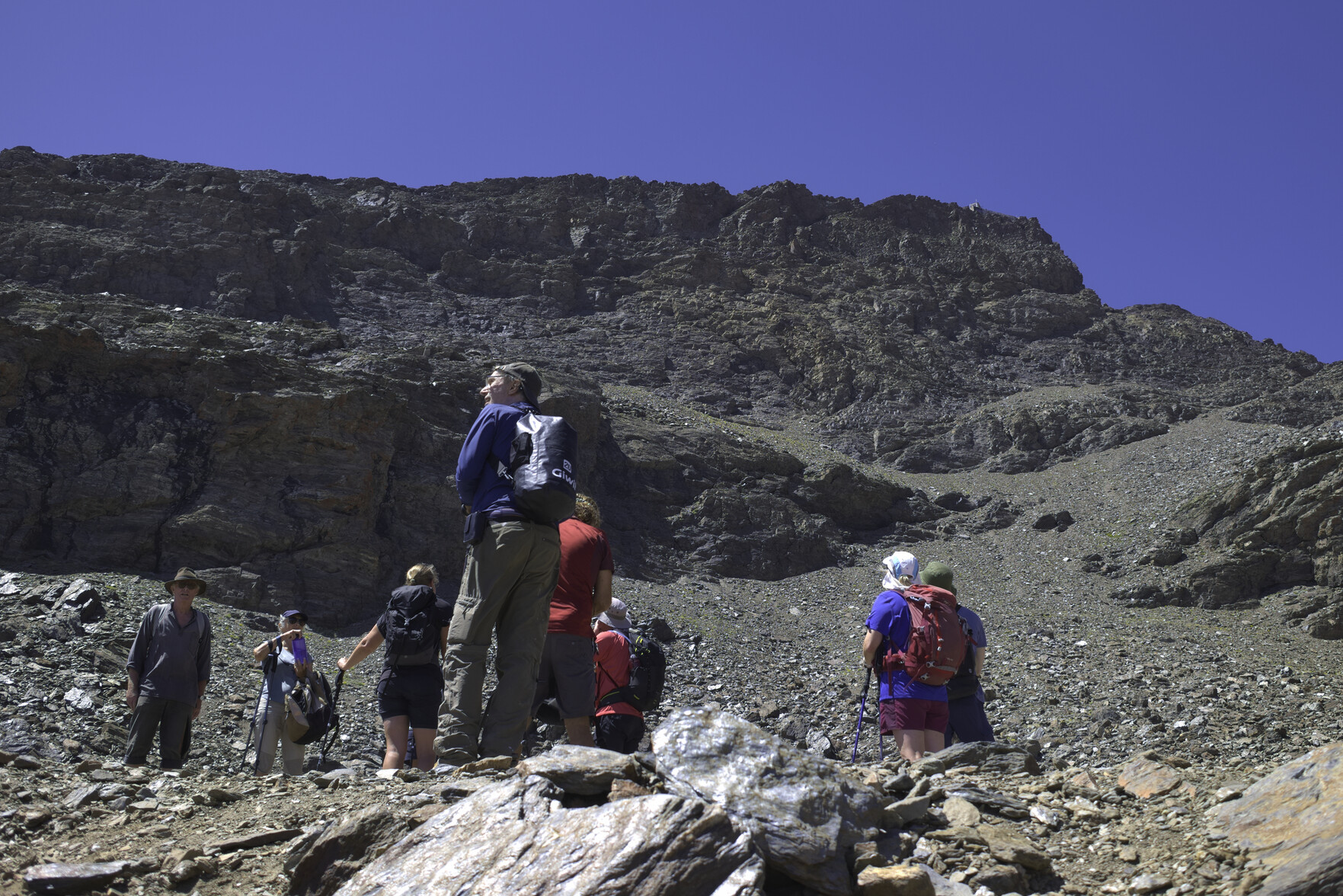
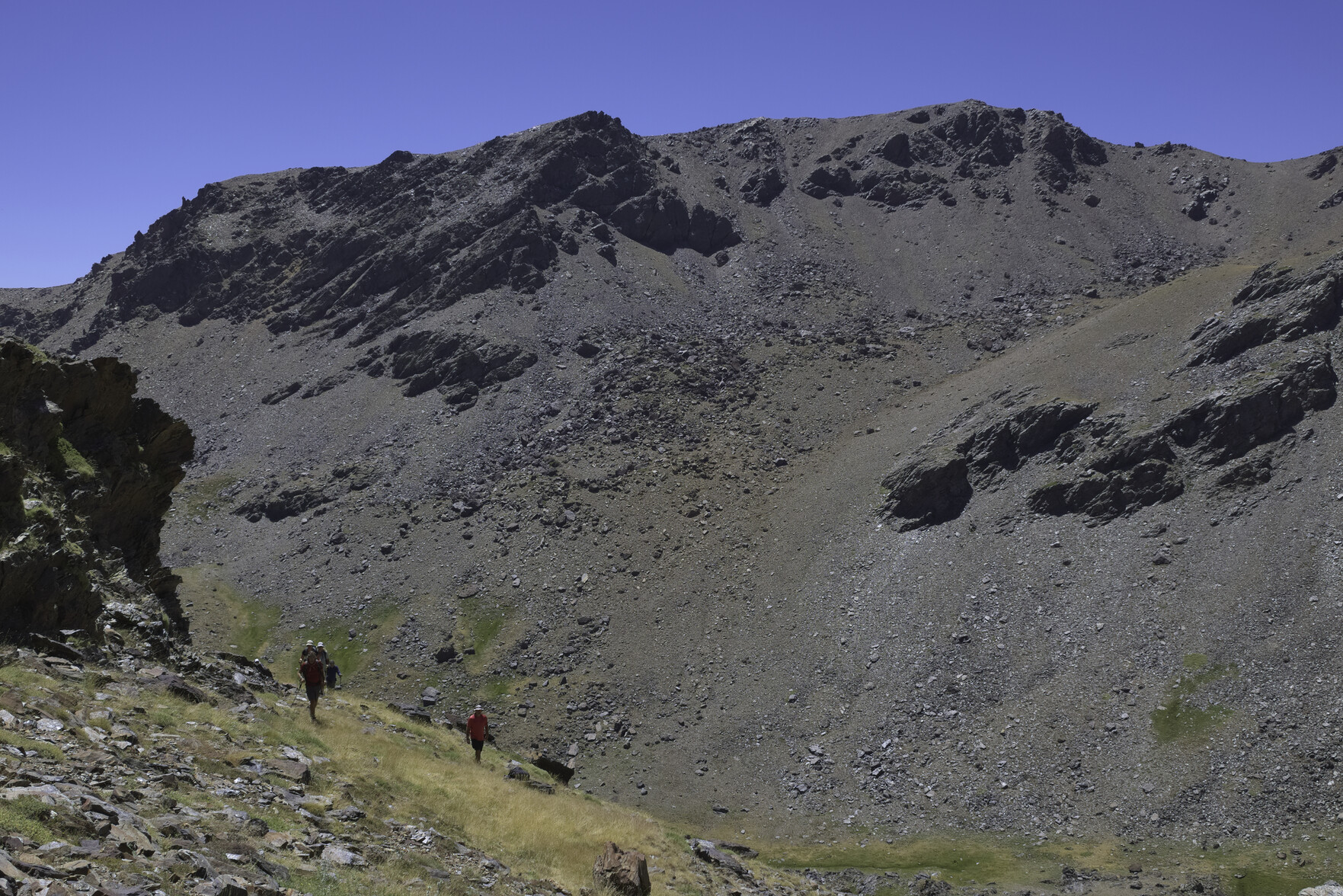
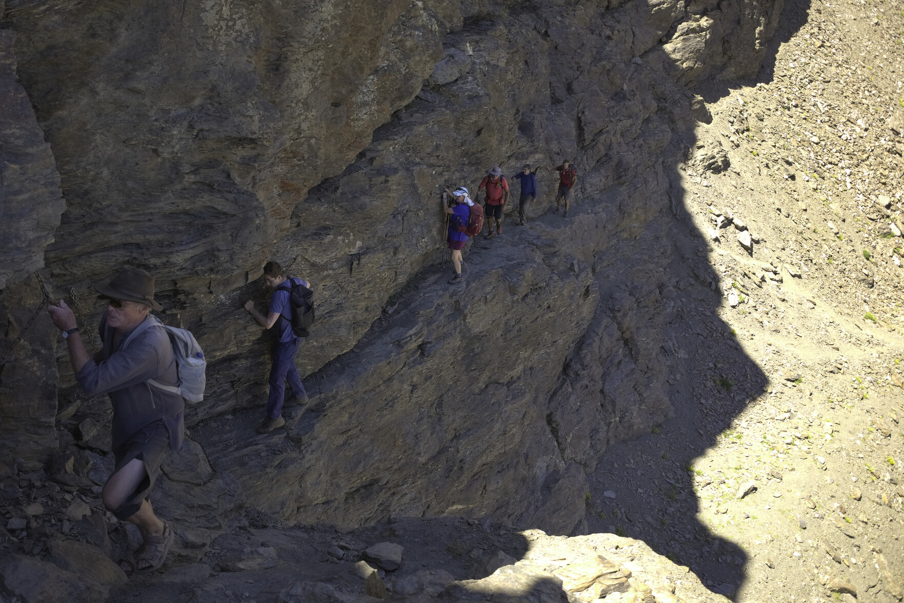
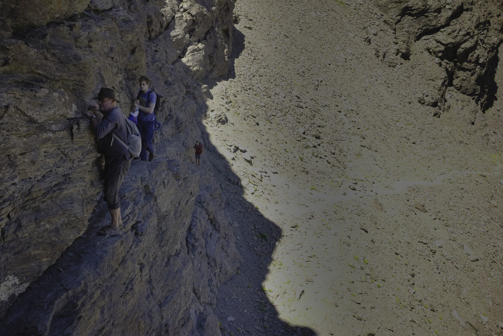
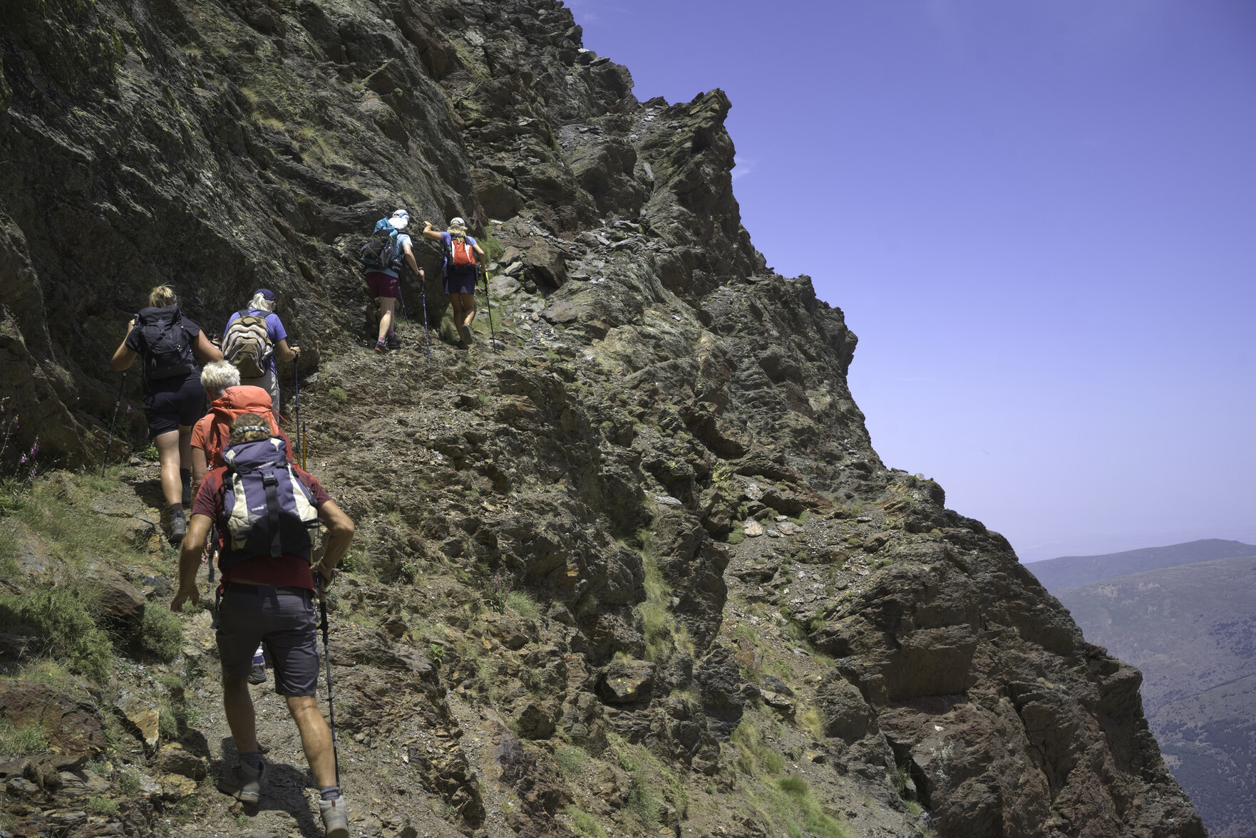
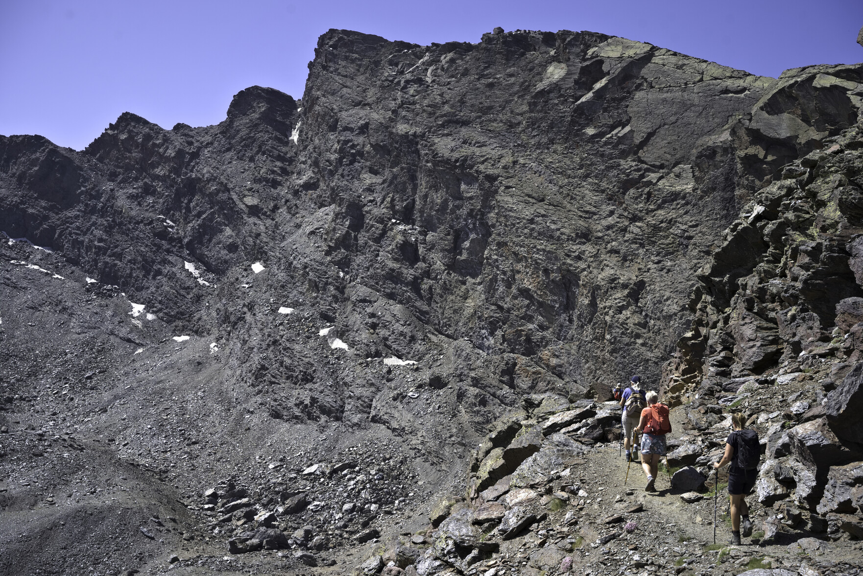
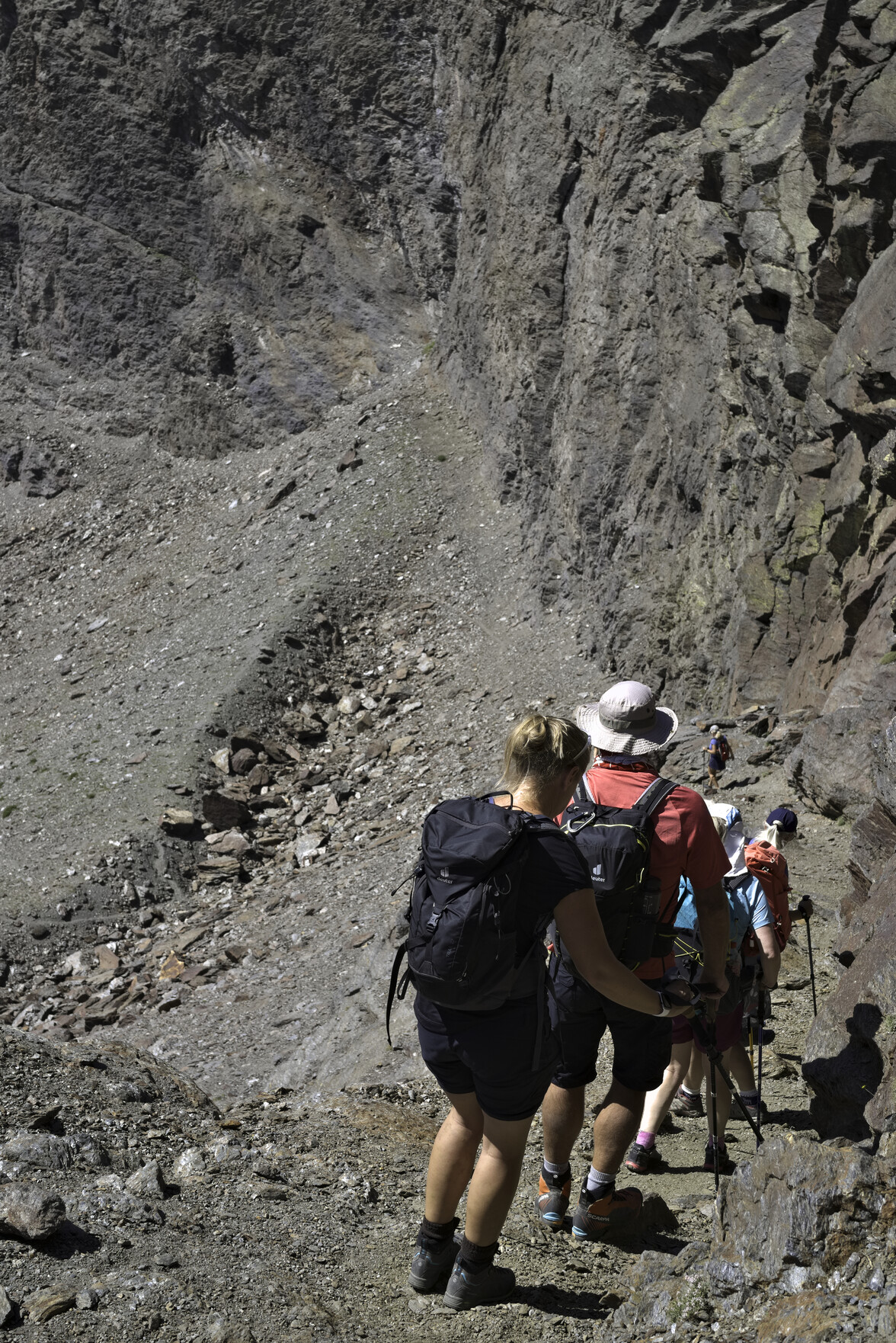
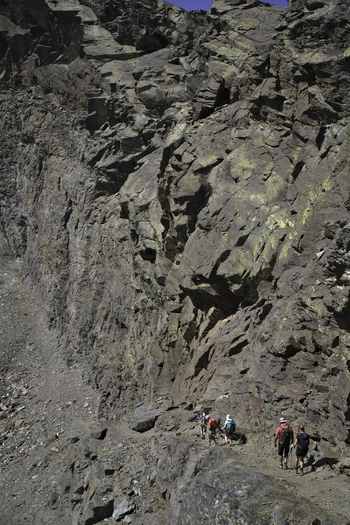
Hikers toil in the hot sun up a barren semi desert like landscape. Blue sky aboveHikers gathered below the summit slopes of VeletaPico Sabinar mountain is in the background. In the foreground can be seen some hikers climbing trail less hillsidesThe "Paso de los Guias" ... a group of hikers crossing a steep rock wall holding onto a fixed chain for safety
Just backed Cory Doctorow's Kickstarter project "The Internet Con - How to Seize the means of Computation". A DRM-free audiobook to halt the internet's enshittification and throw it into reverse (Amazon won't sell it!). Looking forward to this.
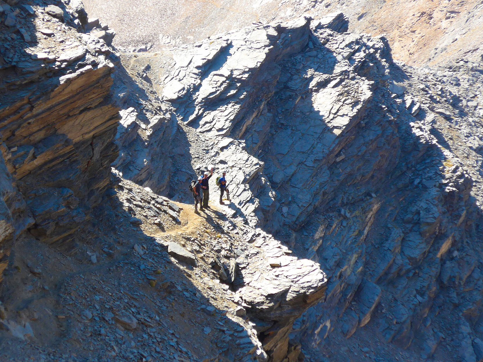
Author Chris Stewart joined our hiking group yesterday. Here he is hanging on grimly to the short but spectacular "Paso de los Guias" in Spain's Sierra Nevada mountains
N.B Chris's travel books have encouraged thousands to contemplate the move to Andalucia. "Driving Over Lemons" was the first. Soon to be a TV Series.
A man on the left moves slowly across a very narrow rocky ledge whilst holding onto a chain fixed to the rock wall. To the right the rock falls away vertically to the valley floor
Looking forward to this tonight. A home grown tomato and basil salad with locally sourced garlic and drizzled with a friends olive oil. The simple things in life are the best
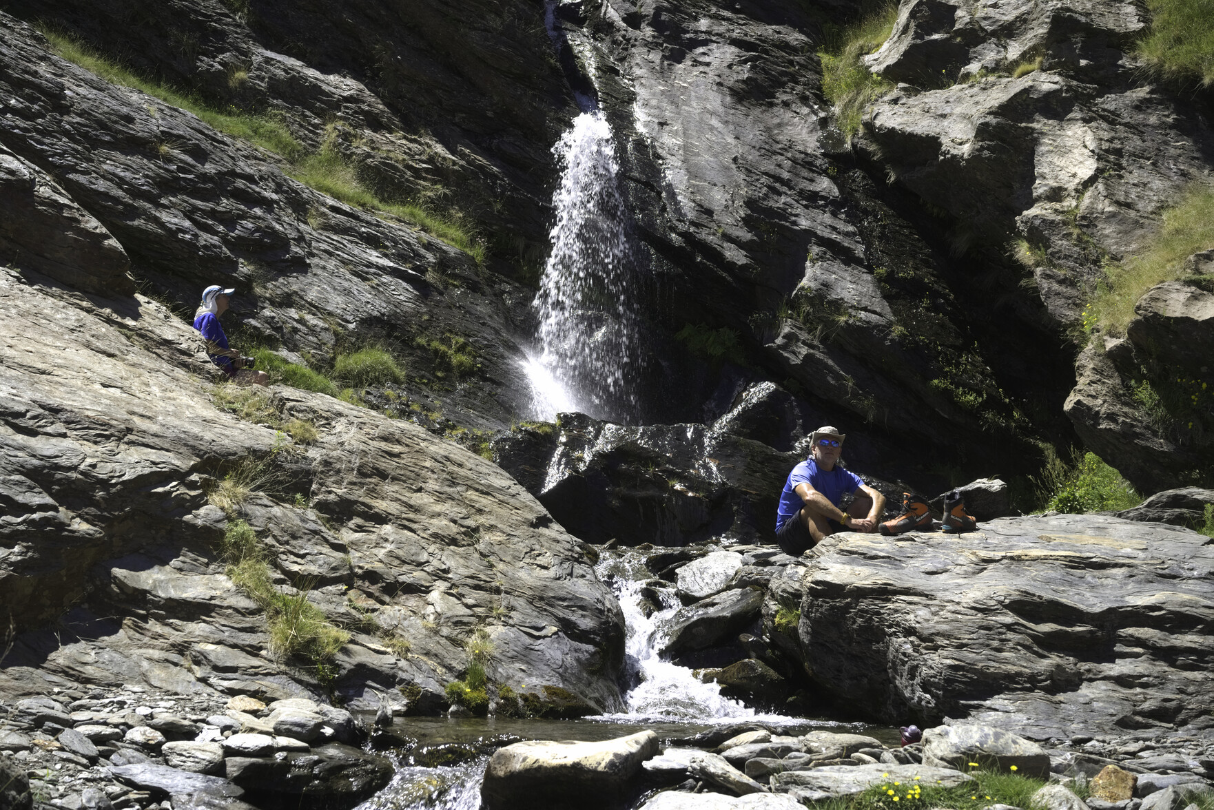
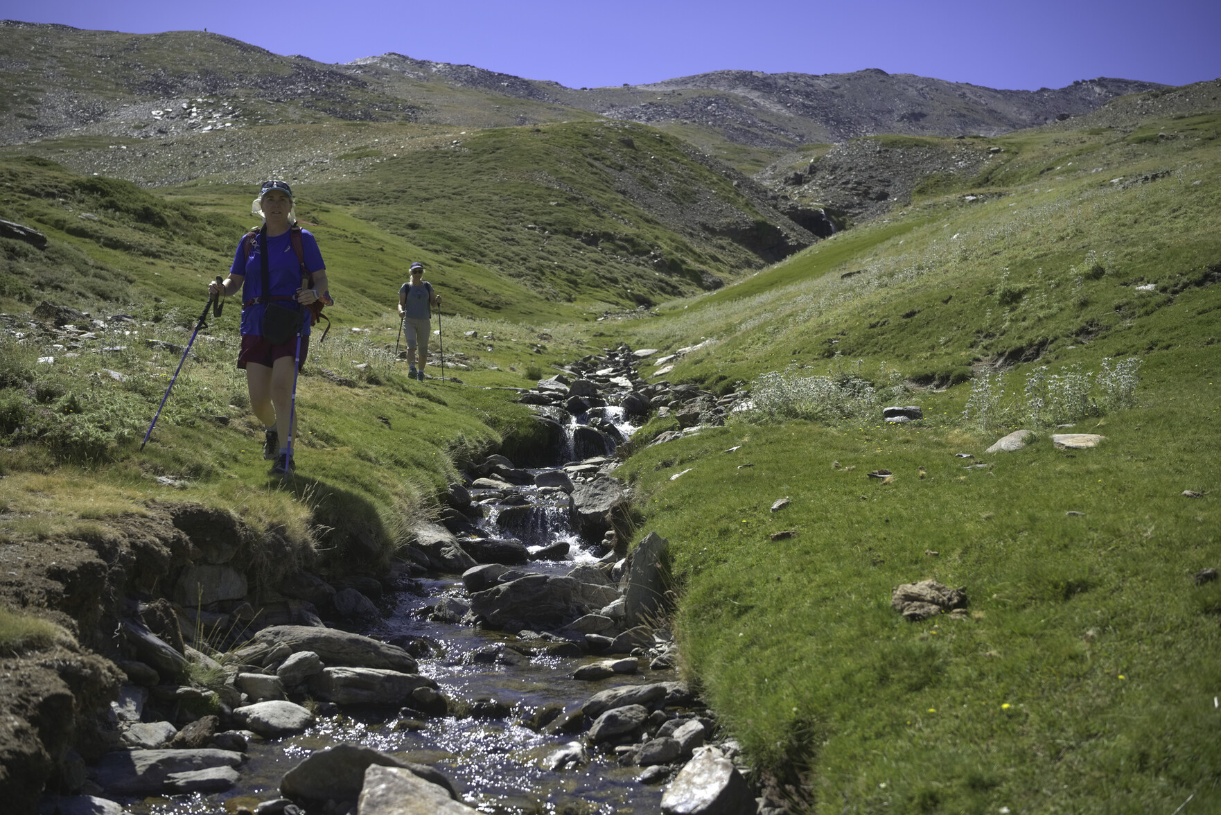
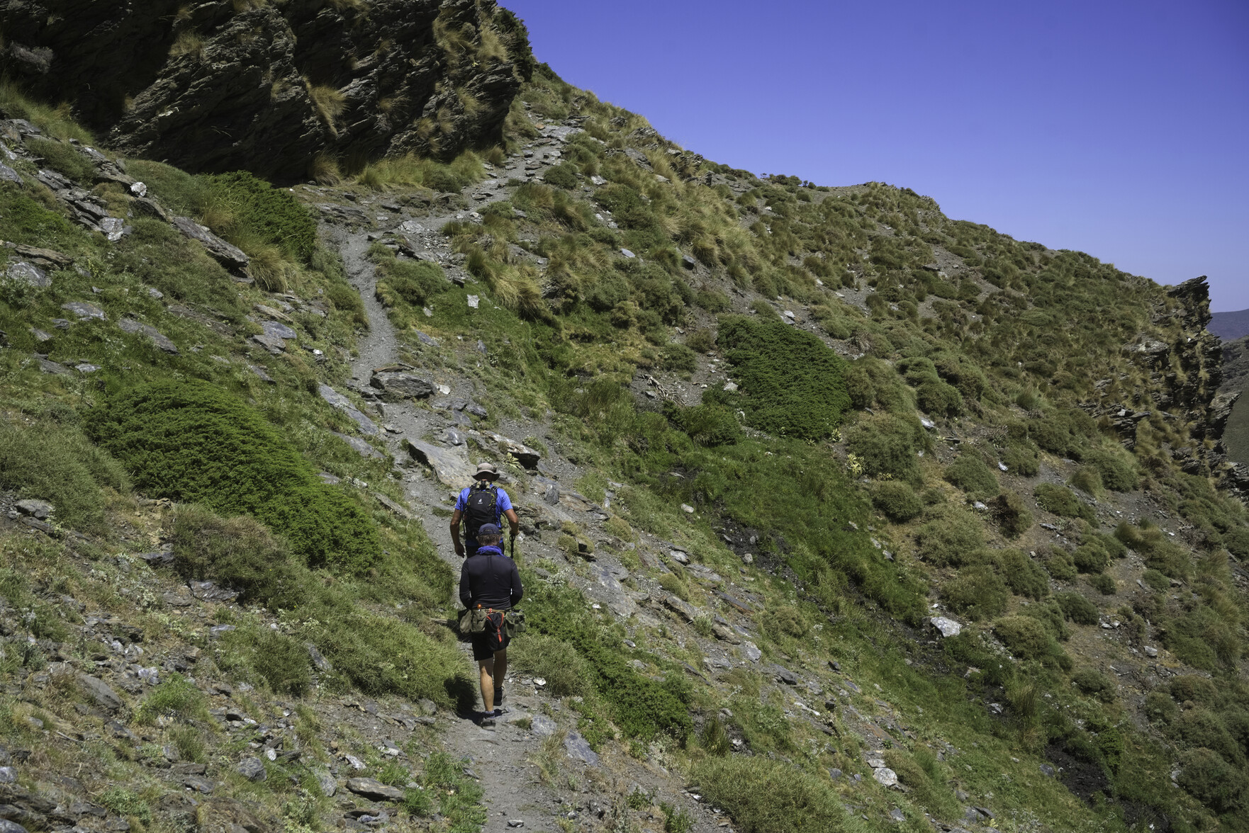
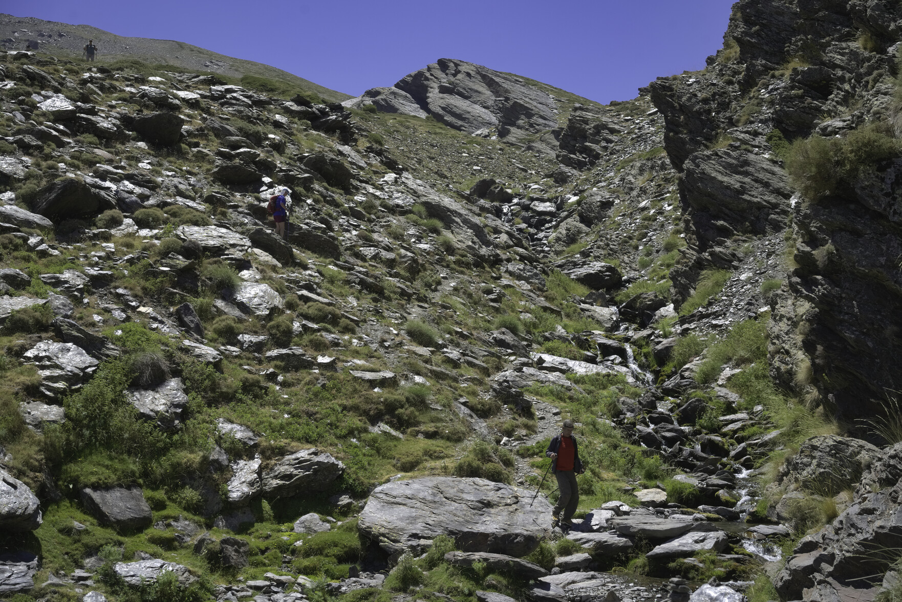
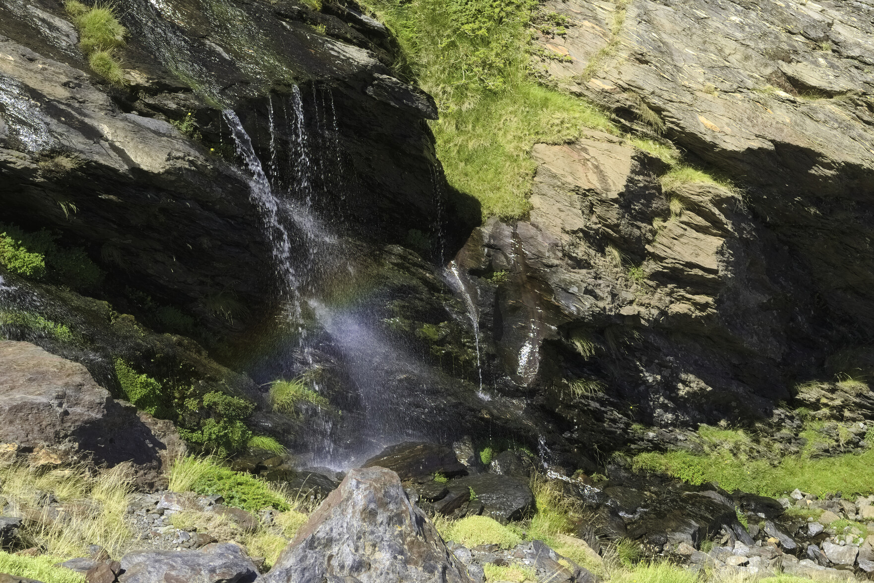
Arriving at the ski lifts yesterday we found that the bottom gondola lift was broken and wasn't running. Never mind, one plan closes, gets put on back burner and another one opens. Instead, we dropped into a quiet valley with just a few animal tracks. This valley was full of streams, greenery, waterfalls and wild endemic plants. A beautiful reminder of how the Spain's Sierra Nevada once was.
Some hikers relax by a waterfallTwo hikers walk down a beautiful green valley with a stream running down beside themPeople ascend a narrow track up a mountainsidePeople descending a rocky rough valley with a small stream and a large cliff to the right
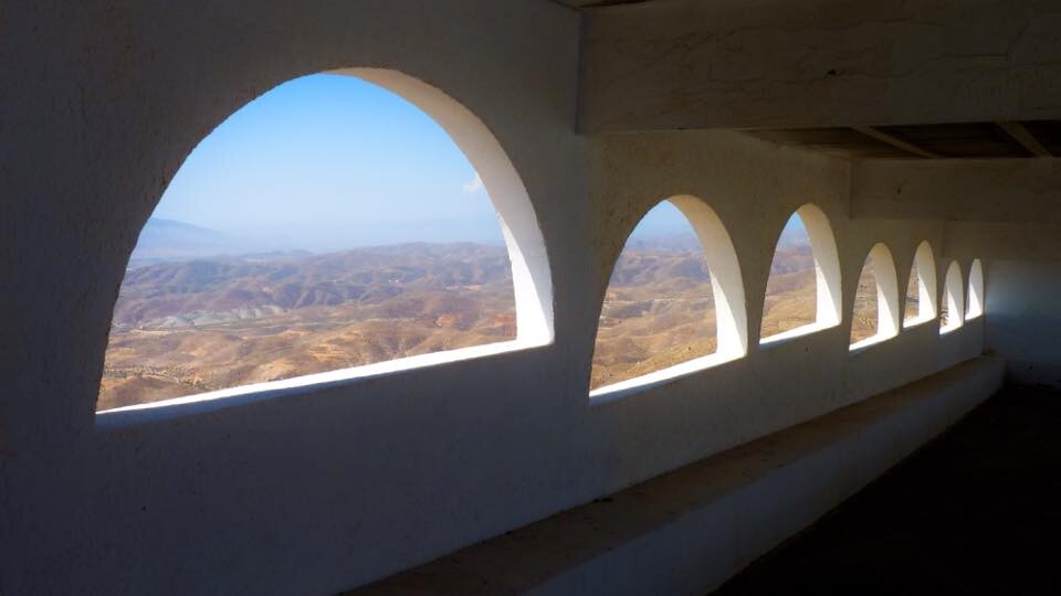
Our predecessors certainly knew how to construct mountain hilltop buildings that took full advantage of any cool air and superlative views.
A religious building with spectacular views of the sea, the desert and the mountains. The sanctuary occupies the site of a Muslim ravita called "Montahur" and is a provincial pilgrimage center.
It's taken me some time to figure it out, as I found it confusing initially, but I am now enjoying using the #anytype note taking app. Offline and local first, fully compatible across devices, supports markdown and keeps notes and files in the same place. Worth a look at https://anytype.io
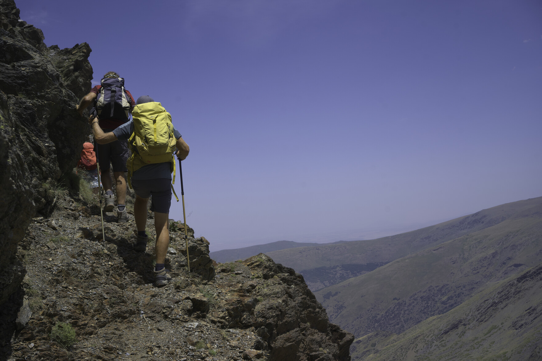
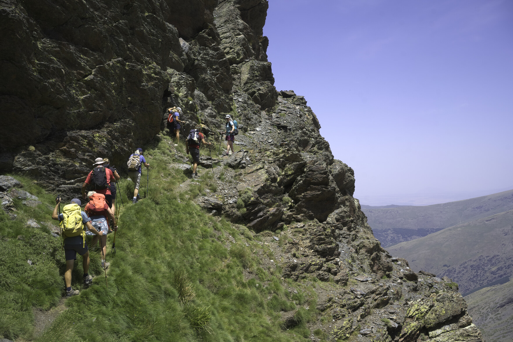
A group of hikers on the left pass along a narrow path that traverses up across the face of a steep mountainside covered with cliffsTwo hikers walk along a narrow path with a steep drop off to the rightA group of hikers on the left pass along a narrow path that traverses up across the face of a steep mountainside covered with cliffsA group of hikers on the left pass along a narrow path that traverses up across the face of a steep mountainside covered with cliffs
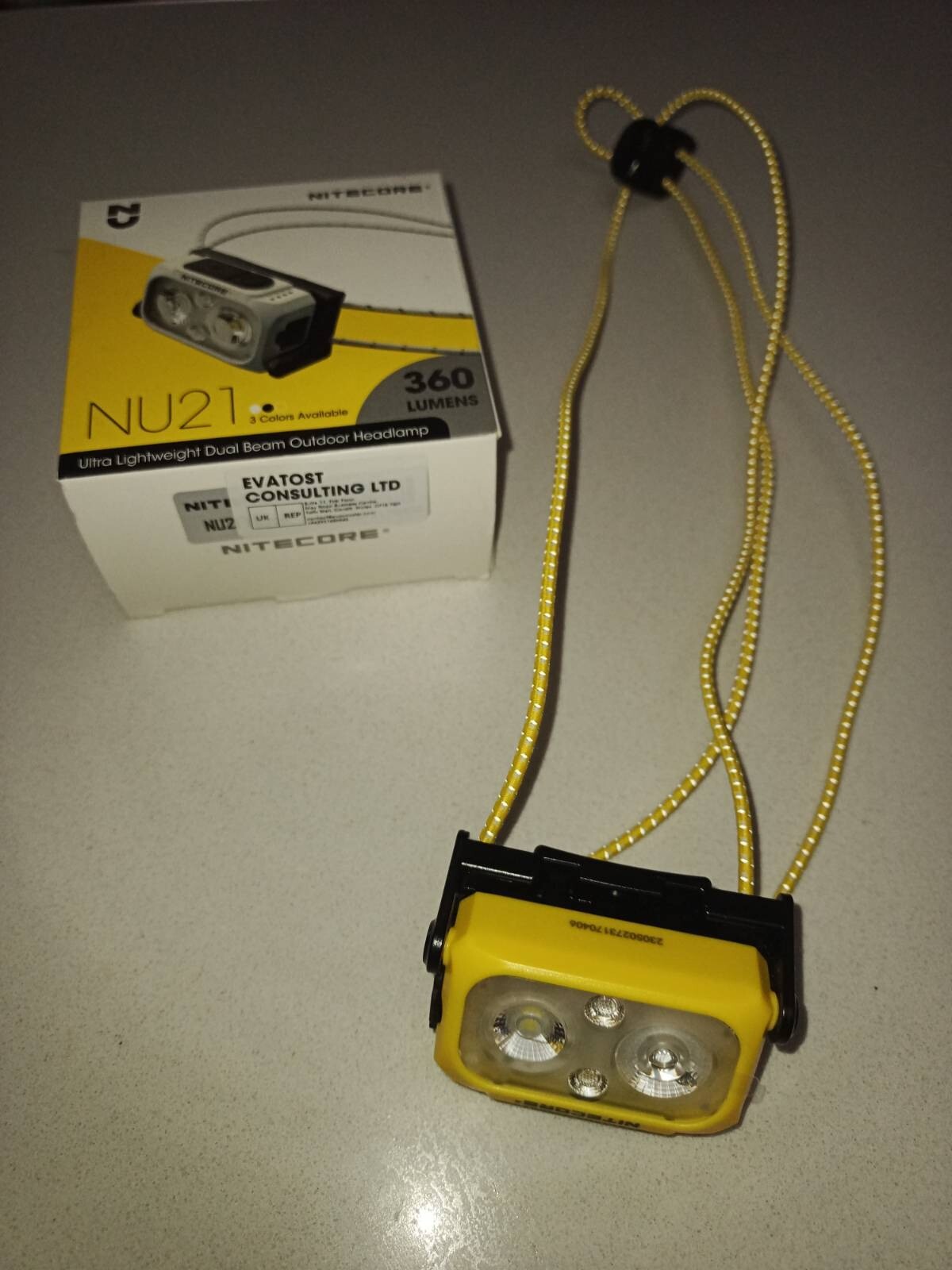
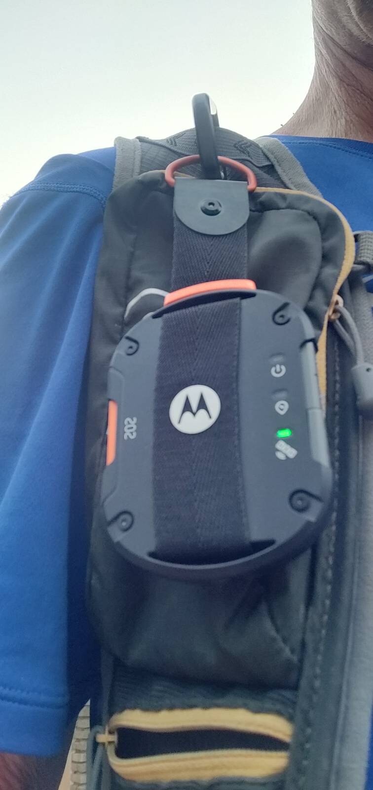
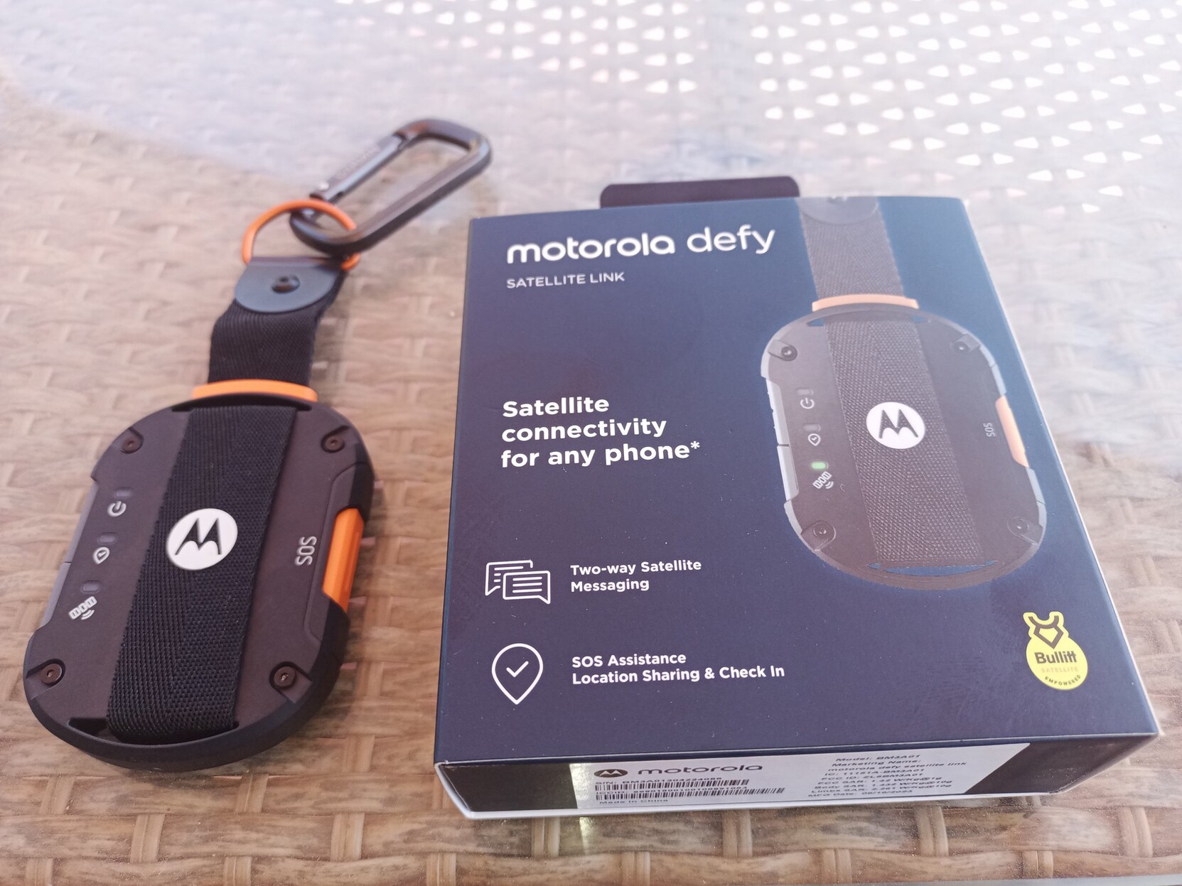
1. The SOS button. This is not in the best place and could be maybe be inadvertently pressed, especially when either turning on or sending a direct location message. I'm not sure how long I would have to press it to activate a rescue because I didn't dare try out! 2. Although I had the device clipped to my backpack, it moved around annoyingly when walking. I am going to fix some form of stabilization with elastic or Velcro around the backpack strap.
We were at 3000m yesterday in a high, remote valley without cell phone signal. Seemed like a good place to give this device a test. I sent two positional messages and then two text messages to two different people, of which I received one (asked for) reply back.
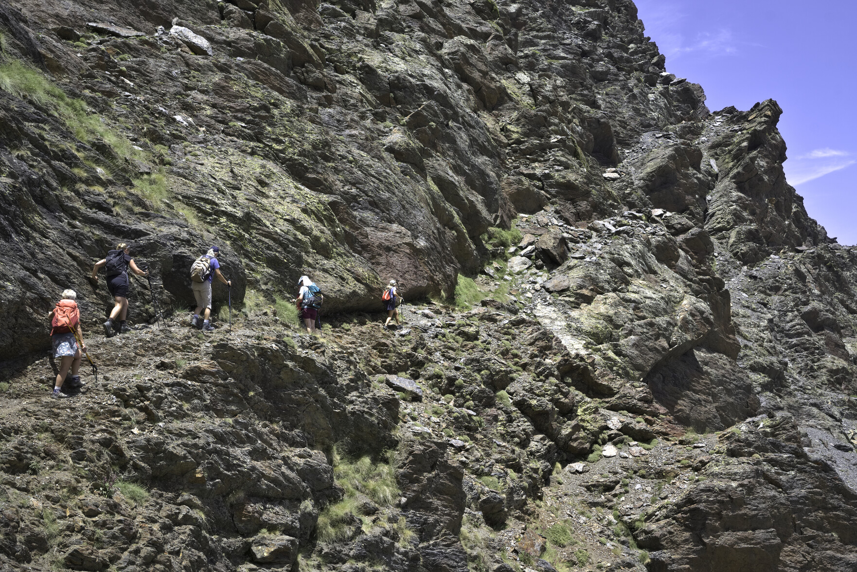
The north face of the peak of Veleta and to the bottom right some hikers approach along a narrow pathA group of hikers descends a path surrounded by rock wallsHuge rock walls tower above some diminutive hikers walking down a path at the bottom of the photo
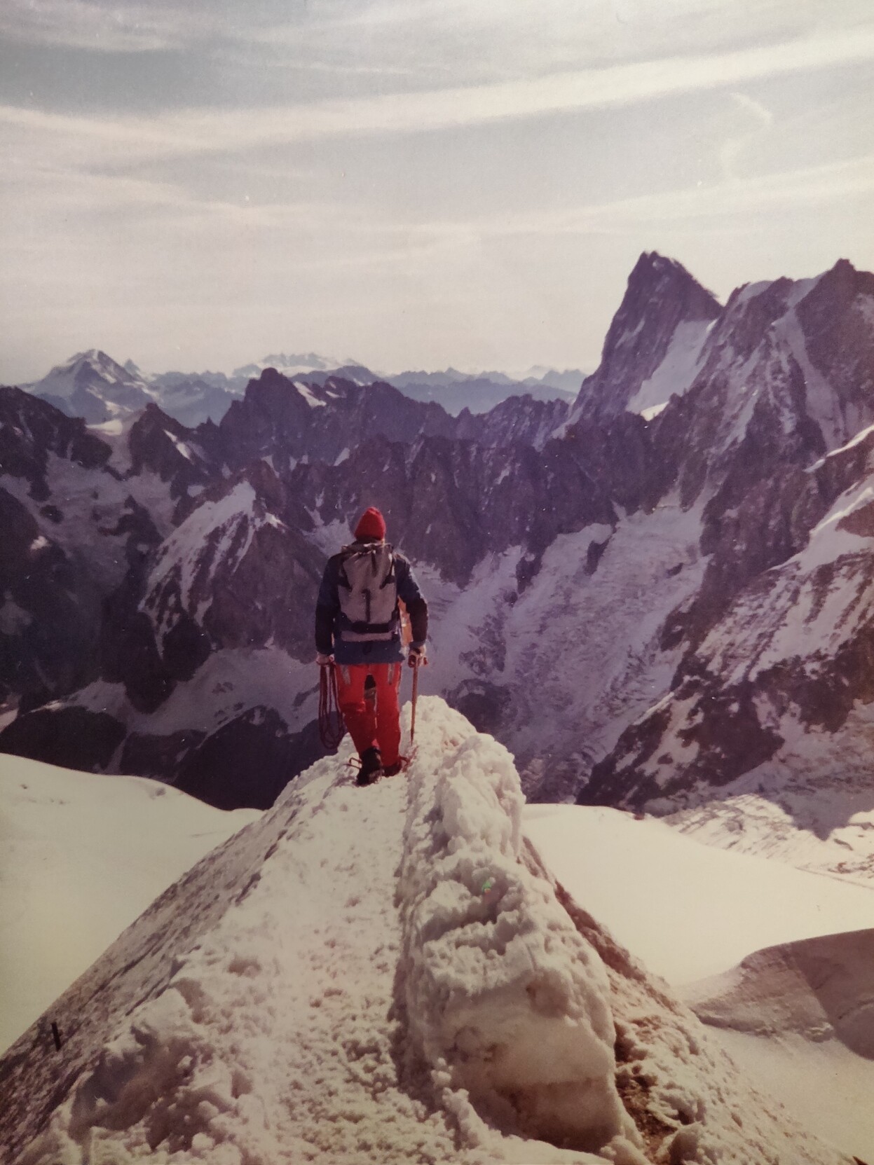
A blast from the past ... heading out onto the Aiguille du Midi arête, heart in mouth! The Grand Jorasses behind. Space all around. My first time in the Alps, 1983
Just moved our company project from Github to @Codeberg. An easy migration as it turned out.
Now, I don't really regard myself as a "proper" programmer, more like an enthusiastic amateur, but I am always happy to support #FLOSS open source projects. "A free home for free projects", unlike GitHub which has the giant of Microsoft behind it. I will support and donate
Took delivery of a Motorola Defy Satellite Link today. I dived in so the setup took longer than expected! Initial test message though was super quick to pair, acquire satellites & send. Looking forward to a real test in the mountains next week. For price of the unit and subscription cost it's remarkable. Good safety communication backup for all outdoor enthusiasts especially when cellphone coverage is sketchy. More next week
One amazing thing about our walking group today was that out of a total of 11 people attending, 4 were full time committed Mastodon users. How good is that?
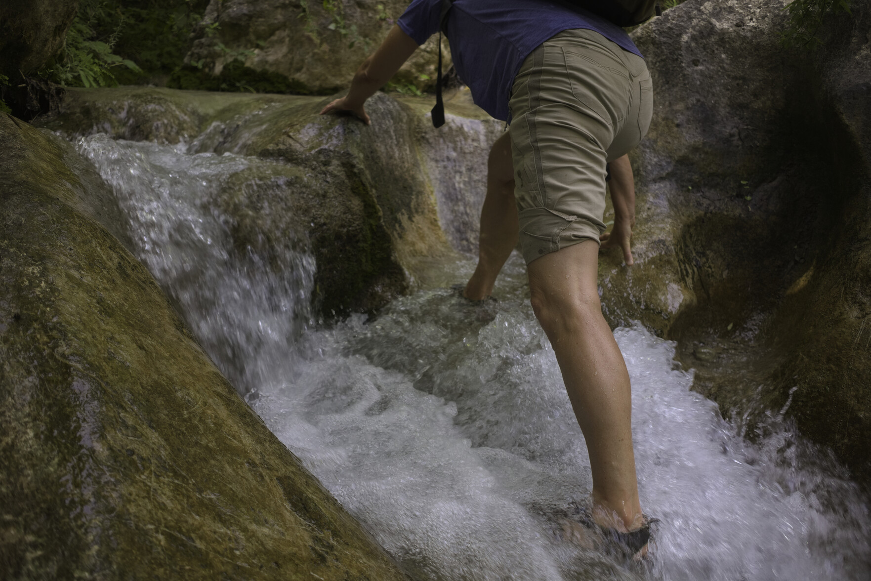
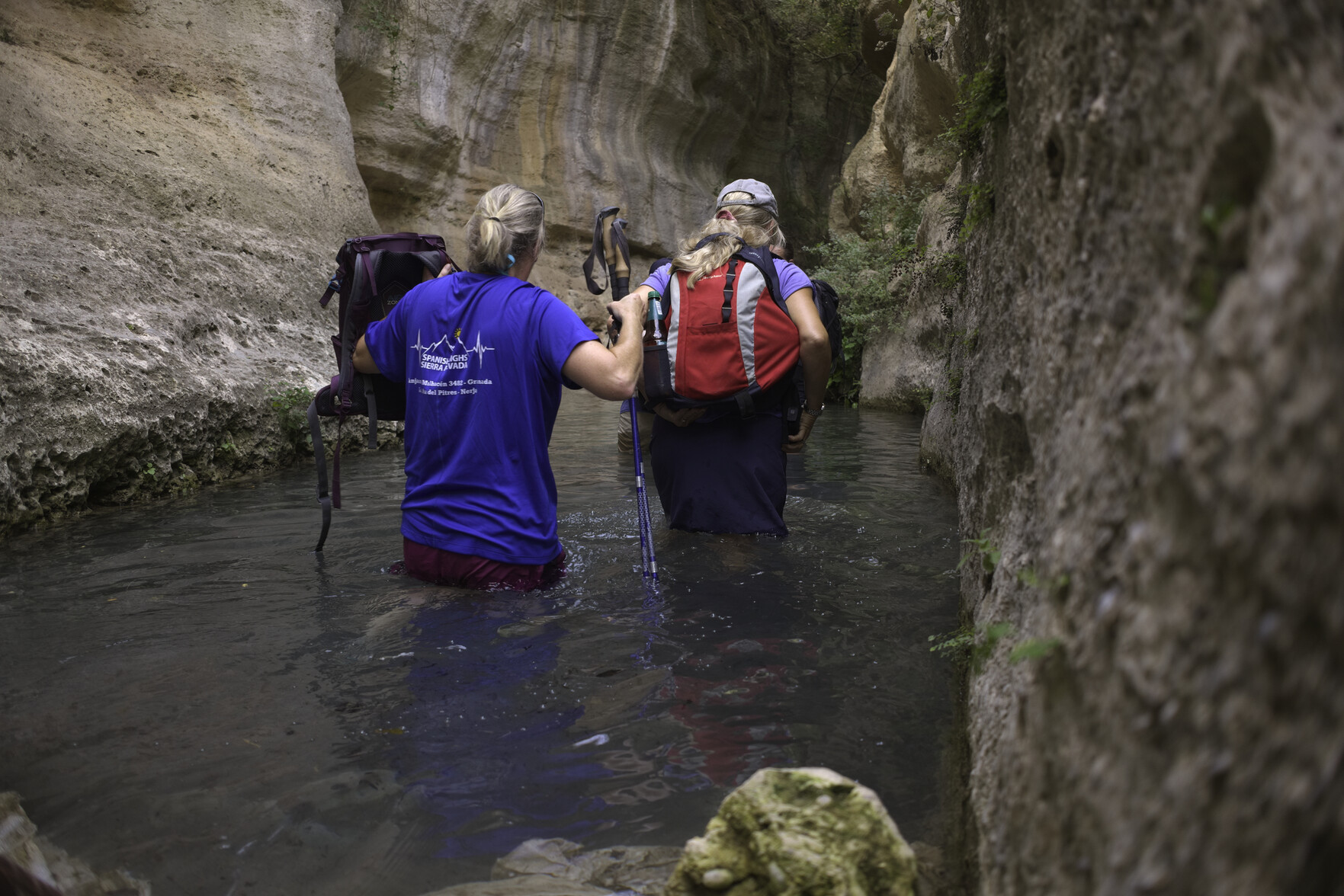
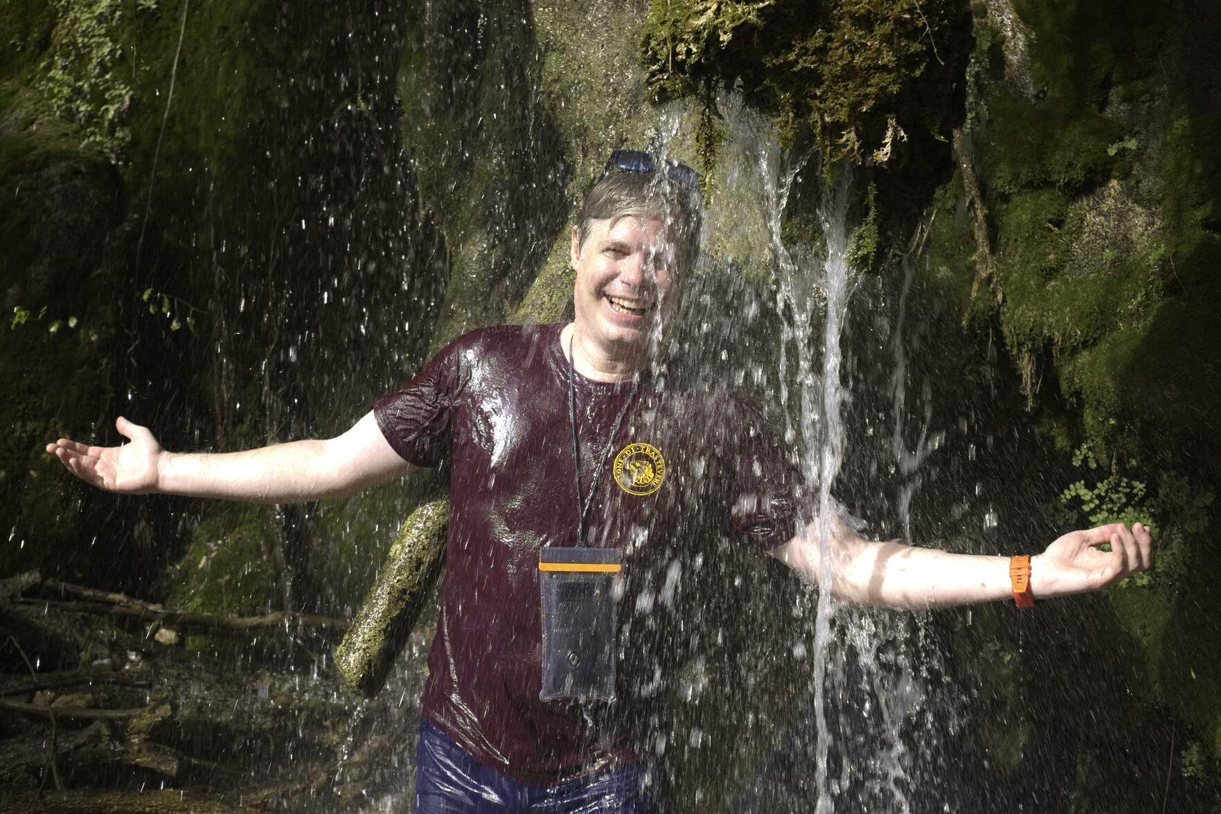
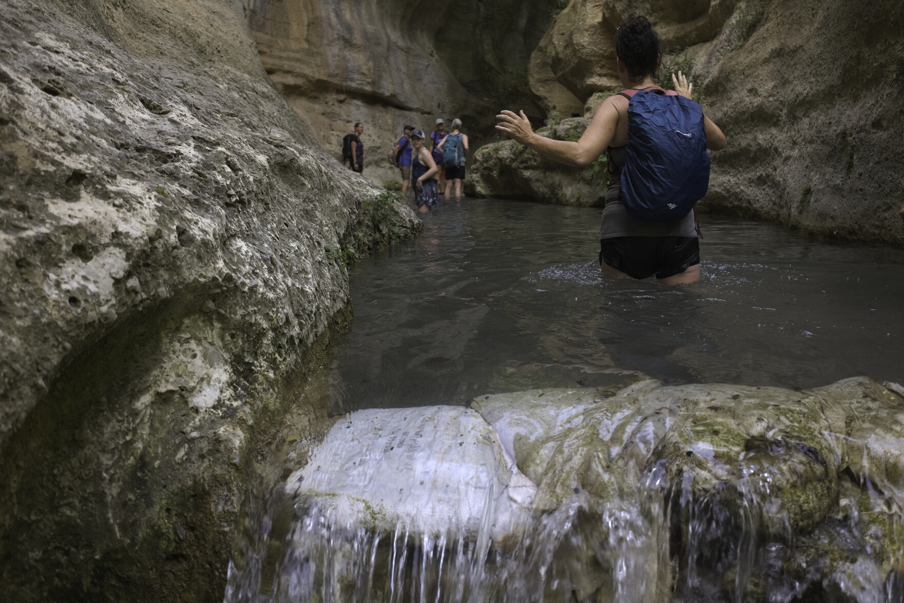
It's 37C outside. You are in the midst of a fierce spanish summer. Either "head for the hills" or as we did today, head to some dramatic local gorges and refreshing, cooling waters. Marvellous!
A hiker makes her way up through a small waterfallTwo hikers are waist deep in a small lagoon within a steep sided dramatic gorgeA man in purple tee shirt stands under a waterfallPeople wade through waist deep water in a small lake formed by a steep sided, dramatic gorge
As it's 35°- 40°+ here now over the next week (and possibly until mid-August), it's time for my own "summer of coding" to start. Our company website badly needs a long overdue overhaul, so I plan to introduce dark mode, simplified navigation, less "clutter" & revised galleries amongst other things. Using @eleventy, Tailwind and Shoelace.
I'm hoping too that the calf injury will allow me to get some light hiking again (above 2000m+) soon.
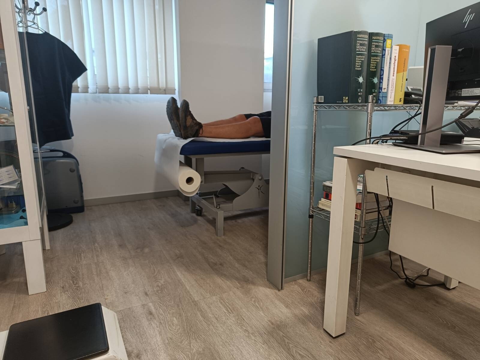
My wife candidly snapped this a few days ago during a routine visit to the cardiologist. Clean bill of health!
Find it amazing that he can Bluetooth into my ICD (Implantable Automatic Defibrillator), tweak things & make adjustments. So lucky to have this device.
1. When heartbeat is too slow, it sends tiny electric signals to the heart. 2. When heartbeat is too fast or chaotic, it gives defibrillation shocks to stop the abnormal rhythm. 3. Works 24 hours a day.
Everyday use, I don't notice it
A pair of legs are sticking out from a hospital treatment bed
Author and political scientist Ian Bremmer commented, “The idea that we get our information as citizens through algorithms determined by the world’s largest advertising company is my definition of dystopia.”
This is a really interesting article on the present state and likely future state of search.
Grade 1 calf muscle tear. Puts me out of next week's mountain trip unfortunately 😭. It happened a couple of days ago after a big day in the hills. I felt it go walking up some small steps leading to our greenhouse. Easily done I'm afraid when the muscles are tired and I hadn't done any post exercise cooling down. Lesson learnt. Now for some weeks of post injury rehabilitation
Just treated myself to the new Motorola Defy Satellite Link. Seems like a great cost effective, simple to use, add-on device for the day hiker/ climber/ cyclist / remote worker on land who are simply looking for peace of mind when travelling to areas where they may have limited Mobile connectivity, to keep in touch with friends and family and summons emergency services if needed.
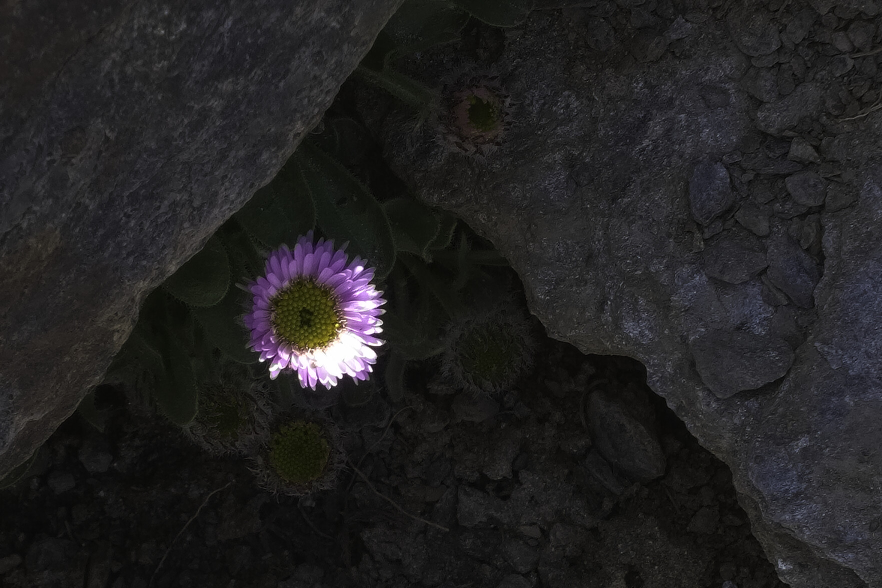
Zamárraga, erigeron de Sierra Nevada (Erigeron frigidus)
We found this at 3460m on Mulhacen in Spain's Sierra Nevada mountain range. Endemic and critically endangered species. Lives on poorly developed stony schist soils in shaded areas. Not usually found below 3,000 meters of altitude but can bloom up to 3460m between June and September.
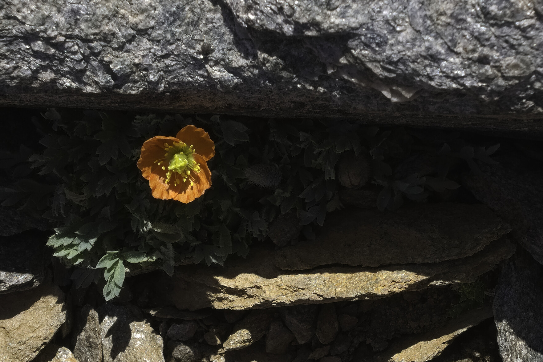
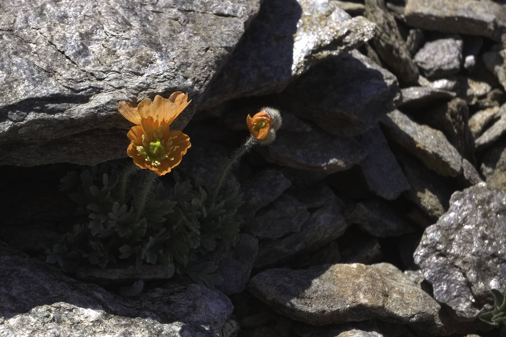
Only grows near the summit of Mulhacén at 3,381 meters of altitude. After the 8 months of snow has melted, and from cracks in the rocky slabs, a small creeping plant with hairy leaves and green stems emerges. A flower of red petals and yellow stamens is born. It blooms only for a few weeks between July and August. Endemic, endangered and precious! Lucky to see these yesterday.
From the shadows of a crack in the rocks a beautiful orange and yellow poppy emergesFrom the shadows of a crack in the rocks a beautiful orange and yellow poppy emerges
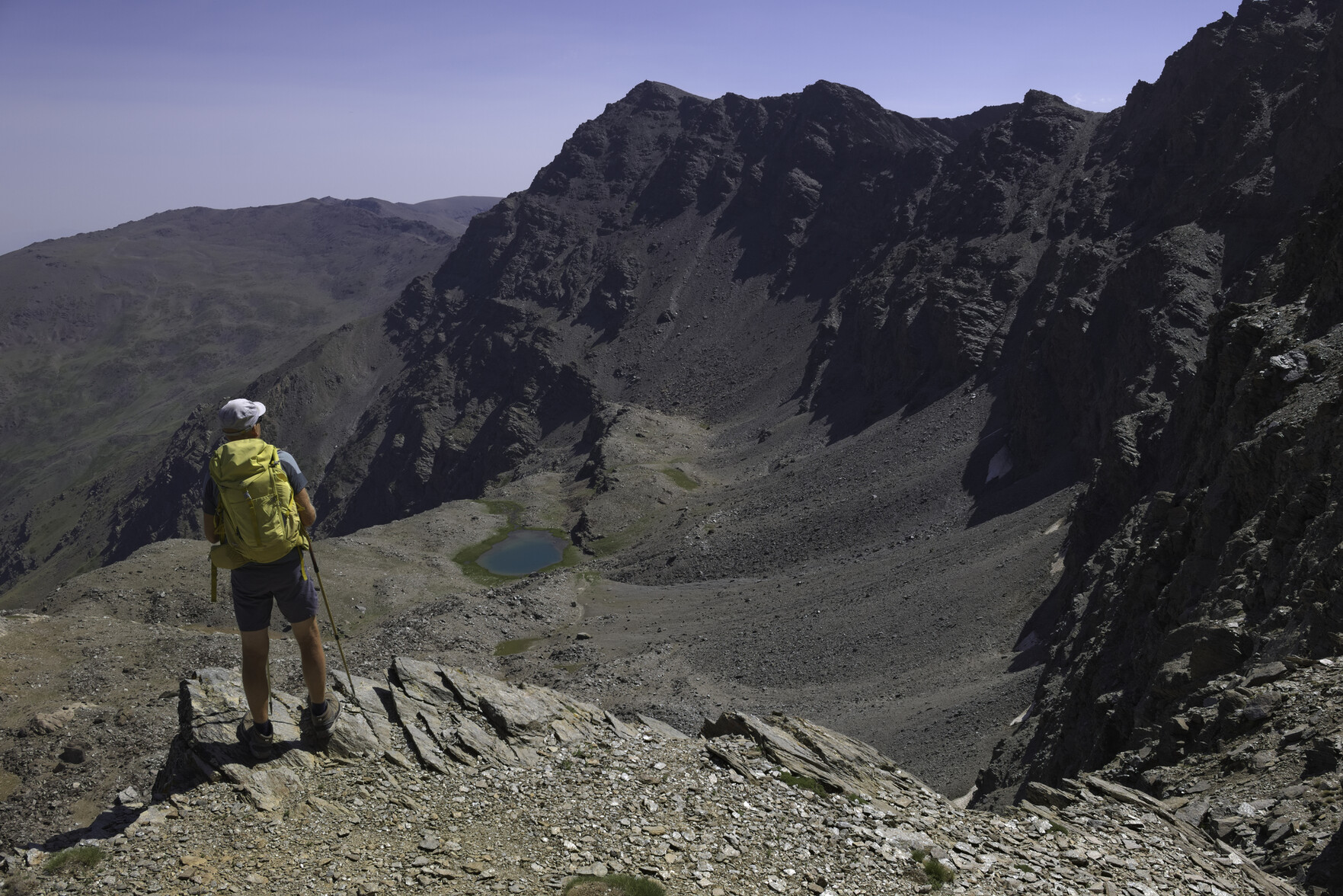
It's a long time since I went up Mulhacén, in fact pre heart problem in 2019. First time to 3482m altitude on the highest mountain in mainland Spain. Of course, today we went up the finest way to the summit ... where the west ridge abuts against the north face. It's a hard pull from the Collado de Ciervo but worth it for the views to the left down to the diminutive Laguna de la Mosca
A person with a yellow rucksack stands looking over a drop towards a distant lake. To the right almost vertical cliffsA man in a blue shirt stands perched above an enormous drop to the left down to a small blue lake
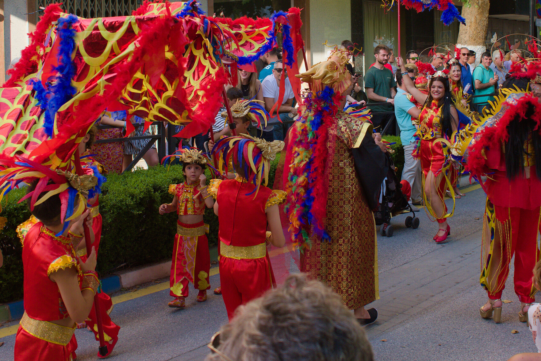
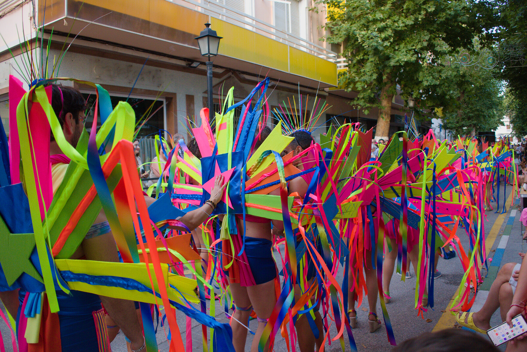
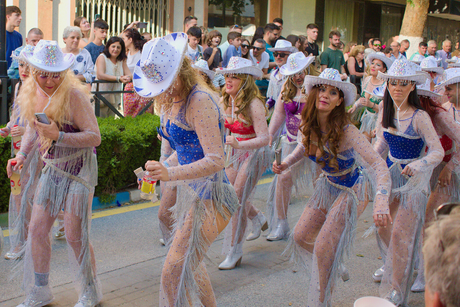
After a night in the hills I came back home to Lanjarón to be met by the towns annual week-long fiesta. A celebration of colour and noise. Senses a bit blown. Enjoyed it, but think I prefer the quiet of the hills.
A group of people dressed in red and yellow attire dance through the streetspeople dressed in multi colored outfits dance their way through streets of a spanish townSome ladies dressed as cowgirls dance during a spanish carnival
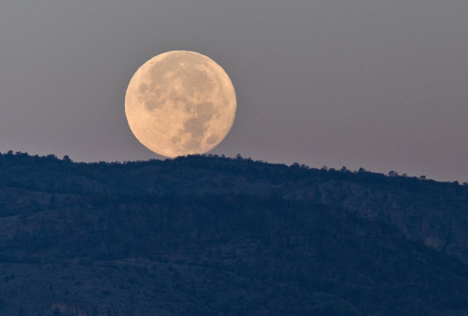
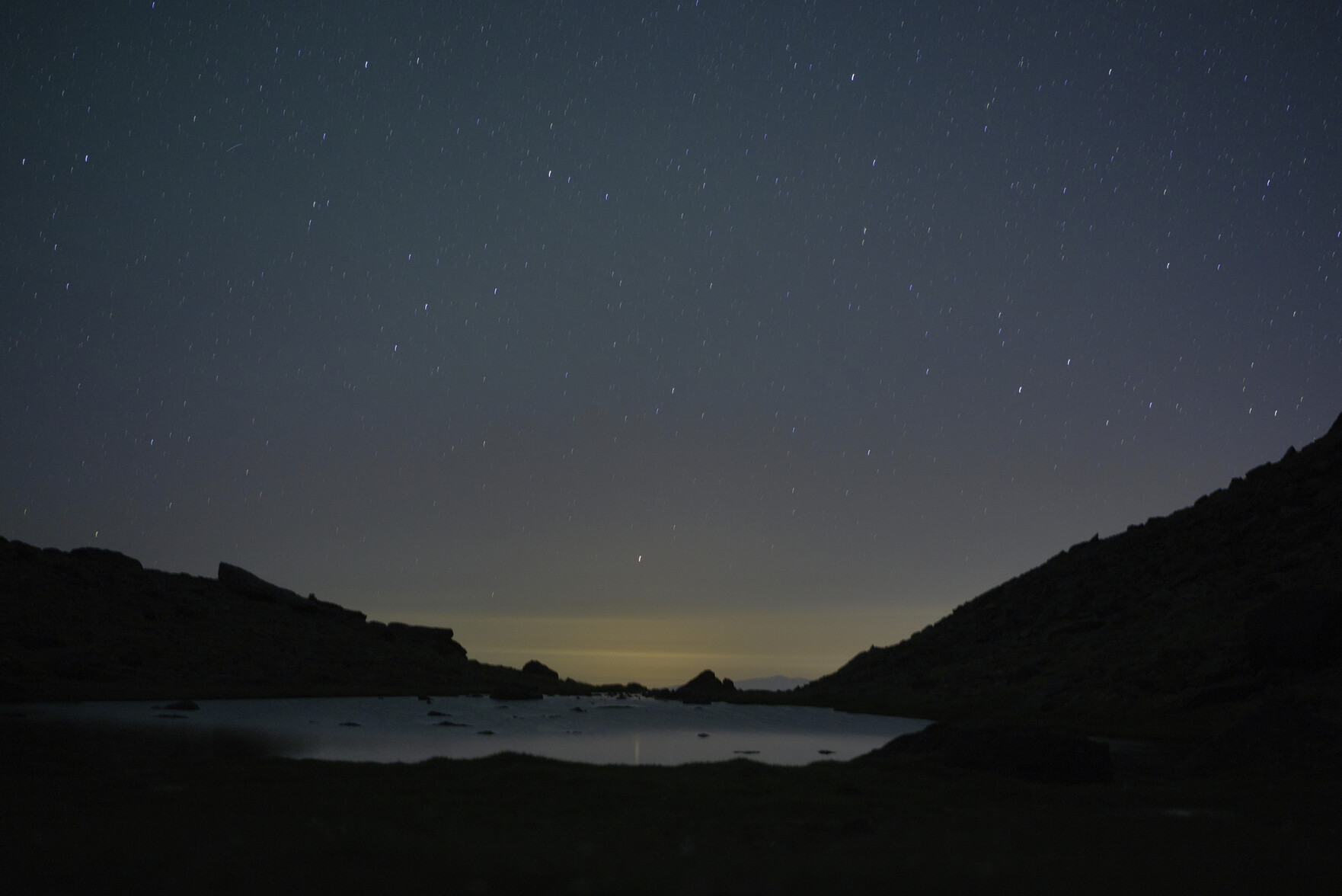
After debating with myself for 30 mins about whether to venture out into the cold to answer the call of nature I eventually left my tent. The sky was amazing. I guess then was not the time to start learning astrophotography but I put the camera on a tripod and a 20 second timer and pressed the shutter. I took a lot of blurry ones but this is the best I managed. Might have to learn how to do it properly 🤣
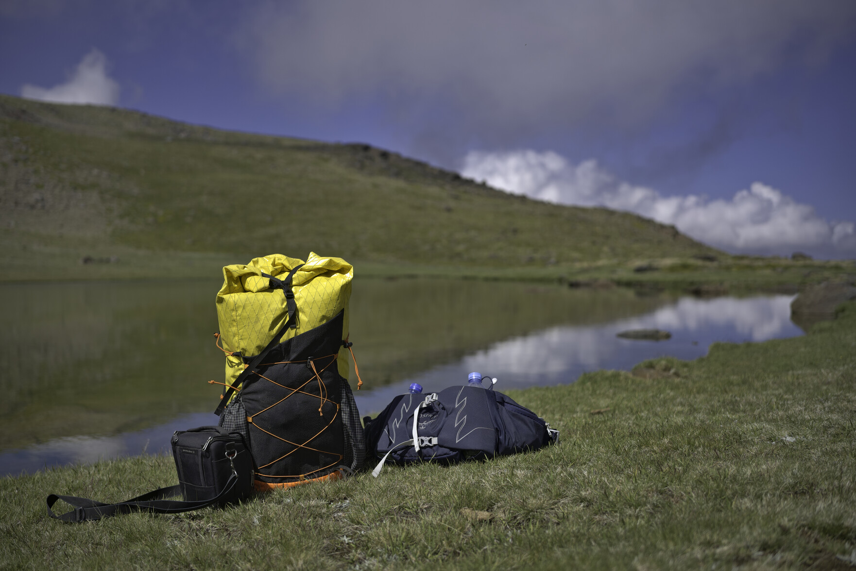
Images from the last 2 days trip to visit "Lake with No Name" at 2900m altitude! A magical, serene place where nature ruled. Humans don't often visit here, if ever.
My head is filled with images and experiences from this trip, the stars overhead, the tumbling waters, the stillness, the Ibex and even the mid-morning break to make a cup of tea! Here are just a few digital ones from a mind blowing overnight camp.
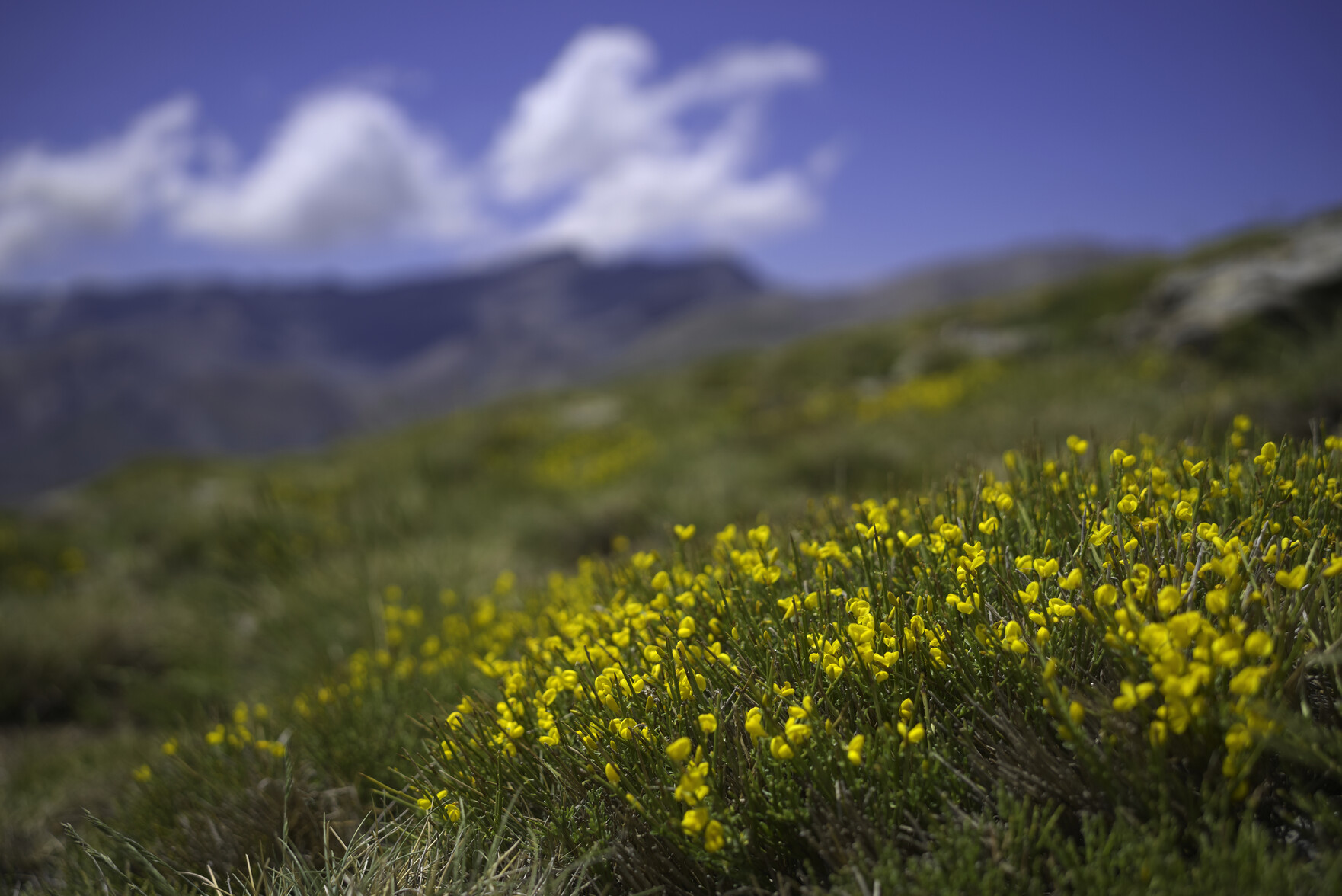
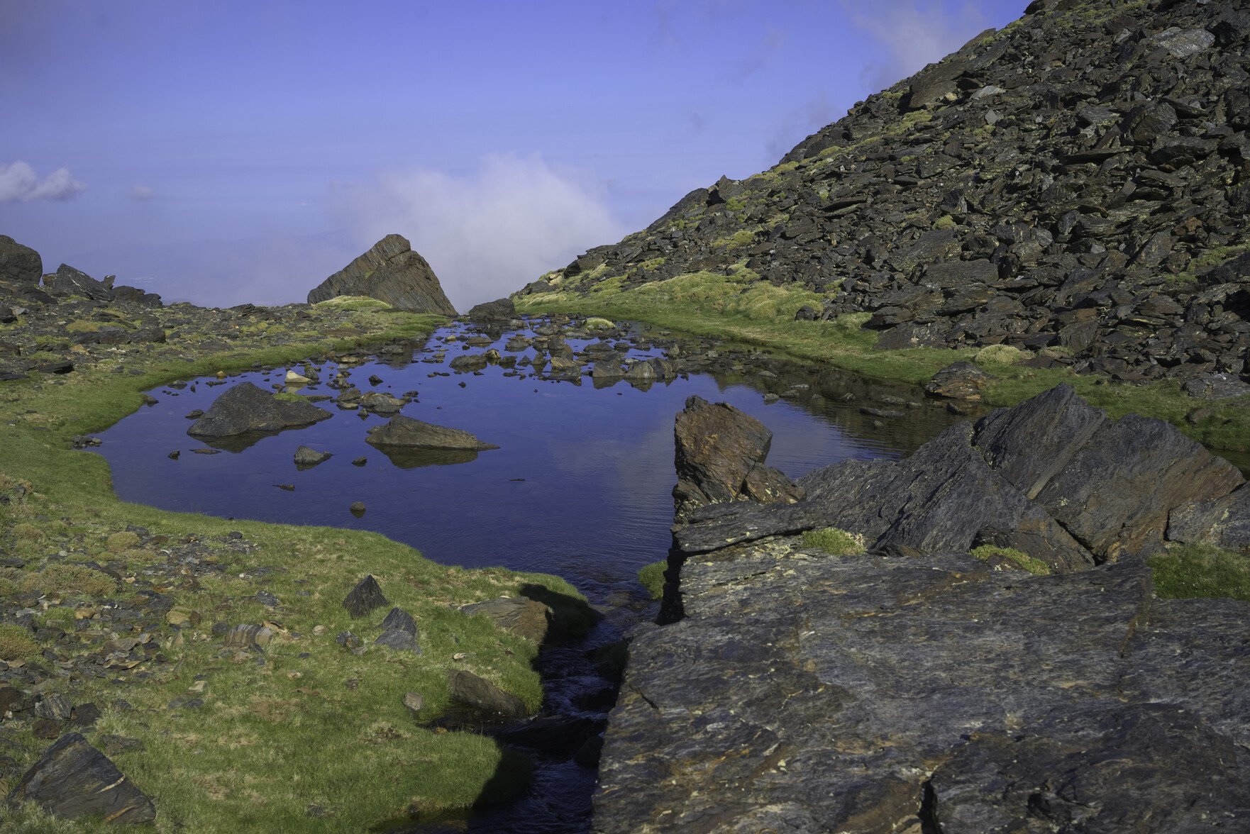
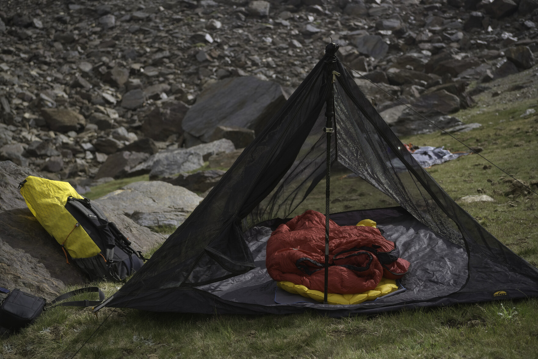
Some bright yellow broom dominates the foreground. Behind are the indications of high mountains, blue sky and white cloudA beautiful bright blue mountain lakeMy tent set up. Good weather so a bug tent was all that was needed.A yellow rucksack sits by the serene waters of the Laguna del Peñon Negro lake
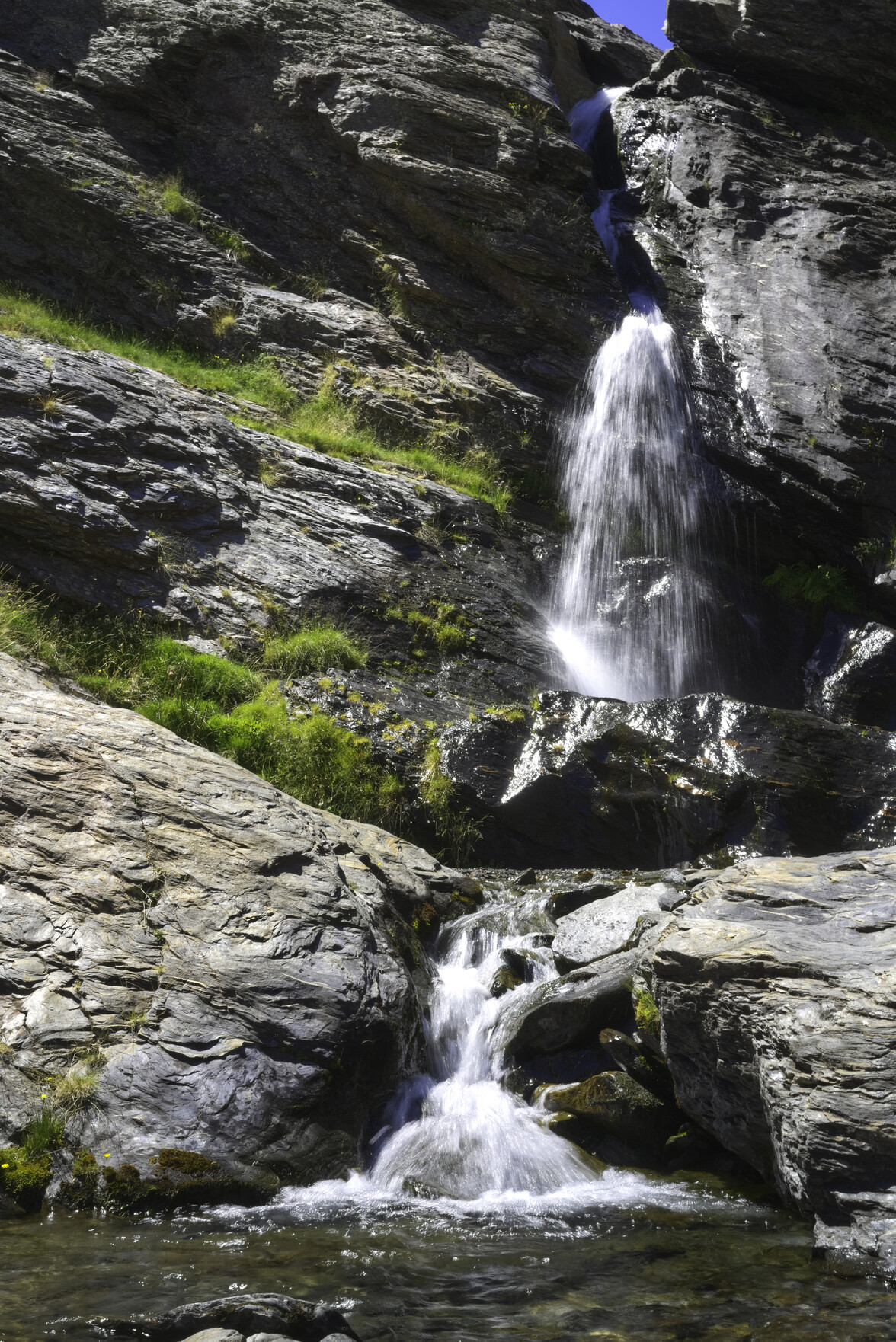
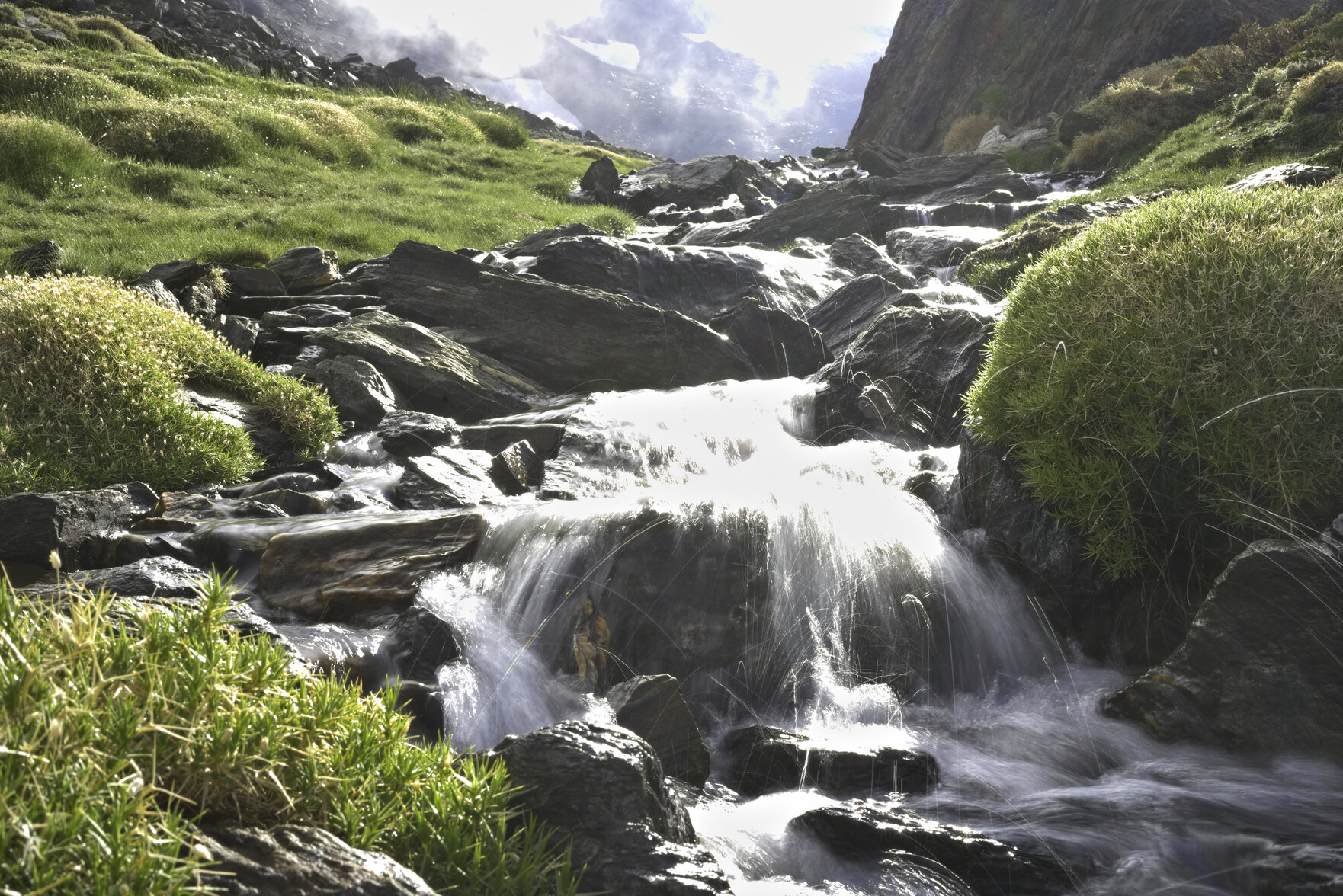
We arrived at the "lake with no name" yesterday afternoon. At the exit of the lake a delightful stream fell out of the hidden valley. I don't normally take a tripod, yesterday I did. Meant I could slow the shot down and close the aperture. Came as a complete surprise when I saw the subsequent image and the path made by water droplets seemingly jumping out of the stream. I guess I will take my mini tripod wherever I go from now on 😀
A stream, slowed down in the image tumbles down between some rocks. Water droplets from the stream leap in the air. Either side of the stream are lush green shrubs
My first overnight trip into the Sierra Nevada mountains since the Pacemaker implant starts tomorrow. Just one night camping by a remote lake. Haven't packed yet but target base weight is 5kg, water and food taking the overall backpack weight to under 8kg🤞 Looking forward to a night in the mountains
Just installing Crunchbang plusplus 12 on an old laptop. Crunchbang has always been one of my favourite #distros. It's remarkably fast, even on old kit, and uses the Openbox DE. Enjoyable