Posted on:

I'm normally quite good at estimating walking difficulty. Years of practice, with a good knowledge and experience of local maps and terrain. And of course we always have the wonderful "internet" to fall back on too for advice and information.
Yesterday's walk I originally classed in my own mind as "Moderate" but the 760 metres of ascent and 11 kilometres of distance involved, made me upgrade that to "Challenging", especially as I hadn't been in that particular mountain range before.
It was supposed to be a straightforward walk from above the town of Durcal, around the peak of La Chaja and taking in the peak of La Buitreras as an add-on. Now, have a look at the map below.

Straighforward. Right?
We start at the central Electrica San José and follow the road as it winds up the mountain. Wikiloc had shown me a path (marked in red on the map) that linked the end of the road with the path descending down the "Barranco de la Rambla" back to the car.
The whole route looks quite amenable, contours don't look too steep. Not many cliffs are marked, apart from those on the southern slopes of La Chaja down to the Rambla.
Easy peasy eh?
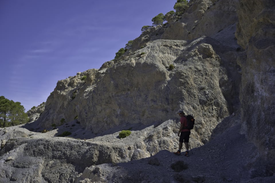
Well, no actually. It wasn't easy. It turned out to be bloody tough. In fact the toughest walk we have done, certainly in 2023, but possibly since we got together as a group. It was steep, loose and involved a necessity for a head for heights and confident foot placement on small steps with big drops all around. Oops! Here is the story of the day.
It started off simple enough. Follow the road as indicated on the map. Yes, there were an abundance of large cliffs around but the road threaded a clever way through the rocky outcrops.
Somewhere on this road I realised I had made a mistake with my navigation. We were chatting away and putting the world to rights when I realised we should have turned off the road onto a small, not well marked, path some 400m lower down. Never mind, I thought, erroneously, this road will join up with it higher up. That's what the map says anyway.
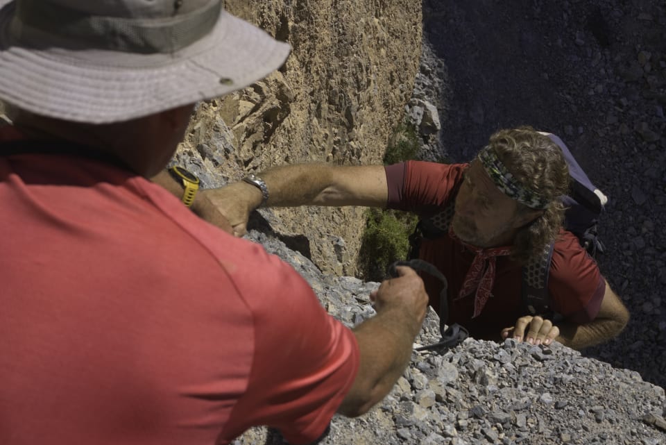
Then ... higher up, we came to a washed out ravine. The rains over the years had washed away the road and instead we were left with a steep, loose descent followed by a 2 metre climb out on vertical rock with loose holds. Dodgy.

But we "Nomads" are built of stern stuff and we rallied round as a team and figured out a safe way to ascend the step. Not super safe for Sean, who had to go first, but once he was up the rest of us followed in pretty quick succession. Thanks to Sean and his big boots.

Sighs of relief were quickly swallowed as a further 100 metres along the track we came to another washed out ravine. This time there was no way we could circumvent the problem. Even with ropes and rock climbing paraphernalia it would have been very difficult. We had no choice but to retreat or find another option.

The other option arrived in the form of a loose descent down a shoulder and a steep drop down through trees and shrub to join the path we should have been on. No problem. On we go.

By now the hot sun was beating down mercilessly as we ascended back up to our high point and beyond. The path was fine hereabouts and views opened out to the north east towards the snowy summit of Tozal del Cartujo in the Sierra Nevada. We stopped and took a lunch break in the shade of some welcoming pine trees.


After lunch we continued ascending to a small pass (Collado del Escopetar), our high point of the day. To the left lay the peak of Las Buitreras but any thoughts of making the trip there and back had dissipated into the ether. I was quite tired by this point.

In my head I had assumed the next stage of our little hike involved a short walk on a reasonably broad ridge trending downhill to meet the Collado de los Volaores. This is the point for the descent down the Barranco de la Rambla.
In actual fact it was a loose traverse, up and down, across the left hand side of steep mountainside. Small paths indicated the route. Tiny footholds on steep scree with a big drop off to the left mean that if you do this route you will need a head for heights and also be very confident with your footwear and how you place your foot. Fortunately our group performed admirably.


At the Collado de Volaores we eventually reach a decent path that winds it's ingenious way down towards the bottom of the Rambla.

Erosion due to rains had made big impressions in the area and, rather surprisingly, some effort has been made here in path restoration. Lower down we meet some large steps reinforced by wooden planks and metal poles. Without these, another arduous battle to circumvent would ensue.

By now the heat, distance and adrenaline used was taking its toll. We dreamed and talked endlessly of cold beer. How many were we going to drink? Can we order the first two rounds at the same time? Can we phone the order through?

We hit the valley bottom and joined the wide, flat Rambla. This was a joy to walk on after the rigours of the previous 6 hours. A further 40 minutes down the valley and we emerged back to the cars.

The benefit of hindsight #
Yes, I did underestimate the difficulty. By quite a lot actually. It wasn't helped by me chatting and not constantly checking the route on my GPS. That cost us some time and used up adrenaline.
I also should have done more internet research but, surprisingly, there is very little information. Afterwards I did find this on Wikiloc that describes the route in reverse order to that which we did. If I had seen this I might have "upped" the difficulty scale. It describes the route rather well I think.
Directly translated by Google, my emphasis on the important points
We will start going up La Rambla, this is the largest and most important in the Sierra Nevada Natural Park. The landscape is impressive, and every time I go there is something different, the rains change it due to the type of terrain.The climb up the slope after the Rambla can be tough due to the type of terrain, but in two kilometers or so, we will reach the path, it comes out to the right, it is well marked and it will take us to Collado de los Volaores.
From the col, where we can clearly see our objective, there is a somewhat delicate section, the paths may be lost due to the rains, and the steps that were relatively good today will not be known tomorrow. But it can be done, with caution*.
We arrive at the Collado del Escopetar, here the path that goes up to Las Buitreras starts, there is no problem, it can be somewhat lost in small sections... The top offers good views of Sierra Nevada, La Magara, Dúrcal, La Maroma... up to the In the 1960s, there were colonies of Griffon Vultures..
We have to go down the same place to the Collado and we take the path to the right, to make a circular excursion. This path is not complicated, just pay attention to the fork you have to take, because the road is cut off due to erosion.
Final Thoughts #
What a day. What an adventure. So spectacular and yet I've lived here 20+ years and never known that such scenery existed so close to home.
Never underestimate a route that isn't well known or talked about. The importance of teamwork and the role that has to play when the going gets tough. Fortunately, I walk with a good group who all look out for each other and help assist when necessary.
Thanks all for coming along!
Smugmug Photo Album
Tagged with:
More posts:
- Next: Searching for the Lake With No Name
- Previous: Ruta Gollizno, Moclin