A Week of Classic Day Hikes with the Nomad Walking group in the Pyrenees, Val de Tena
A week with The Nomads hiking classic Pyrenees routes from our Panticosa base – Punta del Pacino, Bachimaña Alto, Refugio Respomuso, Refuge Pombie in France, and Ibón de Piedrafita. Includes wildlife sightings, minor navigational mishaps, and zero mountain heroics.
Our local hiking group “The Nomads” met up for a week’s hiking in the mountains of the Pyrenees. Kiersten and I were joined by Anne, Jane, Kate, Linda, Nicola, Richard & Stewart at our base in Panticosa. The plan was to knock off some of the classic day hikes in the area. One of the nice things about using Panticosa as a base is that the drive to each day’s start point was never more than 30 minutes away. Very convenient, and frankly about the maximum driving time ten adults who’ve spent the previous evening arguing about who forgot the walking poles can tolerate together.
Thanks also to local friends, Jill and Pete, who gave us advice regarding the best routes in the area. Their knowledge was invaluable.
Tue 9th — The Pico Pacino Loop
10.7km Distance · 691m Ascent/Descent
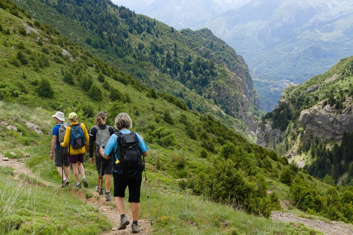
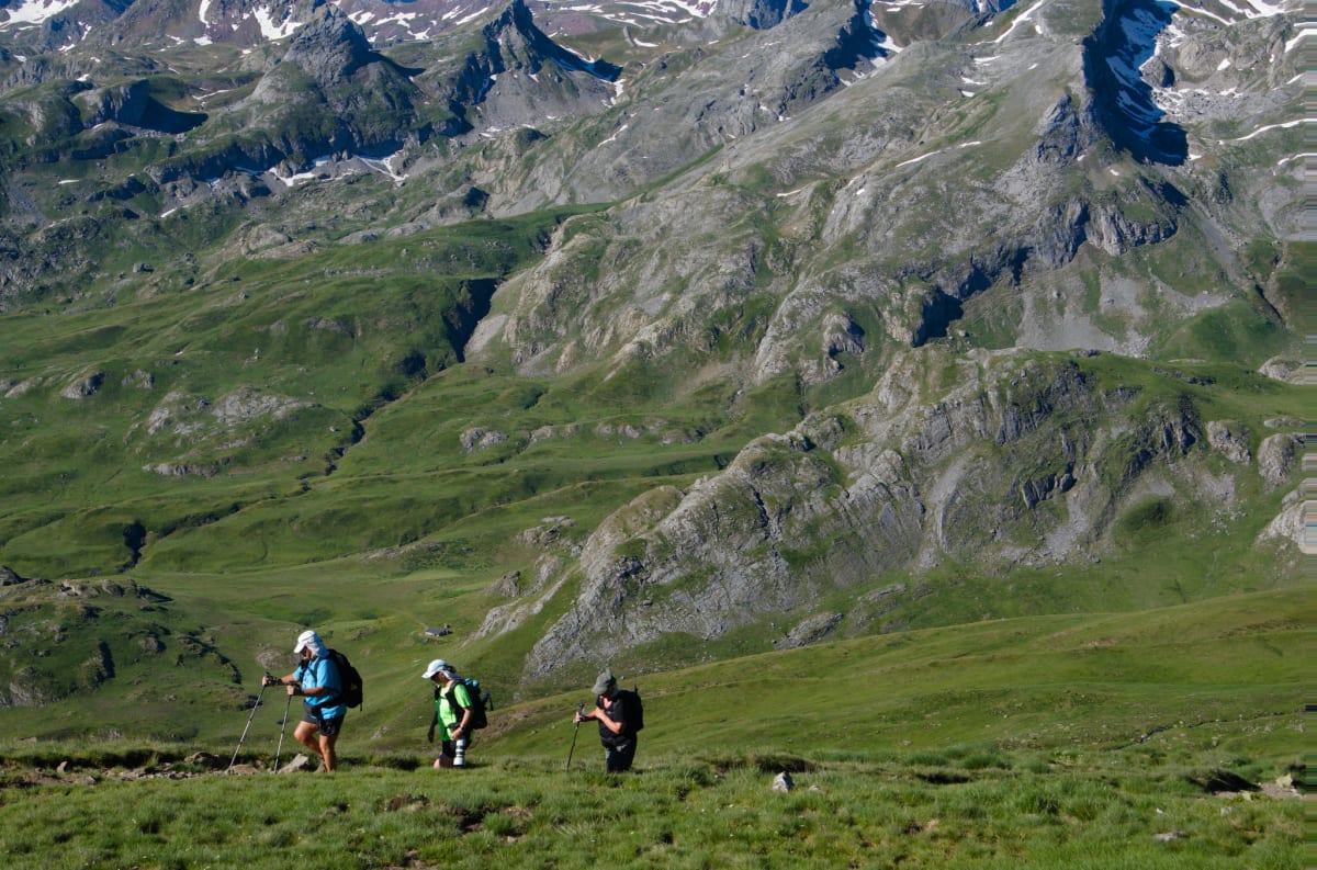
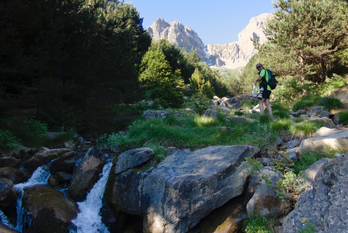
Starting from the charming village of Sallent de Gállego in the Valle de Tena, this loop circuits around and up to the summit of Punta del Pacino, which stands at 1,965 m. Widely regarded as one of the most rewarding day hikes in the region, and who are we to argue?
It’s a well-marked trail that leads through alpine meadows full of orchids and wildflowers, climbing up to the pass at Collado de Pacino. From here it’s a 45-minute return journey to the summit and back. While the others chose the summit option, because they are, you know, proper hikers, Kiersten and I elected to remain on the lovely grasses by the col with 360° views of the surrounding mountains.
We told ourselves this was a strategic wildlife watching decision rather than a knees-related one. Good job we did, as we were treated to close-ups of a Black Woodpecker on the ground not 20 metres away. That was just before it was attacked by a dive-bombing, Stuka-imitating Booted Eagle. The woodpecker escaped, we think. All happened so fast. Things you see when you can sit quietly in nature, which, as it turns out, is also my strongest hiking skill.
The remaining anticlockwise loop started well enough, dropping down towards the Barranco and Embalse de Escarilla, but thereafter deteriorated into an overgrown and sometimes muddy trail where drastic cattle avoidance techniques became necessary at times. Nothing in the guidebooks prepares you for being surounded by cows with attitude while you’re knee-deep in bog and negotiating your way around a bush that’s clearly winning the territorial dispute.
 The group at the
pass, Cuello de Pacino
The group at the
pass, Cuello de Pacino
 Peña Foratata from the
col
Peña Foratata from the
col
 Traversing down
to the Embalse de Escarilla
Traversing down
to the Embalse de Escarilla
 The
traverse path towards the Barranco de Escarilla
The
traverse path towards the Barranco de Escarilla
Wed 10th — Río Caldares, Embalse de Bachimaña Alto
9.9km Distance · 705m Ascent/Descent
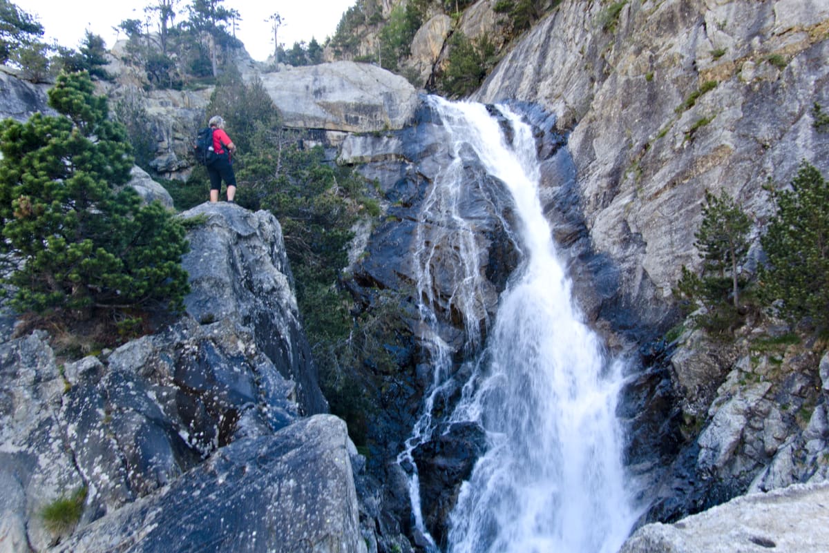
Another classic of the region. This route starts at the thermal spa town of Baños de Panticosa and climbs up the Barranco de Caldares, passes multiple waterfalls, and culminates at the stunning high-altitude lakes of Embalse de Bachimaña and the Ibones Azules.
We started early to avoid the crowds and to get the bulk of the ascent done during the morning, a rare display of organisational competence from our group.
The first section gained altitude quickly with several switchbacks above the Balneario. About halfway up we passed the Mirador de la Reina, which in turn led to the spectacular Cascada Alta, accessed via an equipped passage with chains. Nothing like a bit of chain-assisted scrambling before lunch to make you question your life choices in the best possible way.
Breaking out of the narrow gorge, the trail levelled into a vast alpine meadow, traversed the valley past more chain-equipped sections, before rising in a steep series of zigzags to the Refugio de los Ibones de Bachimaña at 2,240 m.
The setting was genuinely breathtaking. A glacial landscape surrounded by sharp rock ridges forming the Spanish-French border. From here we contoured our way round to the river inlet from the Ibones Azules. Lots of gushing spring meltwaters fed the lake.
This area brought back a lot of memories from the previous year. A stormy overnight camp on these same banks followed by an amazing trek over the mountains into France and back. We sat and ate lunch, reminiscing and enjoying the ambience, before returning the same way.
The return trip was enlivened by the discovery that descending a trail you’ve already climbed is essentially a different walk that happens to share the same path, only this time your knees have opinions about it.
 Jane
looking down at the spectacular Cascada Alta
Jane
looking down at the spectacular Cascada Alta
 Crossing a narrow path, chain assisted above the Rio
Caldares
Crossing a narrow path, chain assisted above the Rio
Caldares
Snow slopes
above the Embalse de Bachimaña Alto
 Lunch stop by the Rio
Caldares
Lunch stop by the Rio
Caldares
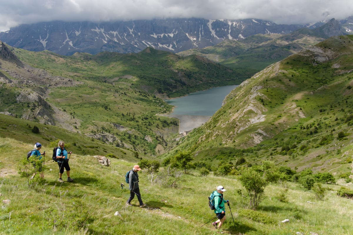
Thu 11th — Waterfalls and Col de Portalet
Today was meant to be a bit of a rest day. We enjoyed photographing the waterfalls at Baños de Panticosa and then made the 30-minute journey into France via the Col du Portalet to recce the start of the trail to the Refugio Pombie for later in the week.
The day was also filled with numerous sightings of marmot, vultures, and various weird, wild orchids. So much for resting, but when the alternative is sitting in the apartment googling “how to fix sore knees,” this seemed the wiser option.
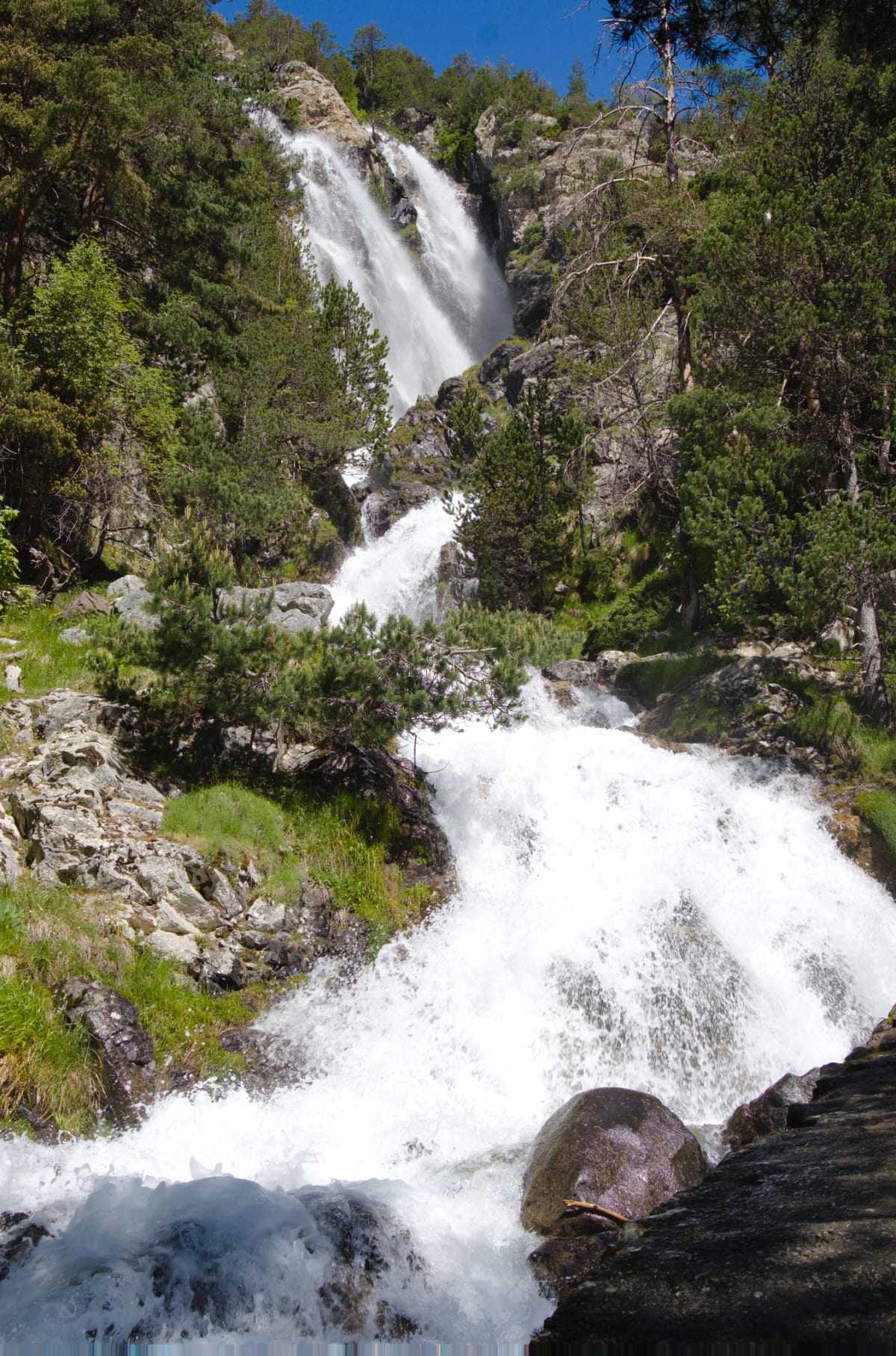 The Cascada
de Arualas near Baños de Panticosa
The Cascada
de Arualas near Baños de Panticosa
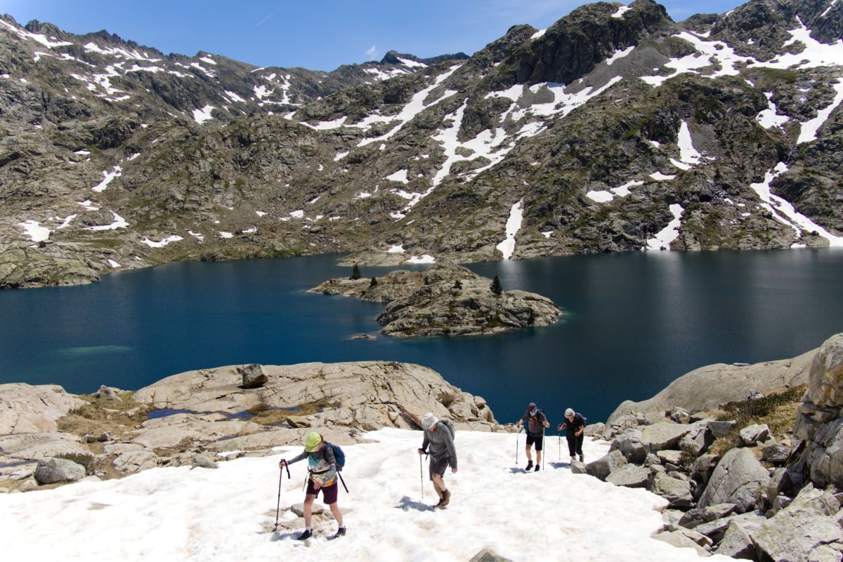
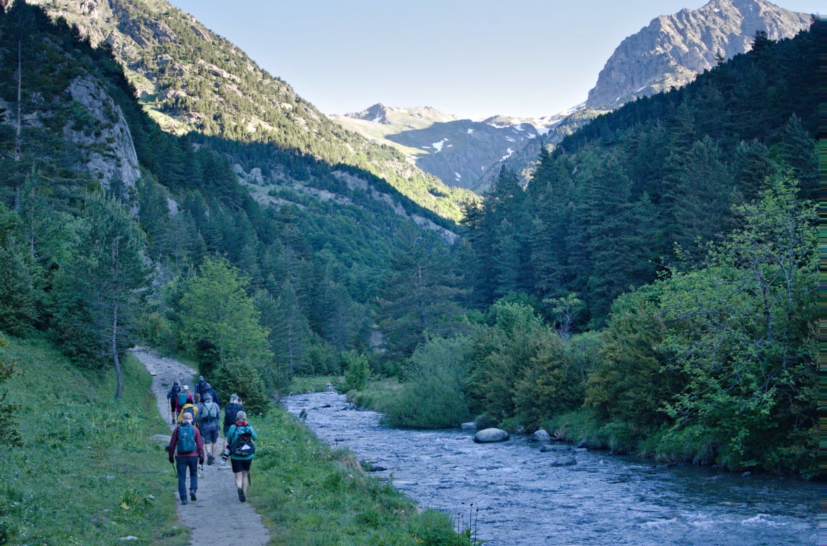
Fri 12th — Trail to Refugio Respomuso
14km Distance · 742m Ascent/Descent
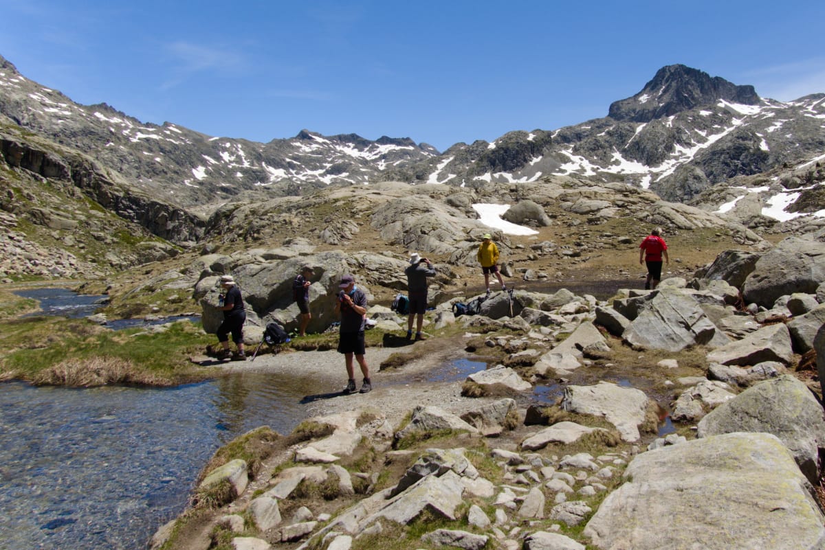
The refuge sits at 2,150 m beside the waters of the Embalse de Respomuso, a dammed high-altitude lake nestled in a dramatic glacial cirque surrounded by snow-capped peaks.
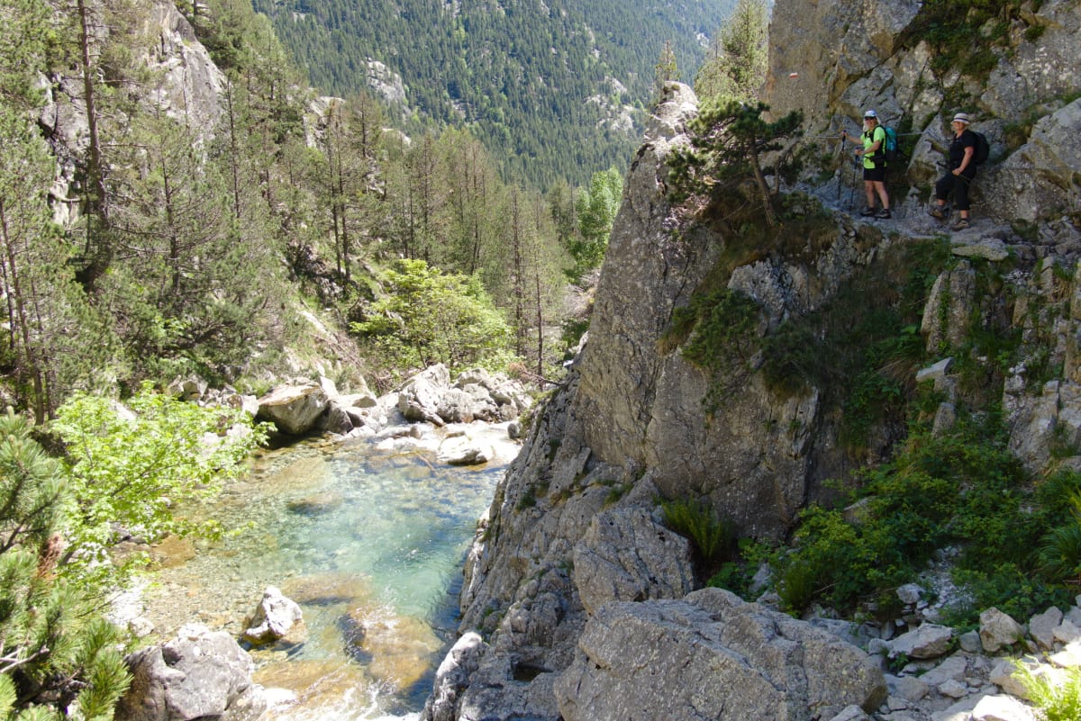
Parking at La Sarra, the trail follows the Río Aguas Limpias steadily up the valley for about 8 km. The path crosses above narrow gorges where the river crashes below, passes several beautiful waterfalls, and climbs through increasingly open alpine terrain.
As you approach the head of the valley, the landscape opens up dramatically. Further on, the Embalse de Respomuso comes into view, a stunning turquoise reservoir backed by snow-covered peaks including the Pico de la Forqueta, Picos de la Fondella, and the Musales massif The refuge sits right beside the dam. The group did this as an out-and-back in about 8 hours, retracing the same path down.
Having done this path the previous week, twice, don’t ask, Kiersten and I opted for an easier day. Wasn’t quite how it turned out though, as we managed to lose each other on the way down. Full disclosure: it was me. I wasn’t concentrating and missed a simple turn. In my defence, the path was very well-marked, which is precisely why you stop paying attention, isn’t it? This meant retracing paths uphill until we eventually met up. Kiersten was remarkably calm about the whole thing, which is either a testament to her character or evidence that she’d genuinely enjoyed the peace and quiet.
 Early morning start from
La Sarra
Early morning start from
La Sarra
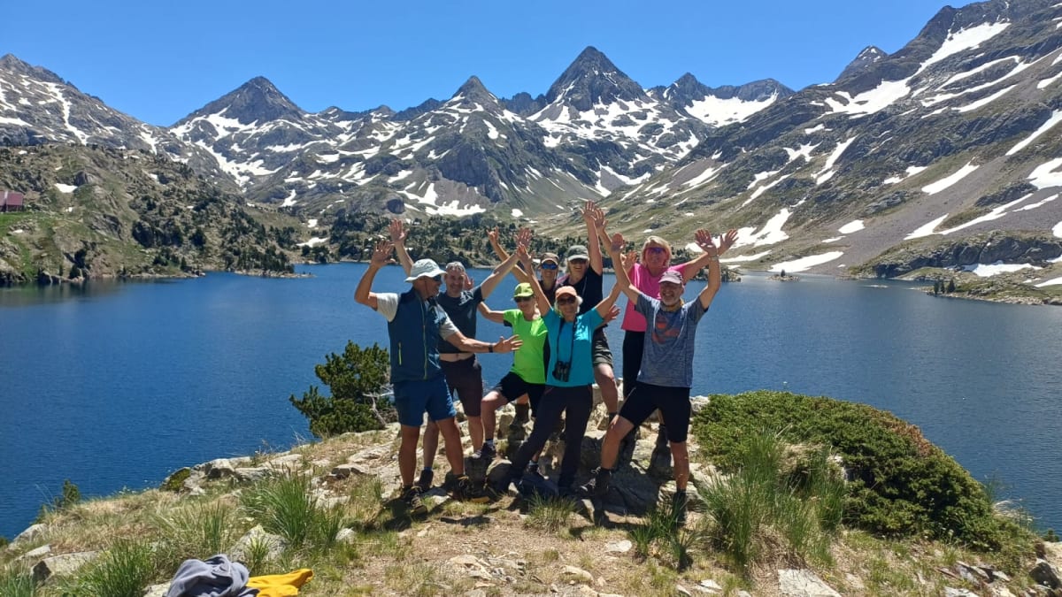 The group at the
Embalse de Respomuso
The group at the
Embalse de Respomuso
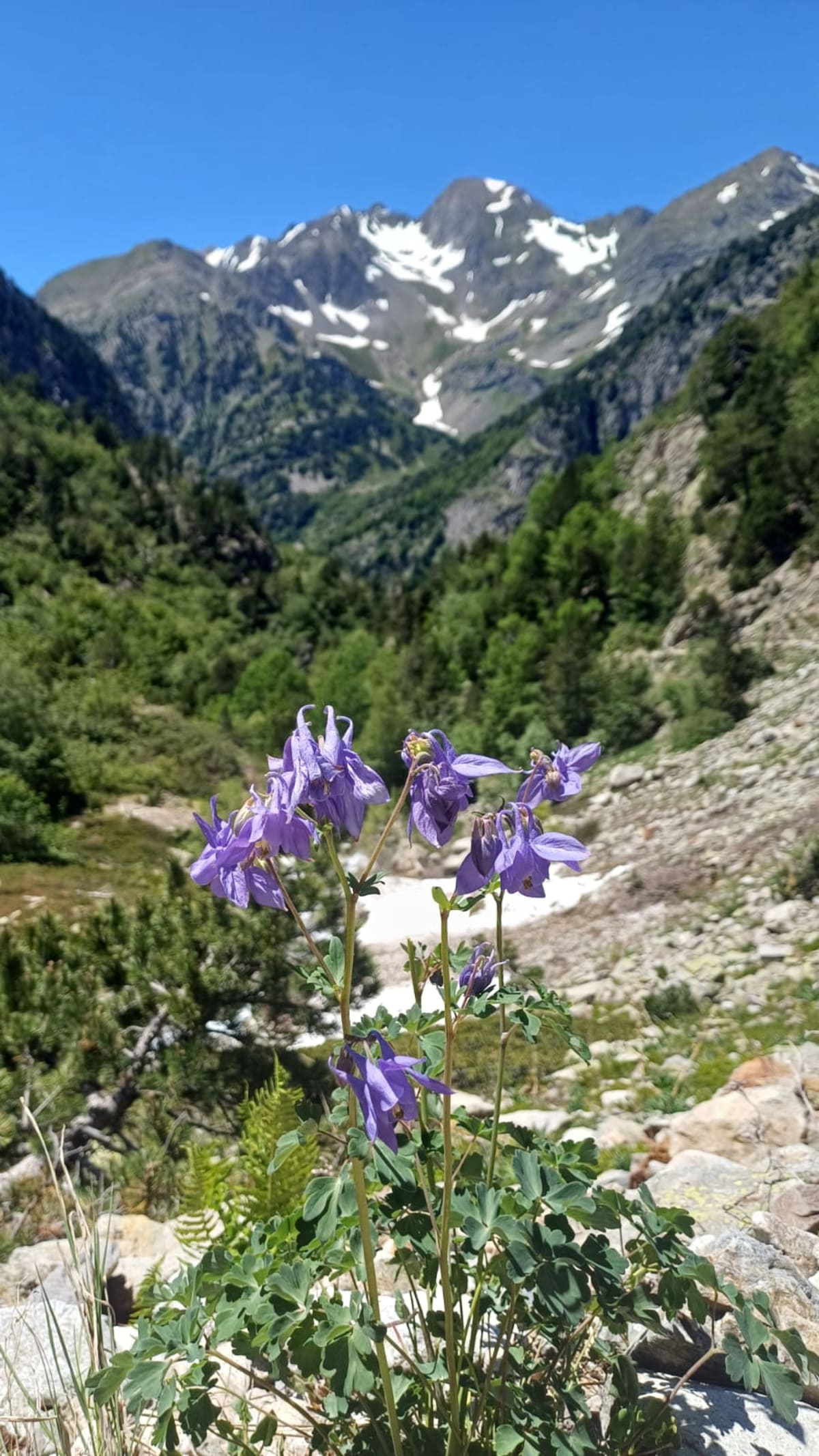 Alpine flowers on the
trail down
Alpine flowers on the
trail down
 The Rio Aguas Limpias
near La Sarra
The Rio Aguas Limpias
near La Sarra
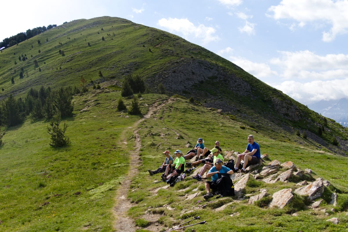
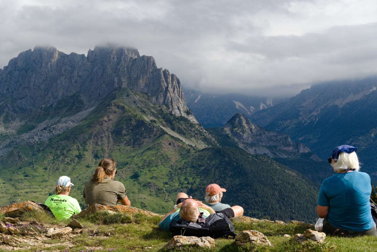
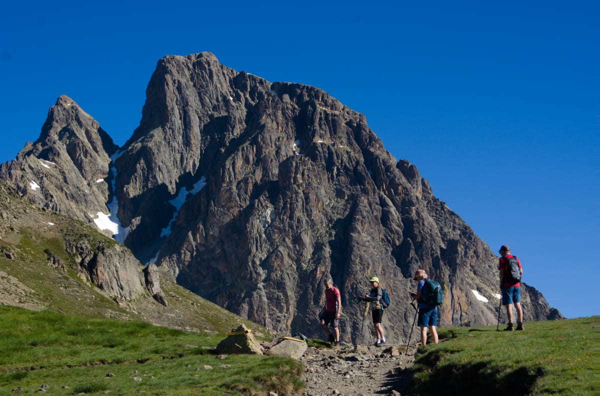
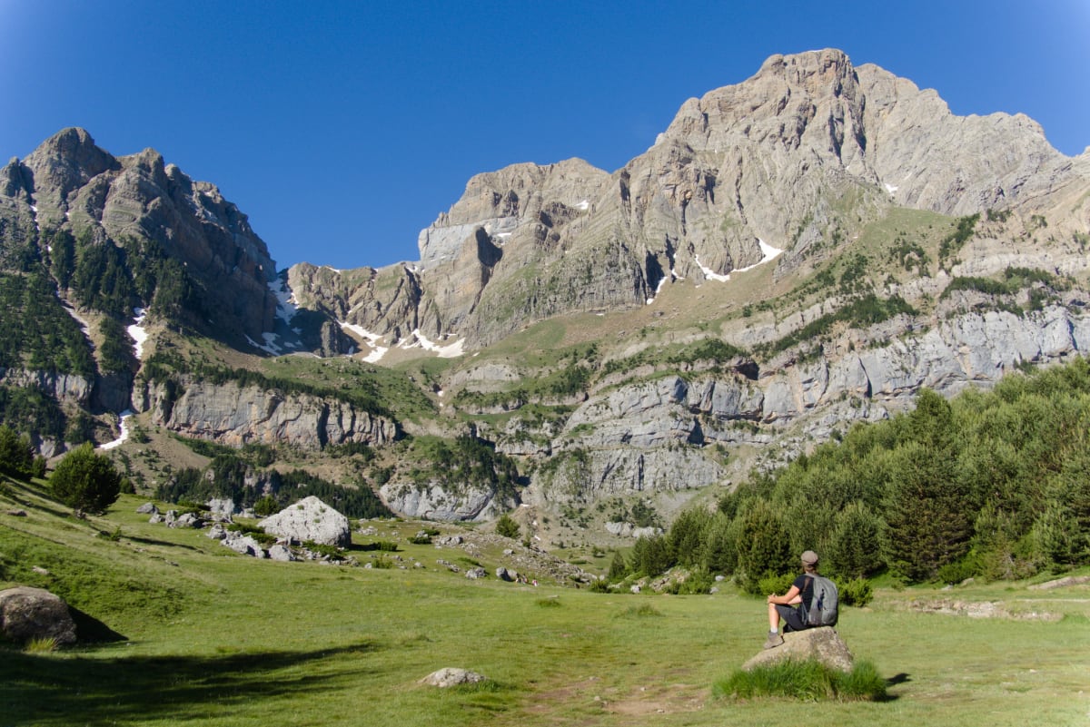
Sat 13th — Refuge Pombie
9.3km Distance · 493m Ascent/Descent
This hike one takes you over into France, into the Ossau Valley and the Pyrenees National Park, sitting right at the foot of the iconic Pic du Midi d’Ossau (2,884 m), that dramatic volcanic spire we could see from the summit of Punta del Pacino on the first day. Or, in my case, from the lovely grasses by the col where I was sitting.
We parked at the Parking d’Anéou near the Col du Pourtalet. The trail crosses the beautiful Cirque d’Anéou, wide alpine pastures bordering Spain, before climbing gradually through open terrain to the refuge. It was a Saturday so quite busy with other hikers. Lots of “très fit” French people striding past us with that effortless mountain confidence that only continental Europeans seem to manage.
Linda is our youngest member and naturally the fittest, so she opted for the longer round to the refuge via the Col du Peyreget. The rest of us took the direct route, which felt like the right ratio of effort to reward.
The Refuge de Pombie is a guarded hut sitting on lush meadows beside the Lac de Pombie, with the craggy walls of the Pic du Midi rising directly behind. Quite a place to stop for coffee and cake, which we did, because there are some mountain traditions we’re more than happy to adopt.
After coffee and cake at the refuge we retraced our steps to the Col du Soum de Pombie, where we… ate our lunch. An easy downhill walk back to the car from there. The perfect day, honestly, stunning scenery, a proper mountain hut, and a descent that didn’t require any chains or knee surgery.
 Spectacular
scenery on the route to the col
Spectacular
scenery on the route to the col
 At the
col with the mighty Pic du Midi rising behind
At the
col with the mighty Pic du Midi rising behind
 Looking for a place to
lunch
Looking for a place to
lunch
 An army (and evidently our walking group) marches on their stomachs,
so they say
An army (and evidently our walking group) marches on their stomachs,
so they say
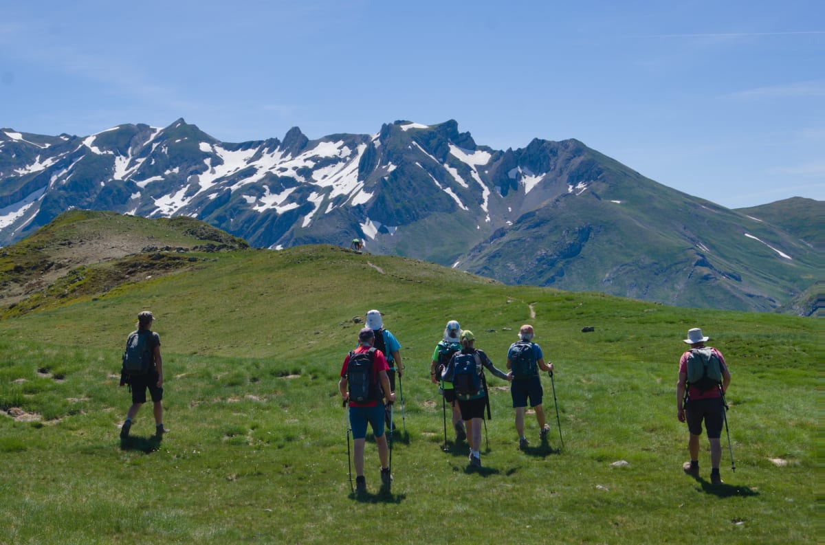
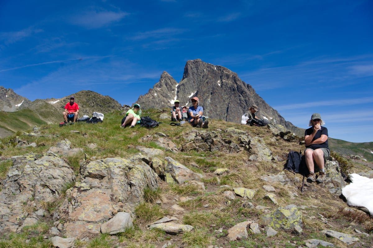
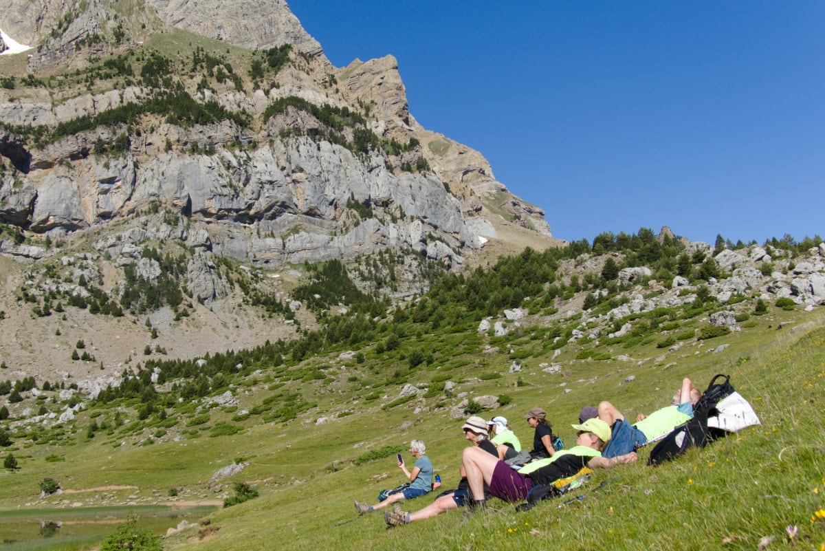
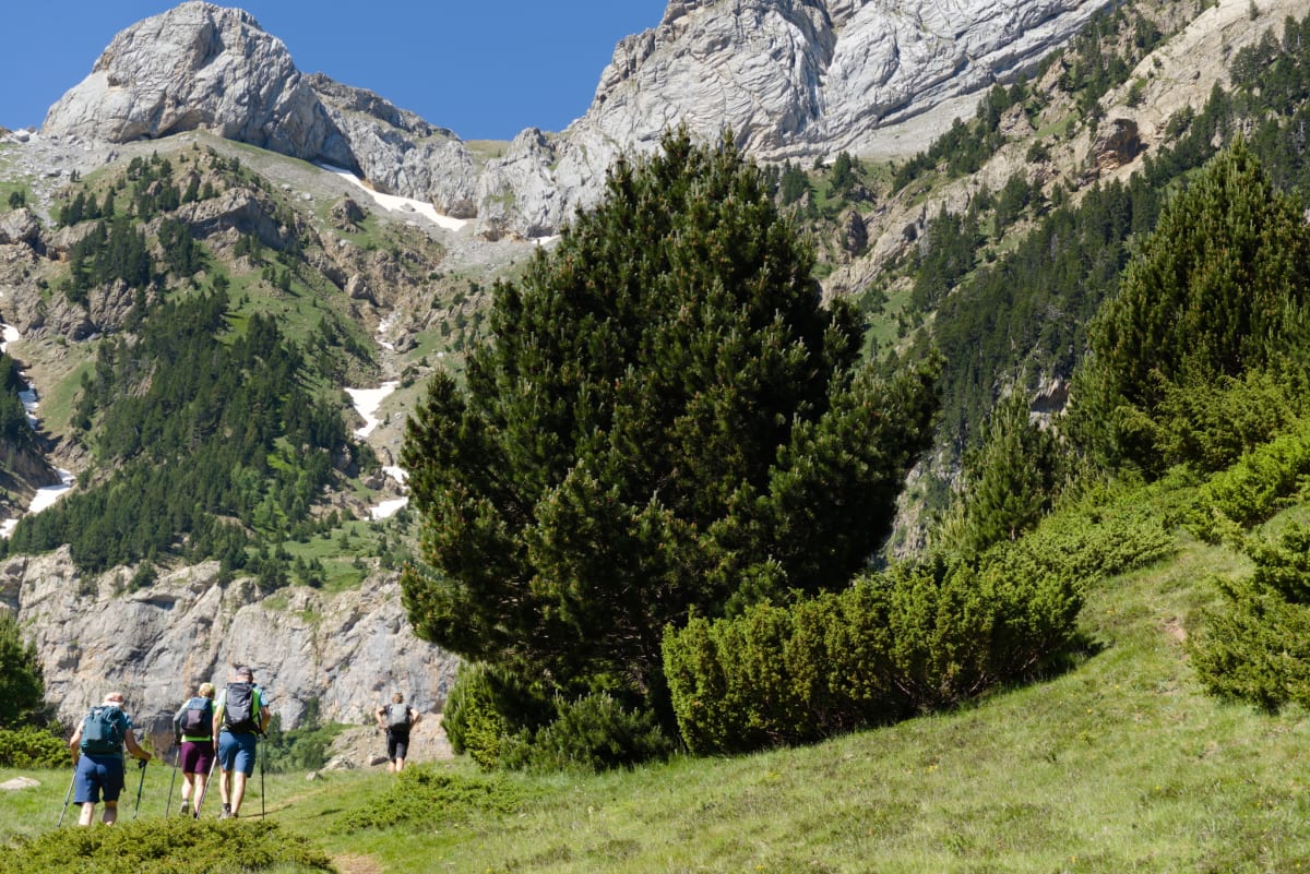
Sun 14th — Ibón de Piedrafita
13.8km Distance · 579m Ascent/Descent
A shorter, gentler hike on the Spanish side with gorgeous limestone scenery and a beautiful alpine tarn. This was meant to be the easy wind-down before heading home. Nature, as ever, had other ideas about the “shorter” part.
Being a bit tight, I mean, frugal, we free-parked in the village of Piedrafita and opted for the additional 20-minute uphill walk to the trailhead. After a rather boring kilometre of forest track we joined a narrow footpath that led uphill. This is where things started getting more scenic, and the decision to save €4 on parking suddenly felt justified.
We crossed several small streams and ravines before entering woodland where the climbing eased slightly under tree cover. Beyond the woods, we emerged into the grassy bowl of La Hoya, a stunning amphitheatre-like clearing surrounded by towering limestone cliffs. The Forquetas de las Palomas rock formation dominates one side, while Peña Blanca stands proud on the opposite valley face.
After traversing through grassy meadows, we arrived at the Ibón de Piedrafita itself, a crystal-clear mountain tarn sitting in perfect position beneath the cliffs. We sat by the lake for a while, doing that thing where everyone pretends they could happily sit there forever before someone inevitably mentions food.
Continuing around the far side of the basin, through woodland again, we picked up a different track that brought us back down to the original road level. Or at least, that was the theory.
I was a bit over-ambitious in our descent plan, as I desperately tried to ensure we didn’t cover the same ground twice, a personal hang-up that’s caused more navigational incidents than I care to admit. Instead I tried to take the marked trail down to the Mirador Punto el Baro but found the trail very faint and/or heavily overgrown. Clearly not used often. By anyone. Possibly for good reason. This descent wound through trees and eventually, mercifully, led back to the cars at Piedrafita. Everyone got down, no one was lost, and I’m choosing to count that as a navigational success.
 The small barranco
leading up to La Hoya
The small barranco
leading up to La Hoya
 La Hoya - Linda
admiring Peña Blanca
La Hoya - Linda
admiring Peña Blanca
 Yet
another delighful place to take a short break!
Yet
another delighful place to take a short break!
 The trail
leading up to the Arco Geotectonico
The trail
leading up to the Arco Geotectonico